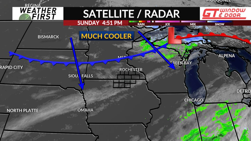
Here comes a cold front…
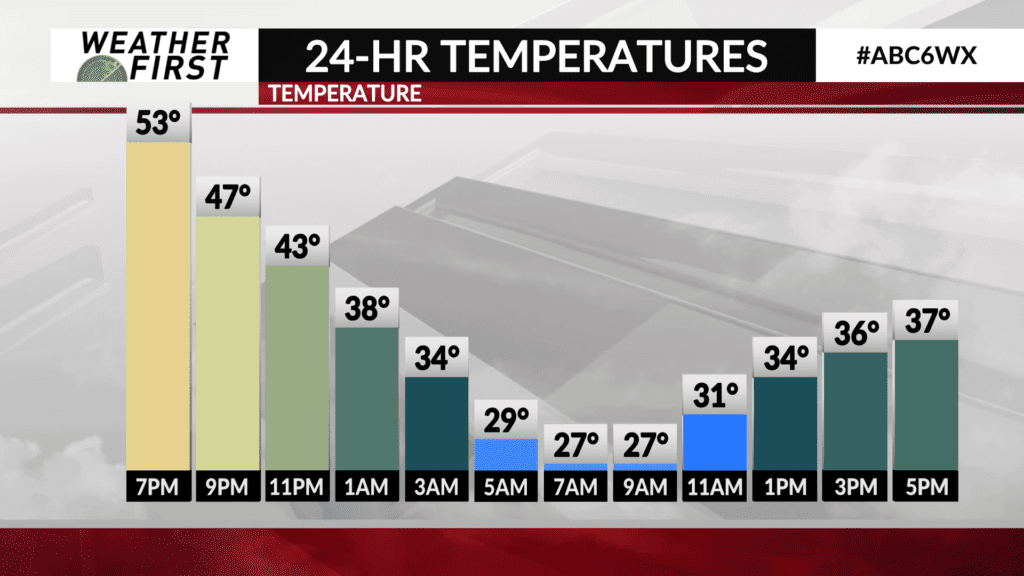
Sunday was a beautiful day across southeastern Minnesota and northern Iowa! We had plenty of sun, mild temperatures, and generally light winds throughout the day!
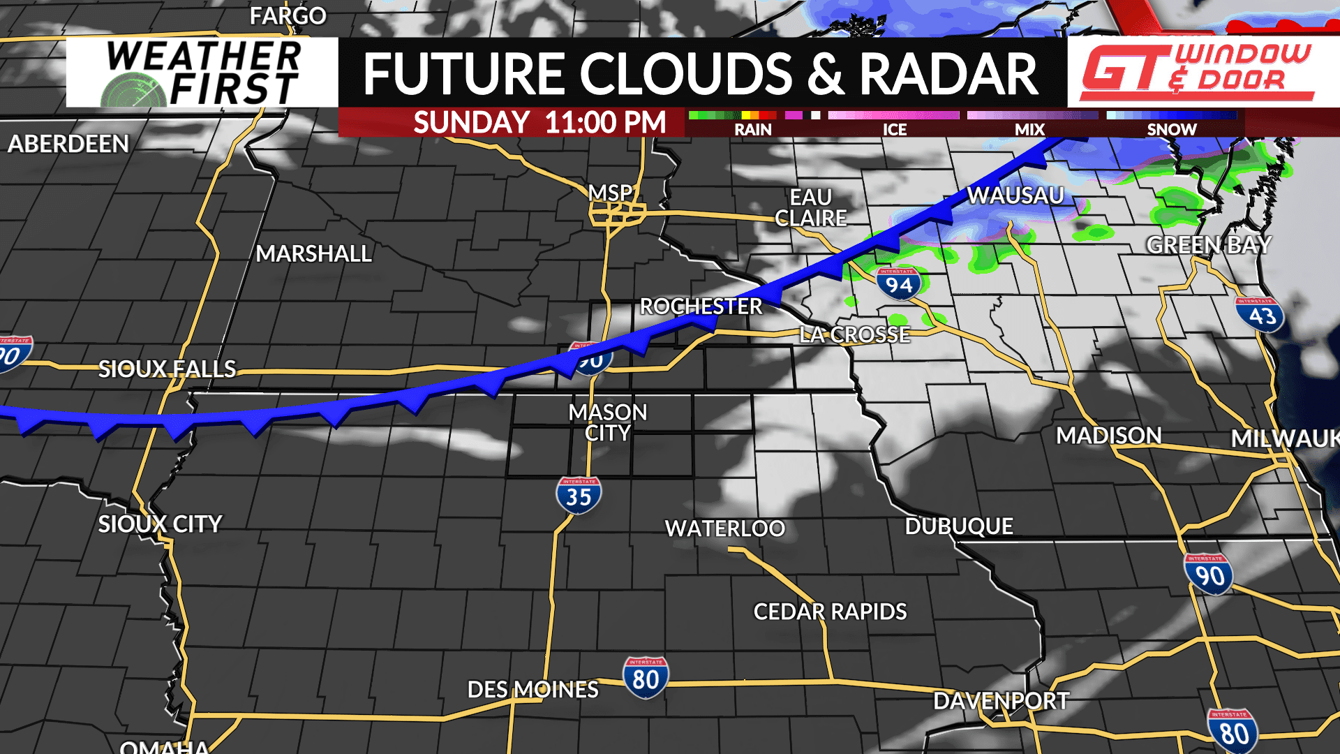
However, a strong cold front is looming, and will swing through the region Sunday night into Monday, bringing much colder air southward behind it. Below average temperatures are expected Sunday night through Tuesday.
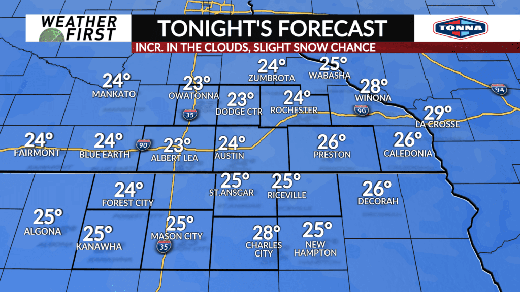
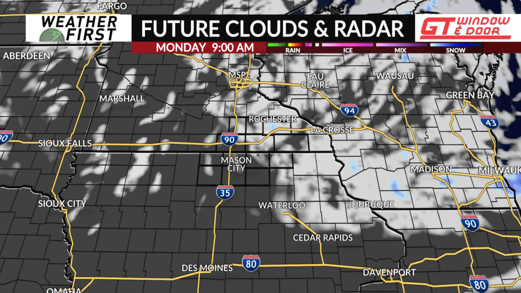
Clouds will increase slightly as the cold front passes through tonight. A lack of moisture will keep cloud cover limited, as well as any precipitation chances. There is only a slight chance of a snow shower, mainly closer to the Wisconsin border.
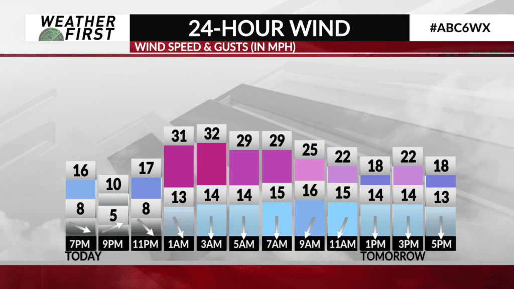
Low temperatures drop into the low to mid 20F’s for most. Winds will shift from out of the west to out of the north, between 10 to 15 mph, gusting up to 25 mph at times, making for a chilly night.
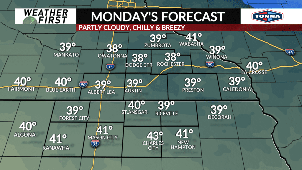
Monday is shaping up to be a chilly day across the region. High temperatures will only climb into the upper 30F’s across southeastern Minnesota and lower 40F’s across northern Iowa. Winds will remain breezy out of the north, especially during the morning, gusting up to 25 mph.
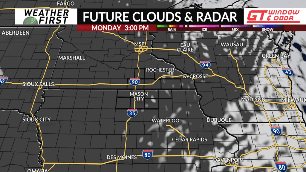
Skies will remain generally partly cloudy during the morning hours, becoming mostly sunny during the afternoon. There is a slight chance of a flurry or two during the morning, but most, if not all, locations will remain dry.
Temperatures drop lower still Monday night into Tuesday morning, with lows in the low 20F’s. Winds diminish Monday night into Tuesday, calming to around 5 mph or so, under a mostly clear sky.
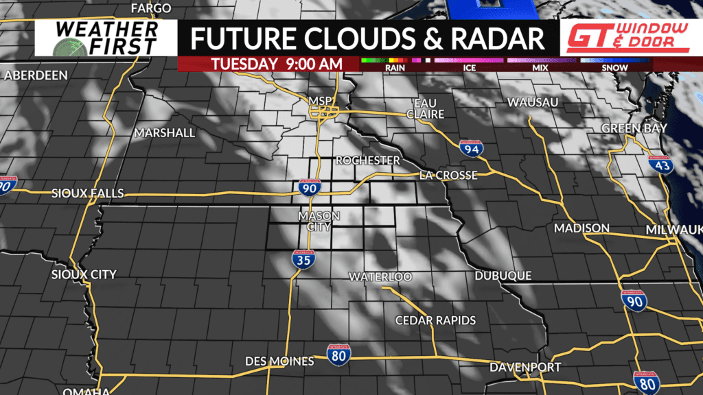
A few clouds will pass over the area Tuesday, but there will be plenty of sun, with highs warming into the mid to upper 40F’s. A far more comfortable day as opposed to Monday!