Increasing chances for rain mid to late this week

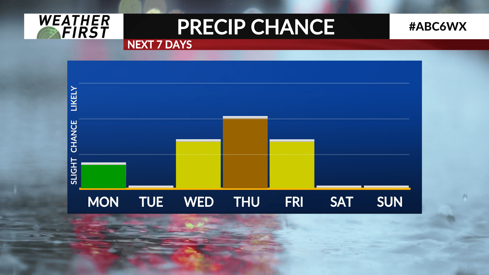
At this time yesterday, it seemed like it would be a mostly quiet week with little in terms of rain chances. That still continues to be the case for the first part of the week, but the story is changing for the second part of the week.
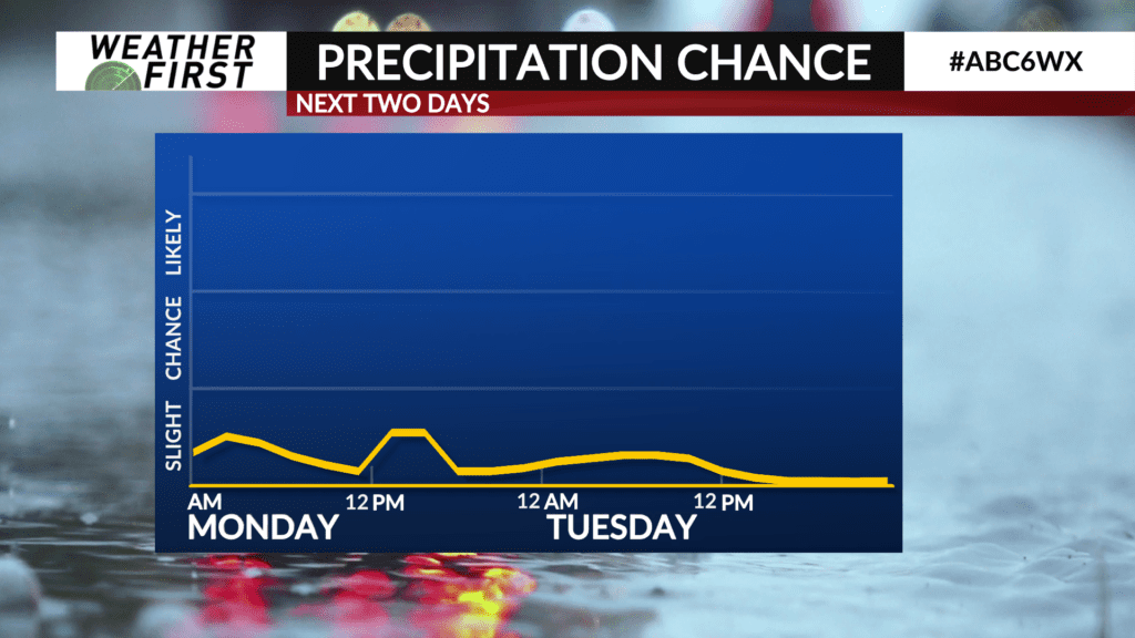
As a weather system passes by to our south tonight through the first half of Monday, most of the viewing area will be dry. The best chance for any precipitation would be south of the Iowa/Minnesota border.
The next chance for precipitation will arrive Wednesday and last through the day on Friday. There is growing agreement that a rather slow moving upper level disturbance will be tracking across the Upper Midwest Wednesday through Friday. Models very on how long this disturbance sticks around, however.
At this point in time, the best chance for more widespread showers and t-storms will be Thursday throughout the day. It is hard to say what exact timing looks like, though.
There is currently no anticipated severe weather for Wednesday through Friday. However, I certainly do foresee a possibility that we may have to adjust that thinking as we get further into the week. The National Weather Service and Storm Prediction Center mention this possibility as well, so will be watching the middle of the week closely.
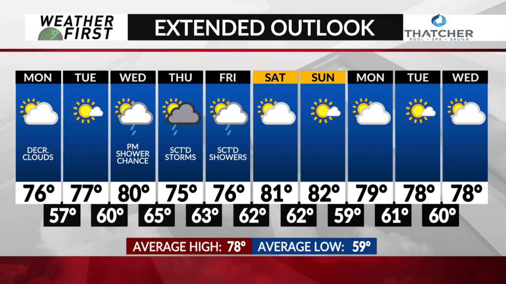
Again, the details are still a bit hazy with the event being so far out. Odds do favor at least scattered shower and storm activity in our area Wednesday afternoon through Friday, however. Something to keep in mind as we head through the workweek.
Otherwise, Monday and Tuesday look fantastic! Next weekend is also looking dry and beautiful in terms of temperatures, so the bright side of things is that rain chances certainly are not dominating the extended forecast at this time.


