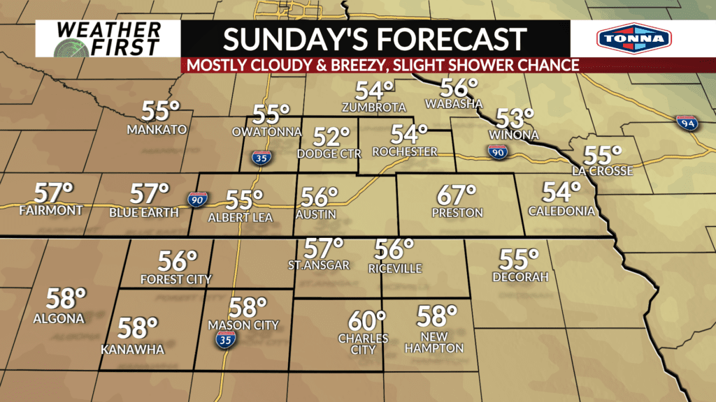
Increasing clouds and breezy for Sunday
Skies have cleared this afternoon across southeastern Minnesota and northern Iowa. An area of low pressure, accompanied by a cold front across the Dakota’s, will be tracking in our direction tonight, however. This weather system will certainly have some impacts on our weather for Sunday.
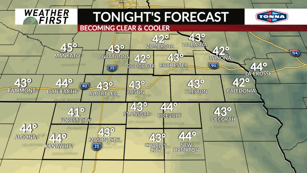
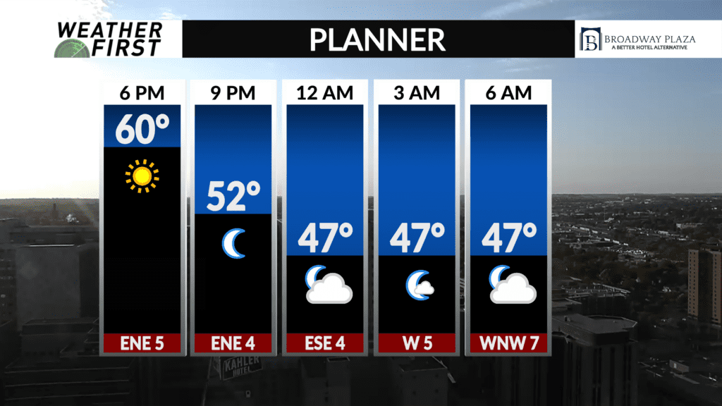
Temperatures tonight cool into the low 40F’s for the entire Weather First area. Skies will be generally clear to partly cloudy, with winds light out of the E around 5 to 10 mph.
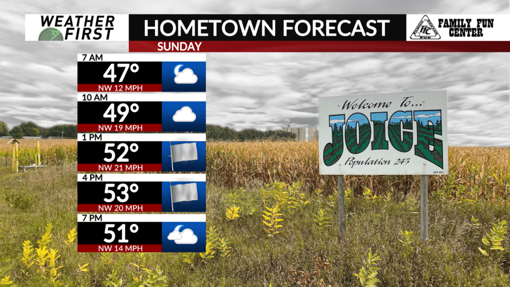
Clouds increase quickly Sunday morning as an area of low pressure passes us by to the northeast. Cloud cover will range across the Weather First area, with fewer clouds south of the Minnesota/Iowa border, especially later in the day. There will also be a slight chance for a few showers, especially closer to the Wisconsin border.
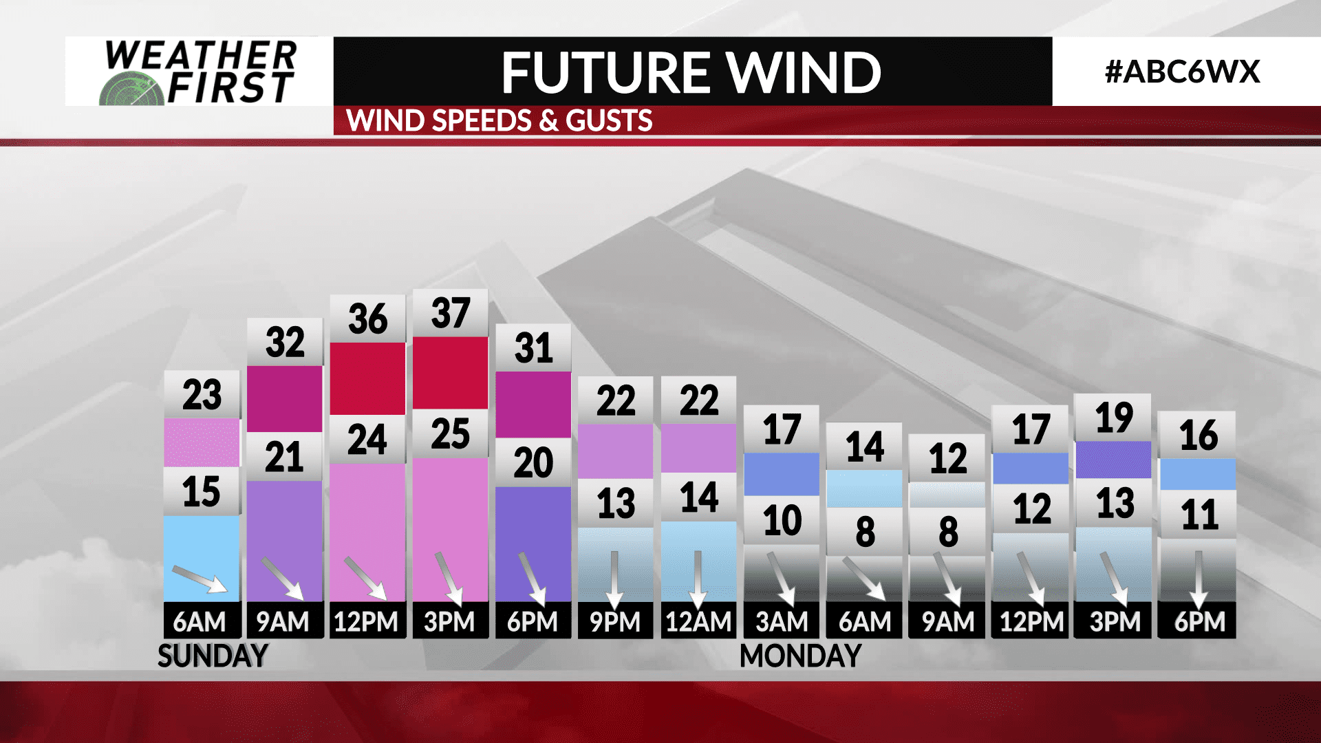
Winds are going to be quite noticeable out of the northwest, ranging from 20 to 30 mph sustained. Some gusts could top 35 mph at times during the afternoon hours!
Temperatures will not climb too much thanks to the cloud cover and strong northwest winds, only reaching into the low to mid 50F’s. Going to feel a bit raw out there for sure!
Skies begin to clear toward Sunday evening as we loose daytime instability, giving way to a generally clear sky for Sunday night. Temperatures will drop into the upper 30F’s for most, with winds decreasing but remaining breezy at times out of the northwest.