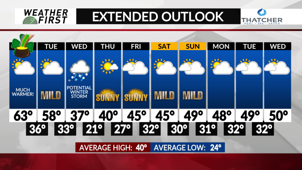
Late week temperatures hinge on Wednesday
Confidence on what temperatures look like the latter half of the week is about as low as confidence on Wednesday’s winter storm. But why?
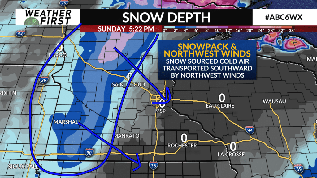
Snow has a high albedo, which means it is highly reflective for solar radiation, which heats the earth’s surface. When snow is on the ground, less solar radiation is absorbed by the ground, then transferred to the air. This results in colder temperatures compared to areas with no snow on the ground.
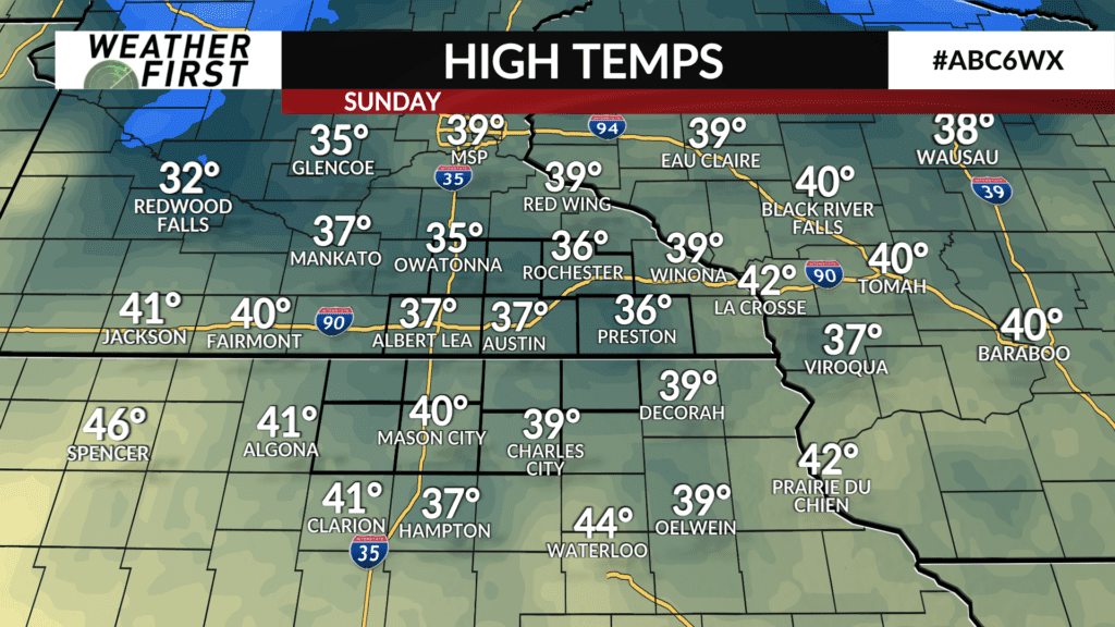
Temperatures today (Sunday), were restrained in the mid 30F’s across the southeastern portion of Minnesota because of snow across the western/northwestern portion of the state. Snow aids in building a colder airmasses, and winds directed this colder air into the area.
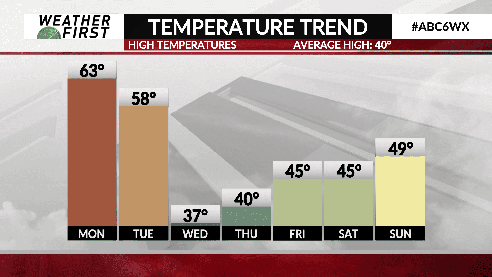
The same situation will take hold later this week, but it will be far more local. Fresh snow across the area will mean high temperatures may have to be lowered in future forecasts. If most of our area sees a few inches of snow Wednesday, highs Thursday through Saturday may be capped in the 30F’s. If our area sees less snow, high temperatures in the 40F’s may return as soon as Thursday.
For now, high temperatures on Thursday will be right around 40F, with plenty of sunshine behind Wednesday’s storm system. Friday will be slightly warmer, with high temperatures in the low to mid 40F’s. High temperatures in the 40F’s will then continue into the weekend.
One thing we have going for us this time of year, is that the sun angle is much higher than it is in January and February. This will allow the snow to melt faster, and allow the warmer weather to return more quickly!
Regardless of how much snow we see Wednesday, odds favor warmer weather returning sooner rather than later.