Major downtrend in temperatures midweek
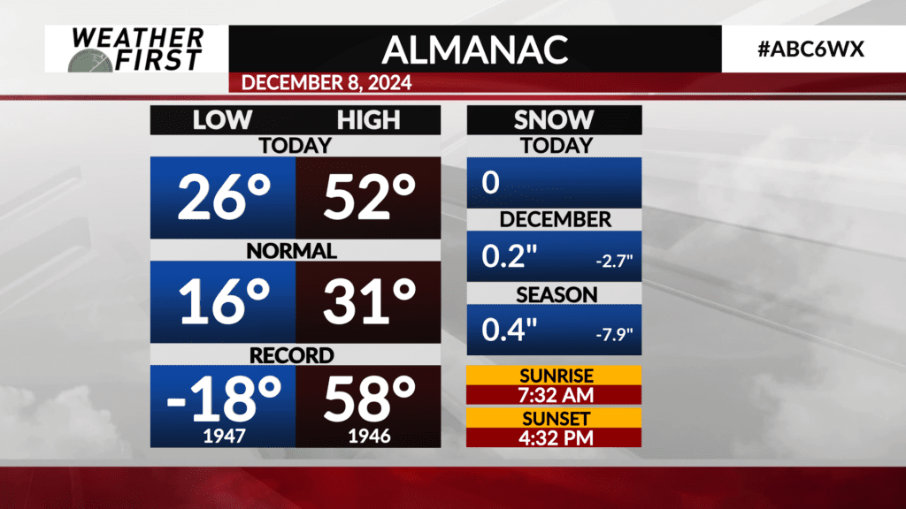
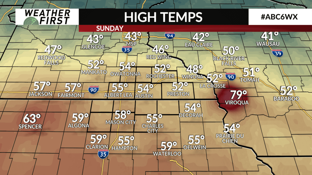
Very warm temperatures relative to average have been hanging around southeastern Minnesota and northern Iowa. Temperatures topped out in the low to mid 50F’s across southeastern Minnesota and in the mid to upper 50F’s across northern Iowa! Even warmer than Saturday!
While we didn’t break any temperature records in Rochester, we came much closer to reaching the record high of 58F set back in 1946 than to reaching the record low of -18 set back in 1947.
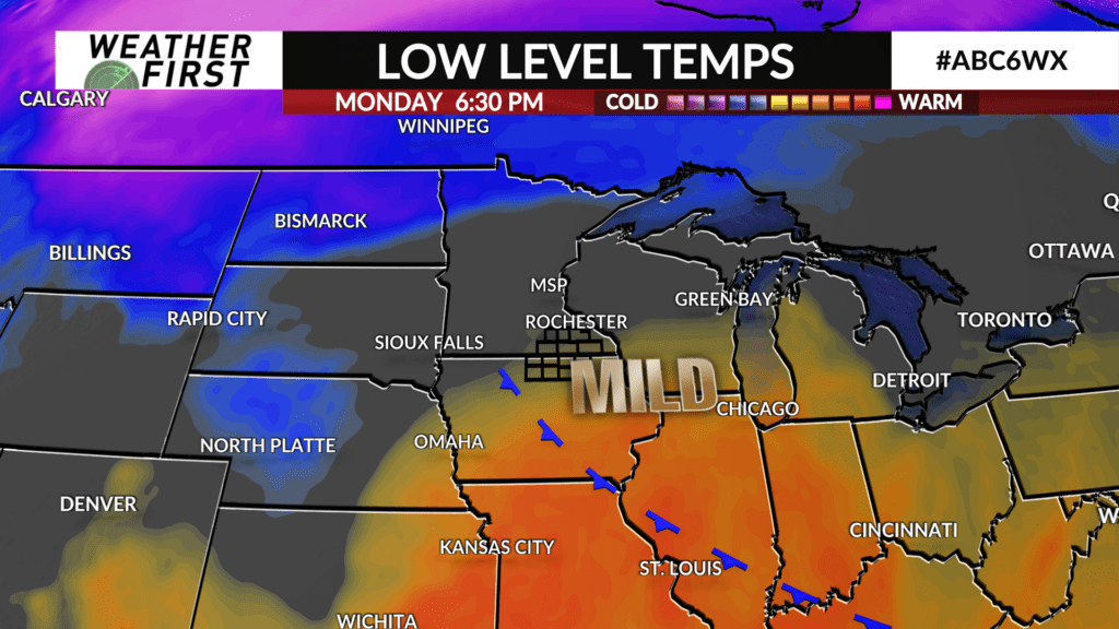
The warm temperatures are not going to be sticking around much longer, however, with several cold fronts set to track through the area early this week.
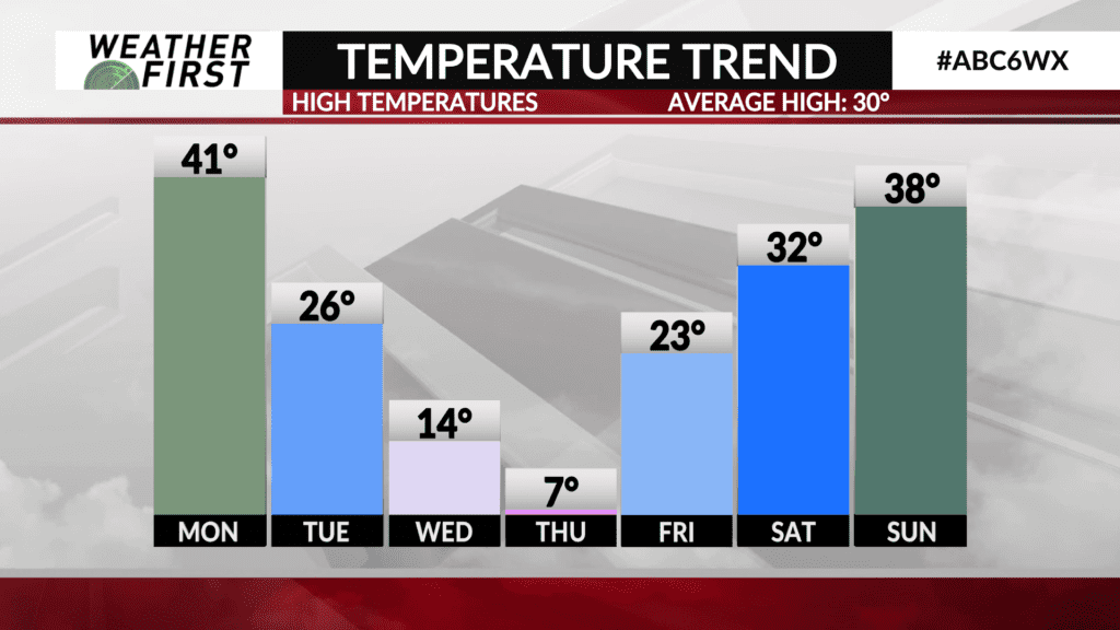
The first cold front tracks through tonight, shifting winds from south to west overnight. Monday will be cooler as a result, with highs in the low to mid 40F’s.
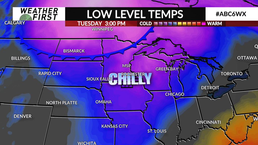
Another cold front tracks through Monday evening, bringing much colder air into the area for Tuesday, resulting in high temperatures only making it into the mid 20F’s.
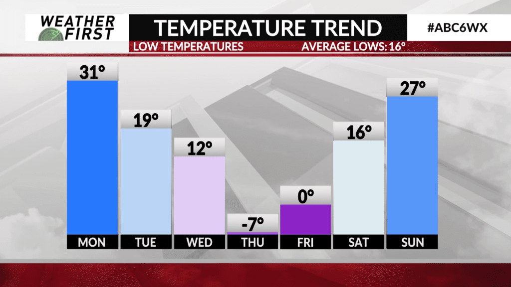
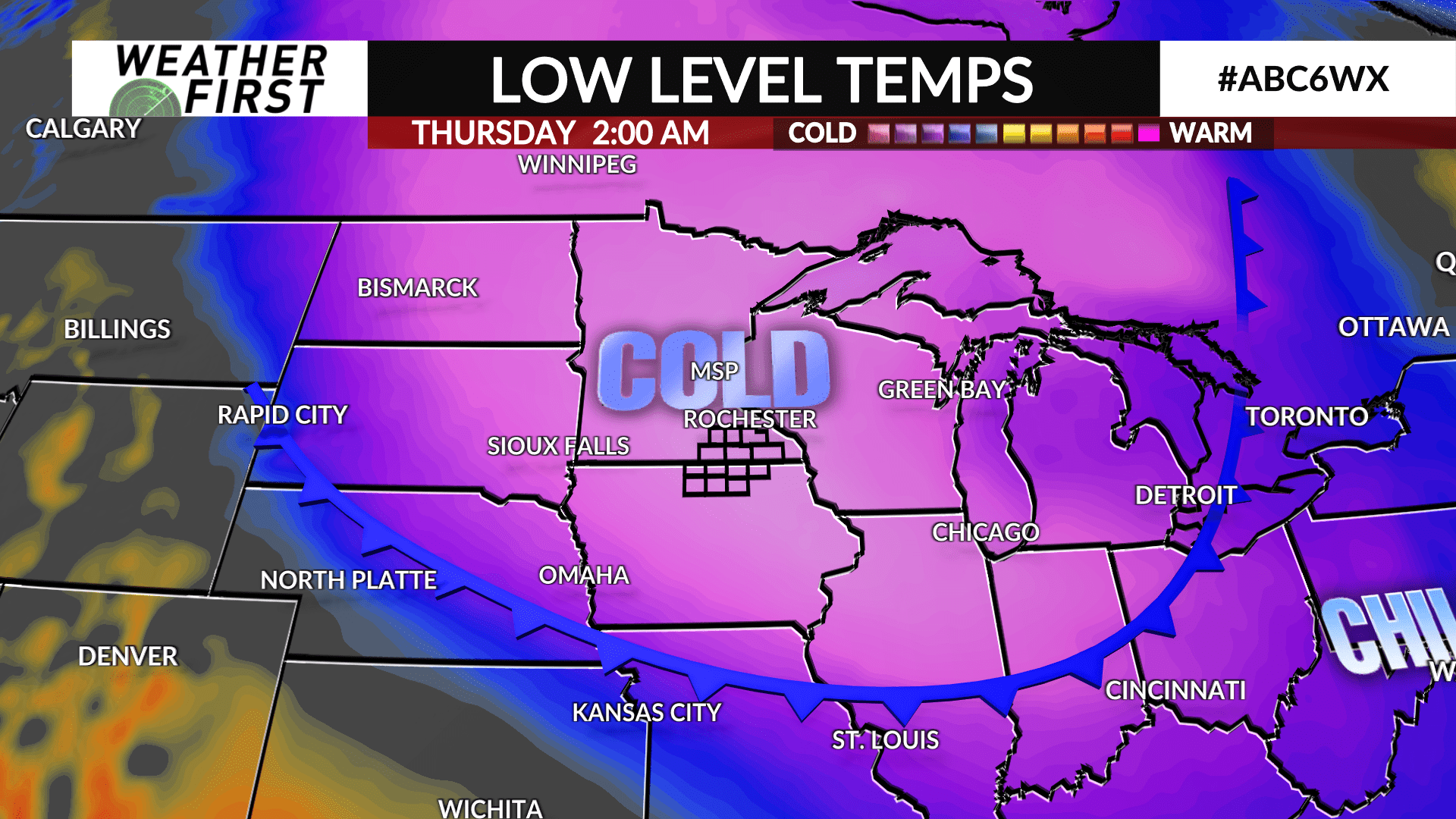
Yet another cold front passes through Tuesday night into early Wednesday, bringing in gusty northwest winds and MUCH colder temperatures. In fact, it appears we will see the coldest air of the season so far Wednesday night into Thursday morning!
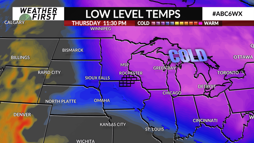
High temperatures on Wednesday will be in the mid teens during the morning, with temperatures dropping throughout the day. By Wednesday night, temperatures will drop below 0F, and bottom out in the negative single digits by Thursday morning. Factor in gusty northwest winds up to 25 mph as well, and wind chills are going to be dangerously cold.
Highs only make it into the single digits Thursday, with lows near 0F Thursday night. Fortunately, highs in the 20F’s return for Friday, with 30F’s making their return next weekend!
Overall, the wild temperature swings look to continue through the next week, temperature swings that are almost hard to believe!
