Mild this weekend, colder next week

The mild temperatures we have been seeing as of late will continue through the weekend ahead, before colder air arrives to usher in the new year.
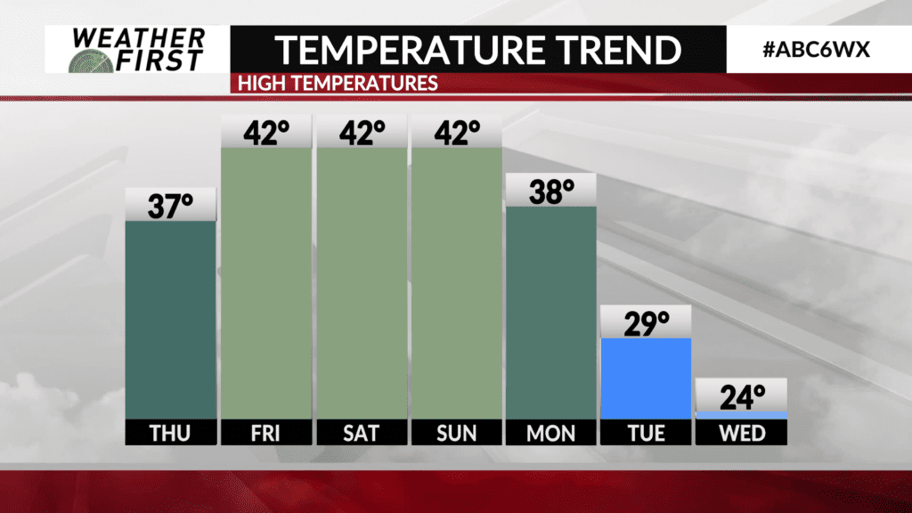
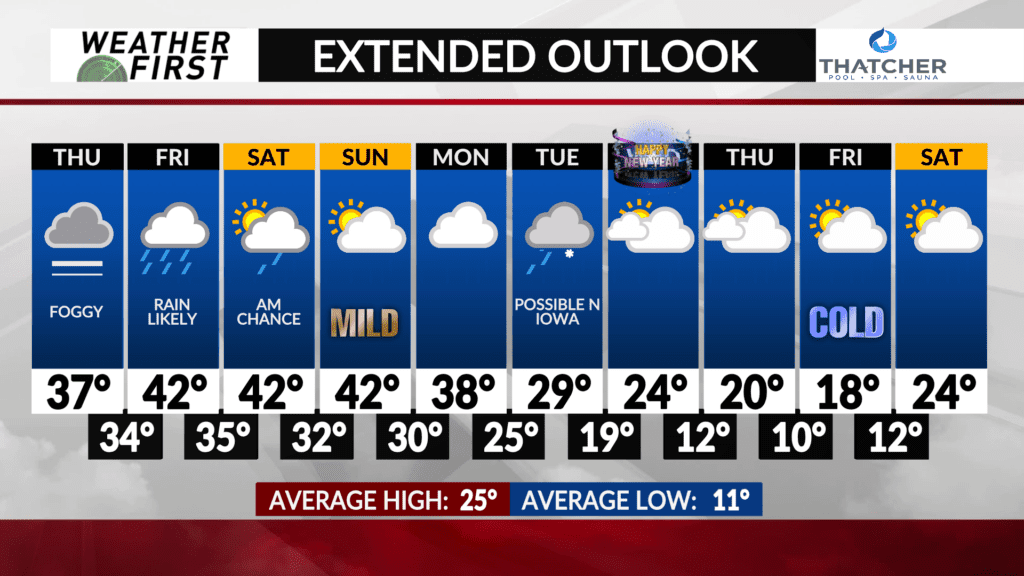
High temperatures Thursday will reach into the upper 30F’s across all of the Weather First area. A subtle trough of low pressure swings through the area Friday, bringing a widespread rain with it. This trough will not be tapping into much arctic air to its north. With that said, mild temperatures will continue through the weekend ahead.
High temperatures will climb into the lower 40F’s for Friday, and remain there Saturday and Sunday. Clouds hang around most of this weekend, with the potential for some sun on Sunday. Would certainly make the lower 40F’s far more enjoyable!
Another trough passes through Sunday, deepening as it does so. This deepening will result in the trough tapping into arctic air over Canada, and tugging it southward. This will result in highs dropping into the 30F’s for next Monday.
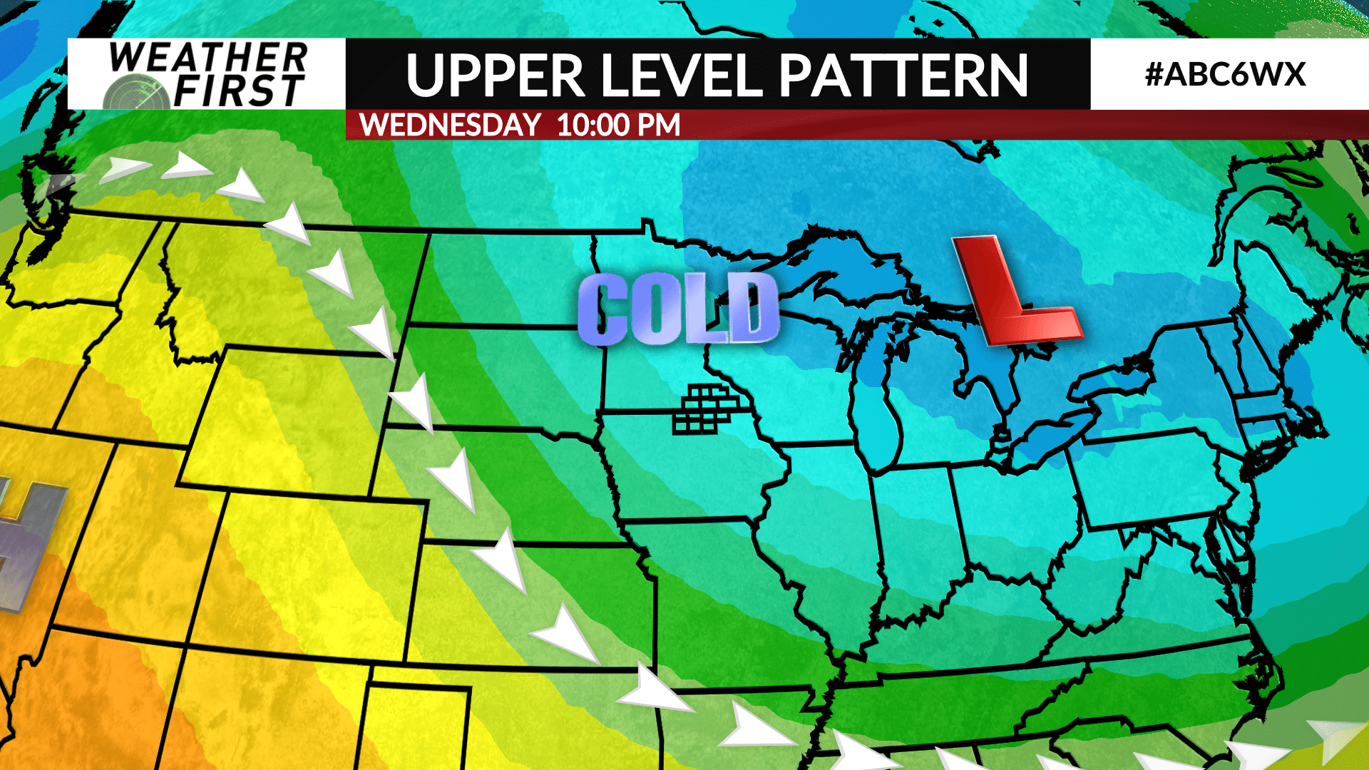
Yet another trough passes through next Tuesday, all the while an upper level low beginnings to build across southeastern Canada. The parade of troughs will amplify this low, which will open the arctic air gates toward the end of next week across the Upper Midwest.
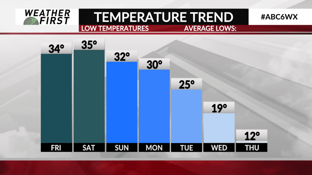
With that said, high temperatures drop into the 20F’s to start the new year, with highs in the teens by the end of next week. There are no lows in the single digits in the forecast for the time being, but the overall upper level pattern starting next week will likely lead to multiple rounds of arctic air during early January.
Enjoy the mild air while it lasts!


