Much colder air on the way next week

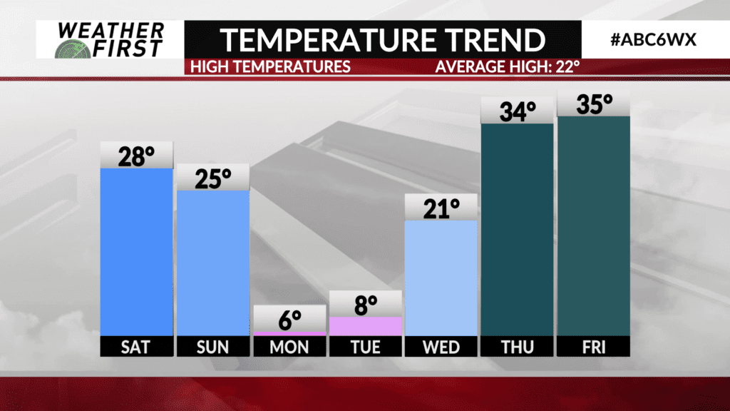
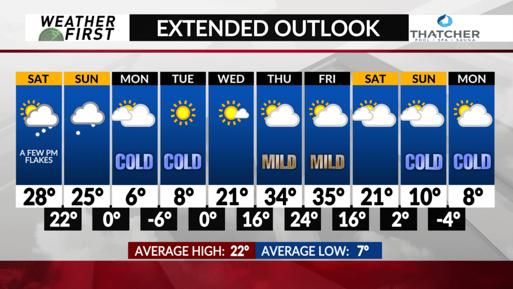
After a weekend of above average temperatures, much colder air will come pouring in from the arctic tundra, and send those thermometers crashing into the single digits above and below 0F through early next week.
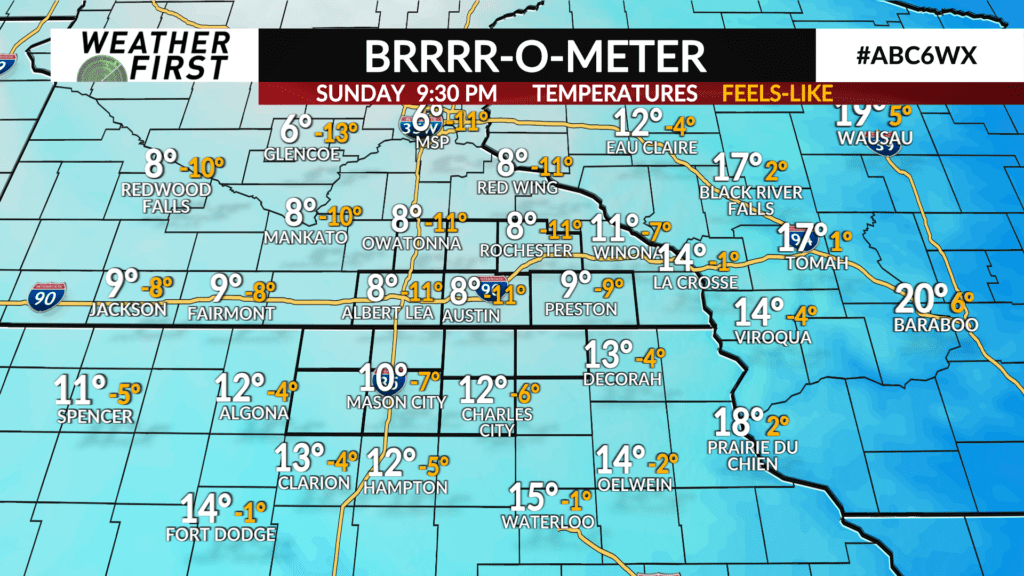
The same Alberta Clipper system bringing our weekend snow chance will be pulling MUCH colder air southward behind it late this weekend. Behind the cold front winds will shift to out of the northwest Sunday afternoon, knocking temperatures down into the single digits by late Sunday evening.
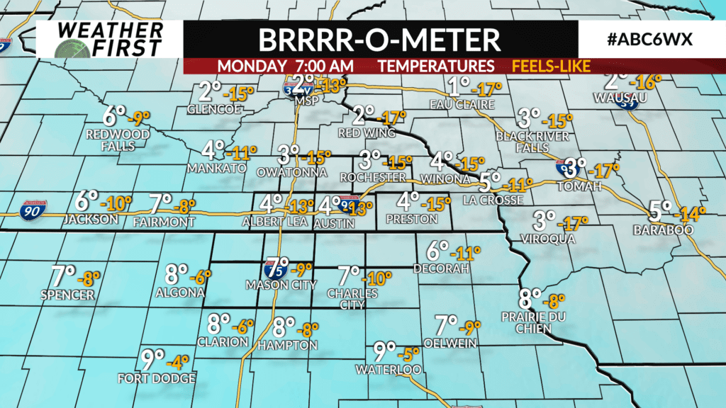
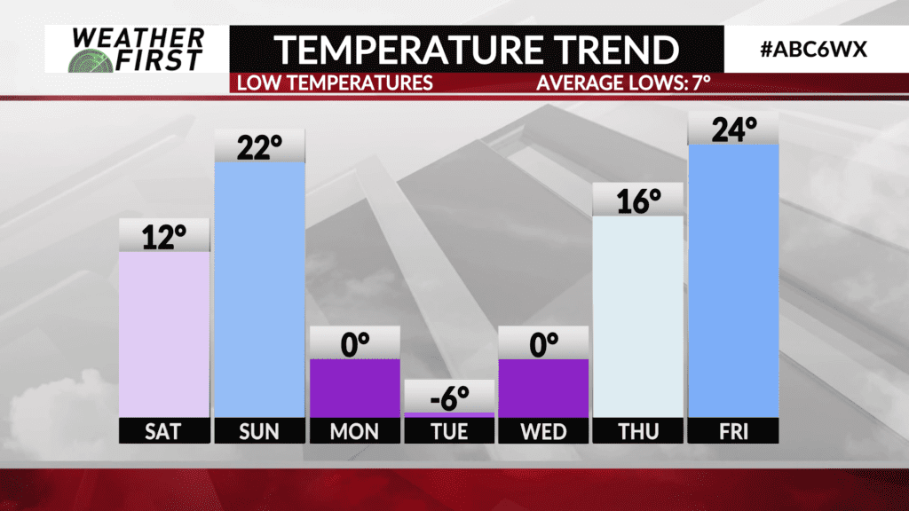
Overnight lows Sunday night into Monday morning are expected to be below 0F for most of southeastern Minnesota and northern Iowa. Northwest winds will also be sustained around 10 to 15 mph, gusting up to 25 mph at times Sunday through Monday. This will result in wind chill readings as low as -20F.
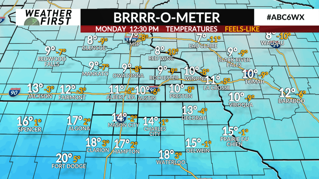
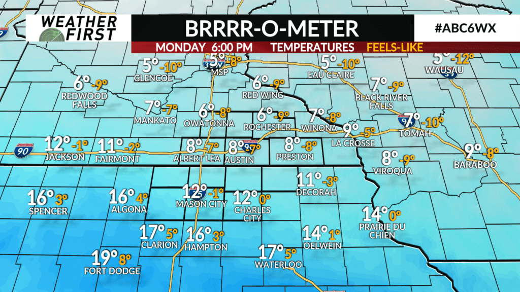
High temperatures only climb into the single digits Monday during the day, with clouds hanging around and northwest winds remaining brisk. Wind chills will only climb to around -15F or so Monday afternoon given the winds and temperatures.
Low temperatures drop into the negative single digits Monday night into Tuesday morning, with wind chills as low as -20F once again.
Wind chills remain well below 0F Tuesday night into Wednesday morning, with overnight/morning lows around 0F. Temperatures finally moderate Wednesday, with high temperatures climbing into the low to mid 20F’s, thanks to winds shifting to out of the south.
The main thing to remember early next week is to bundle up in thick winter jackets, gloves and hats with wind chills reaching dangerously low temperatures. Stay warm!
