Our next winter storm?
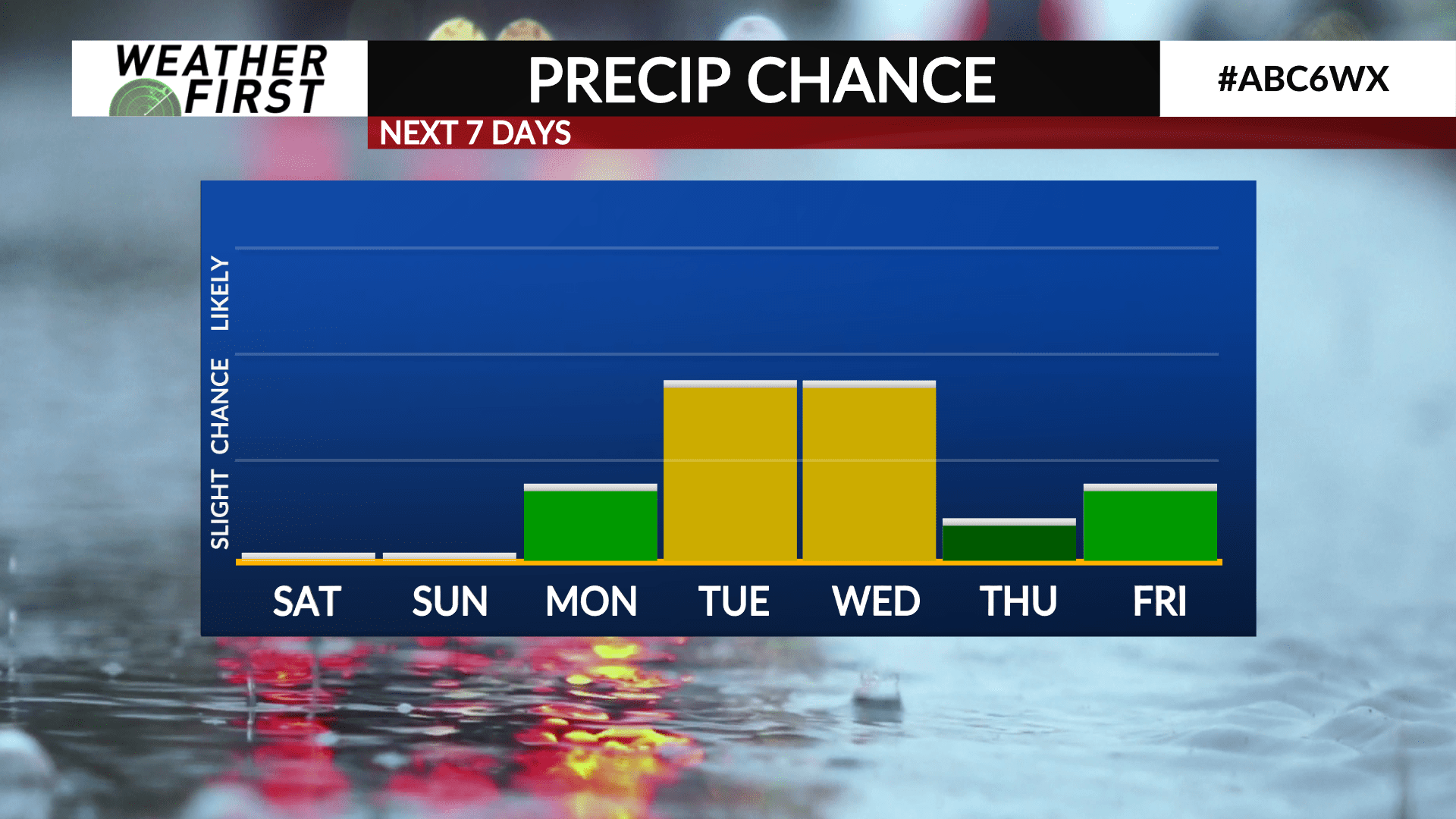
Model guidance has been hinting at the potential for a winter storm to impact our area next Tuesday and Wednesday for weeks now, and while confidence is increasing in this system actually taking place next week, whether it impacts us or not is still uncertain.
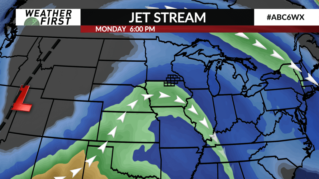
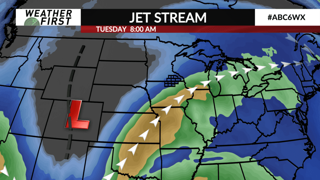
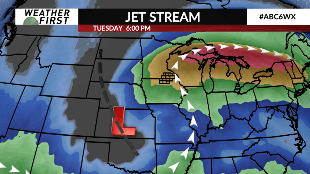
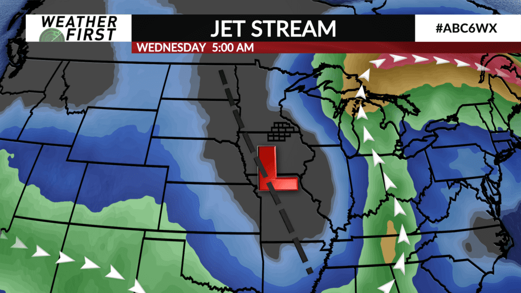
A pronounced upper level trough of low pressure is expected to develop along the United States West Coast, and track eastward through the weekend, and into early next week. This trough will amplify and deepen as it does so, tapping into copious amounts of Gulf of Mexico and Pacific moisture.
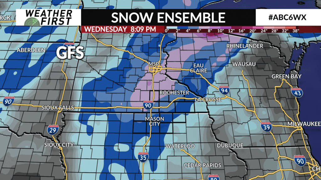
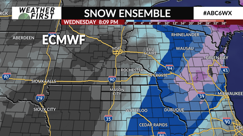
The big uncertainty factor with this system, is where the surface low pressure tracks. Model guidance is very split on just how far north the low will track, with some guidance bringing the low right through the area, while others indicate it will pass well south and east of the area.
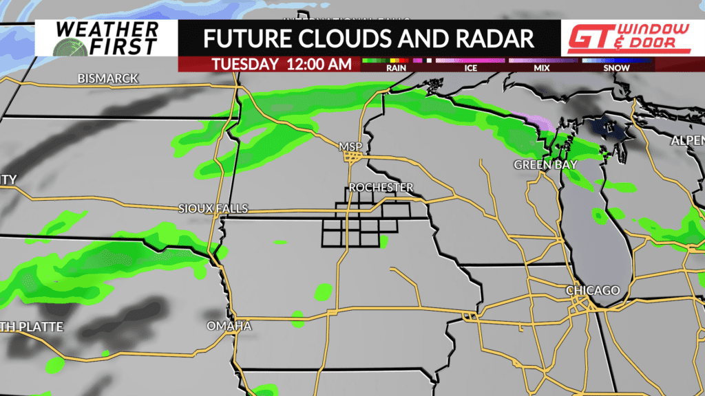
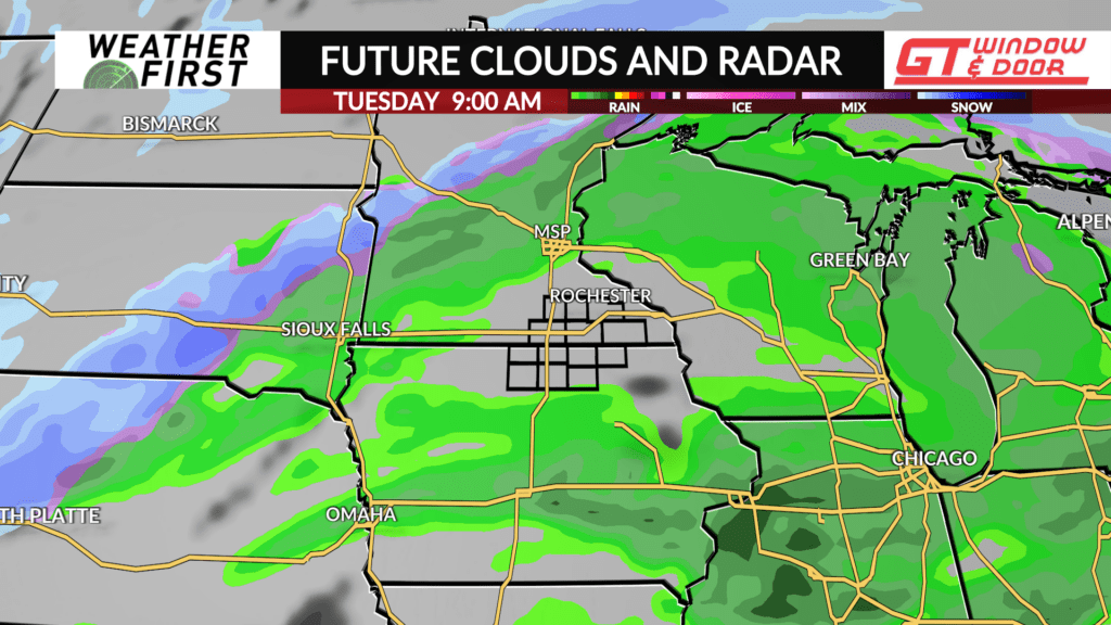
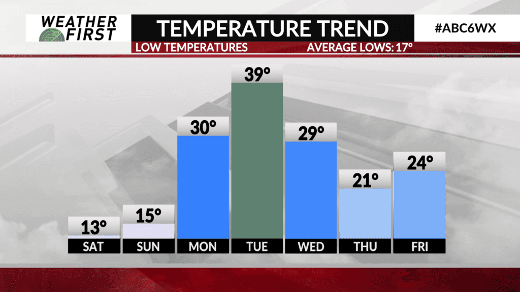
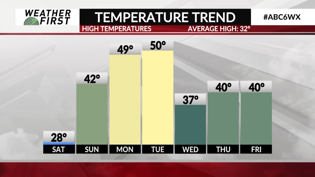
If we want a big precipitation event, the low has to track closer to our area. Temperatures through early next week will be quite warm for this time of year, with highs near 50F both Monday and Tuesday. Any precipitation that takes place across our are Tuesday will be in the form of rain.
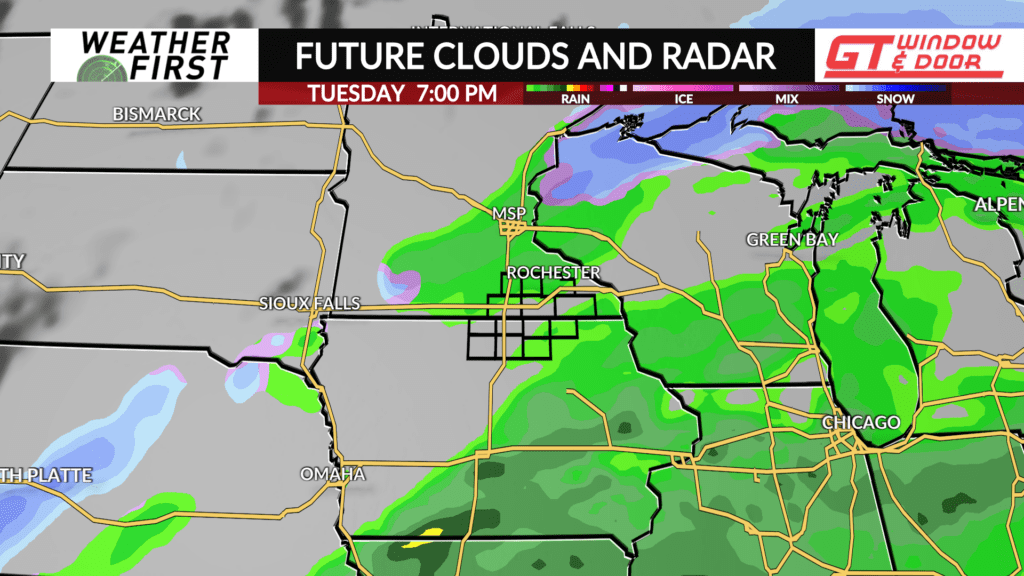
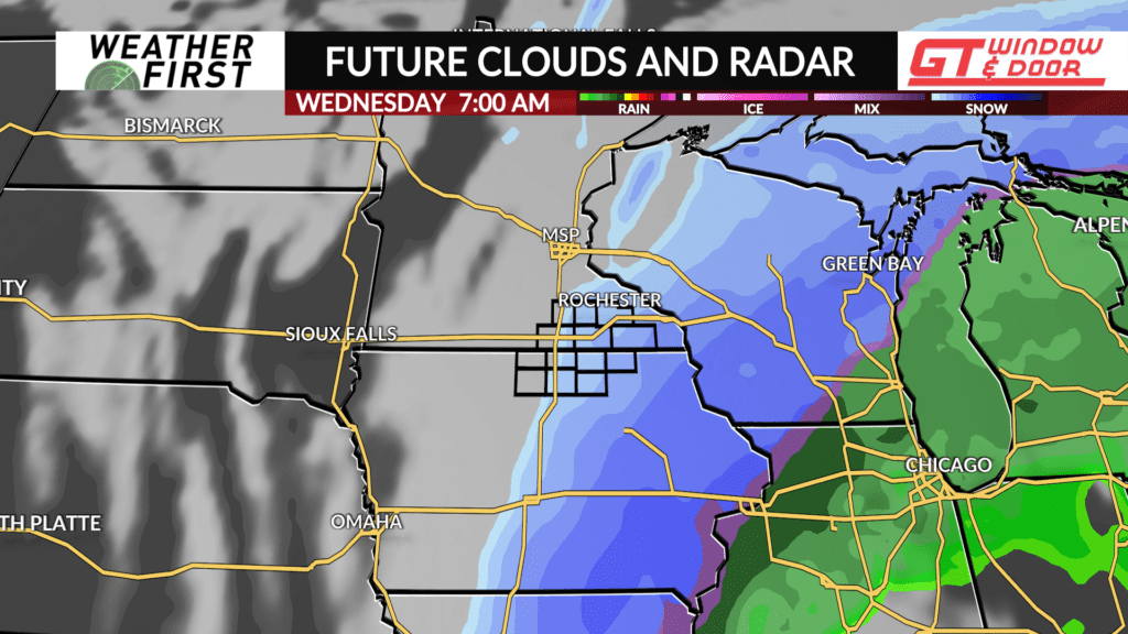
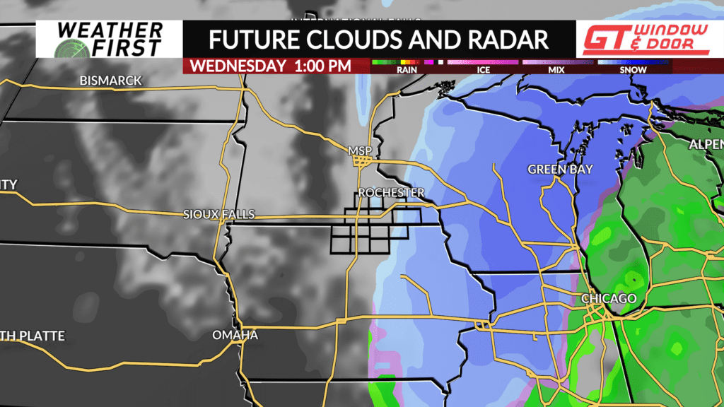
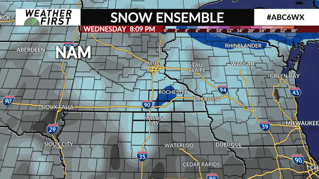
By Tuesday night and into early Wednesday morning, temperatures begin to drop quickly as the low passes either over us or south of us. This will result in the potential for a transition from rain to snow across the area.
But how much snow? Again, this depends on where the surface low tracks. If the surface low tracks near our area and we are caught in the intensification of lift near the low, we could see quite a bit! However, if the low tracks further south and east, we may not see any snow at all.
As said before, there is still a lot of uncertainty with this storm system. We’ll be tracking it closely over the weekend, and will have all the updates as they come in. For now, it’s just something to watch. No point in worrying about impacts yet!