Patchy fog possible tonight

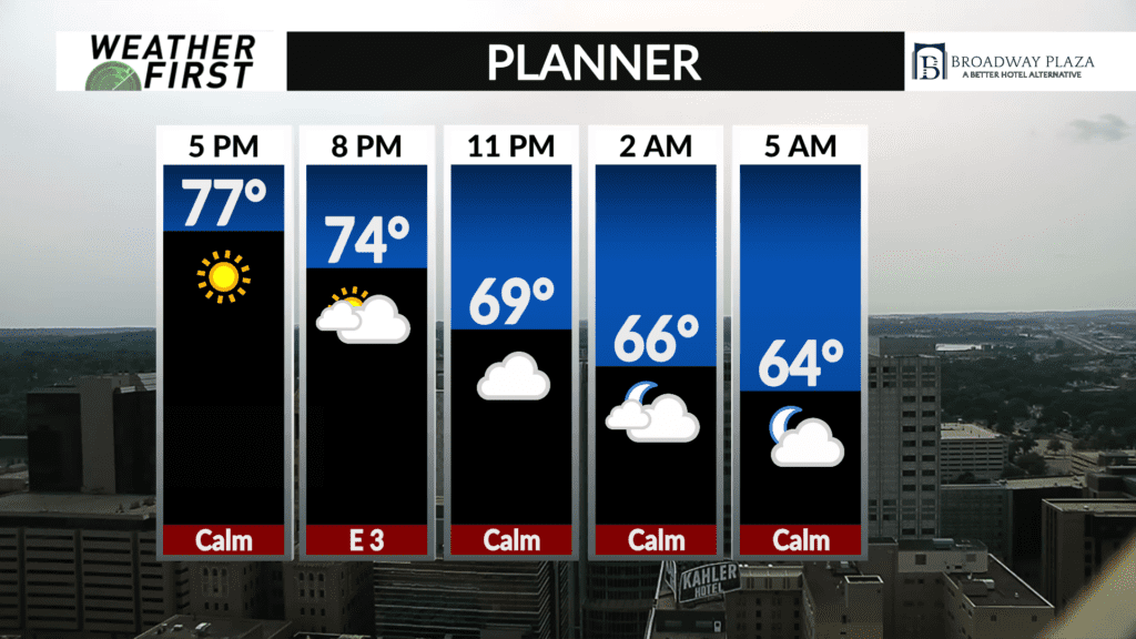
As we head into the early morning hours of Monday morning, there is the potential for some patchy fog across the viewing area.
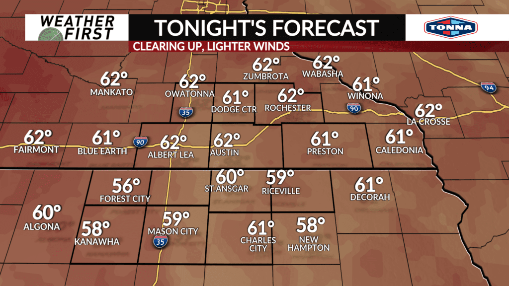
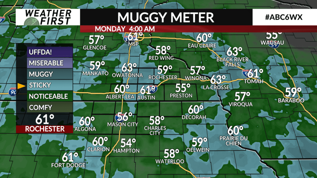
Temperatures are expected to drop into the upper 50F’s to lower 60F’s across southeastern Minnesota and northern Iowa by early morning. Dew points are also expected to be right around this range, if not slightly lower.
Winds are expected to be relatively light to calm through tonight and into tomorrow morning. Skies will be on the clear side as well, allowing for more cooling tonight, especially over flatter and lower terrain.
When your temperature and dew point are in close proximity to one another, combined with light winds that do not disturb the air too much, you tend to see the formation of fog, especially in lower lying areas.
This being said, when you are heading out the door tomorrow morning, just be aware that you may encounter a bit of fog out there. As of right now, the fog is not expected to be widespread and dense enough to prompt a dense fog advisory.