Rain early next week, cold to follow

Next weeks potential storm system has been a topic of a lot of attention the last few days. With it being as far out as it is, many details have changed since even this time yesterday. Two things ae looking more likely though: we could quite a bit of rain early next week, and temperatures are going to trend much colder by weeks end.
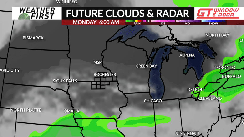
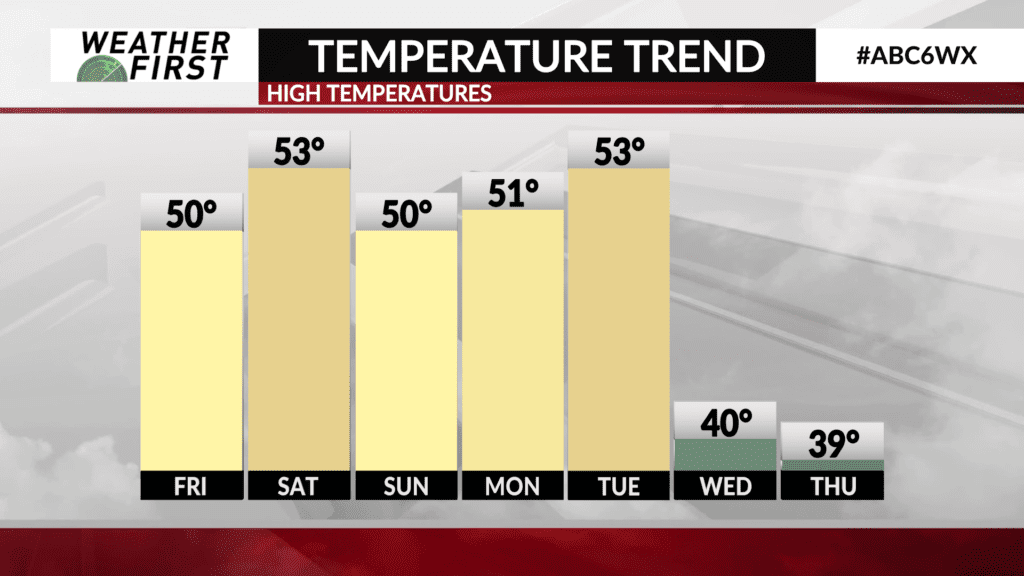
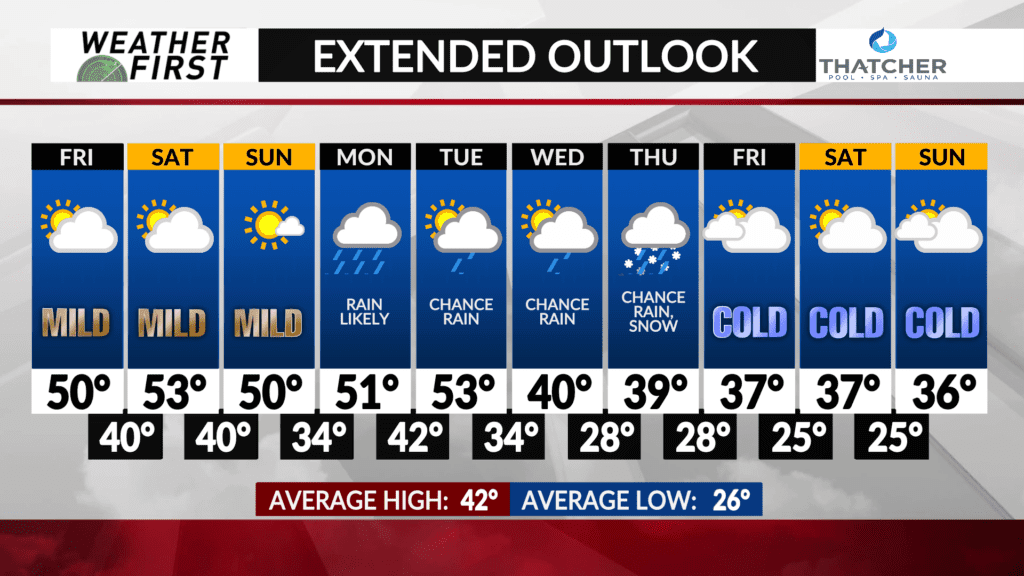
Monday will start out dry, with increasing clouds through the morning hours. High temperatures will reach the low 50F’s for most of the Weather First area as well, making for a mild mid-November day.
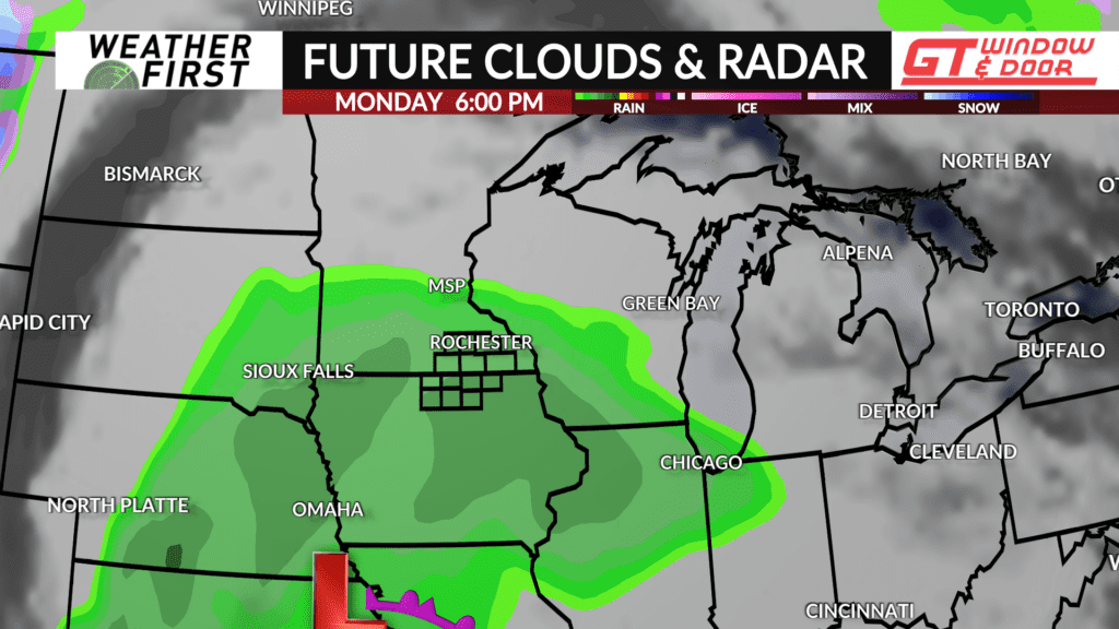
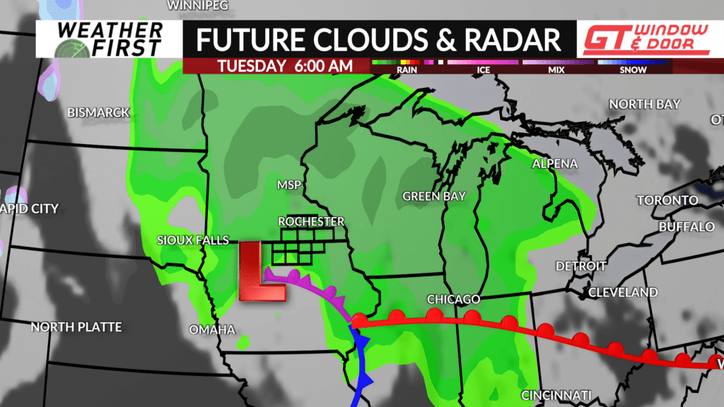
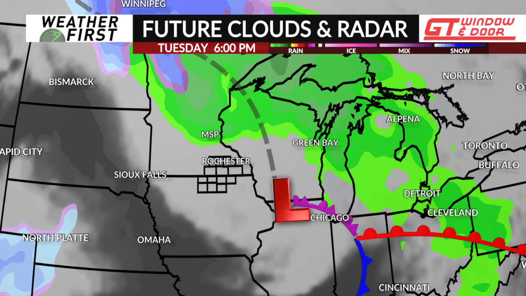
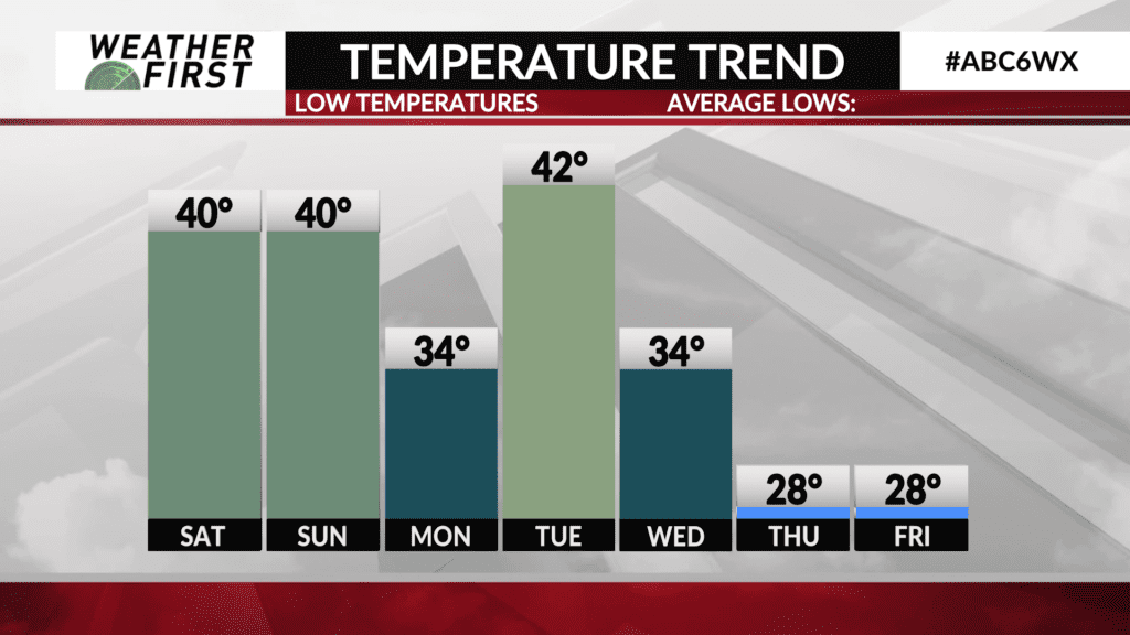
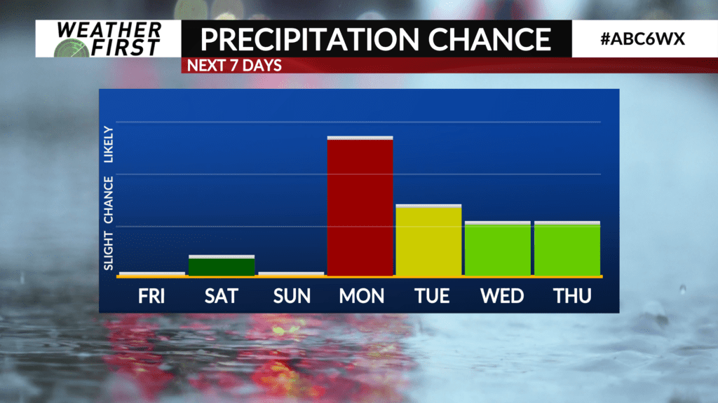
Rain moves into the area quickly Monday afternoon and into the evening hours, and could last through most of Monday night into early Tuesday morning. Current rainfall projections show up to 1″ of rain or more here locally Monday afternoon through Tuesday morning, a highly beneficial rainfall! Temperatures will only drop into the low 40F’s Monday night, preventing the possibility for any snow to mix in.
Tuesday highs remain in the low 50F’s, with scattered showers remaining possible throughout the day, although Tuesday afternoon continues to trend drier.
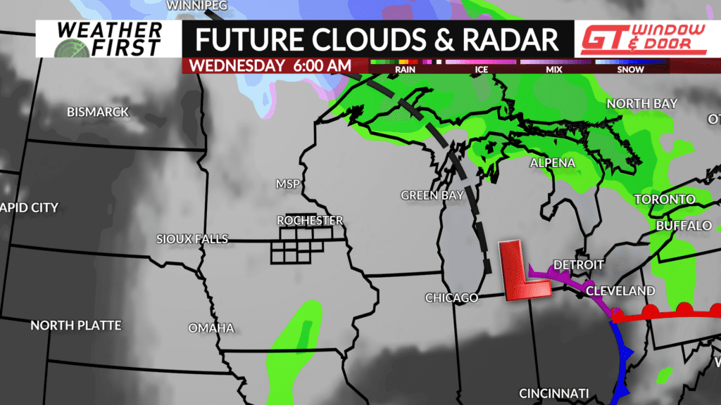
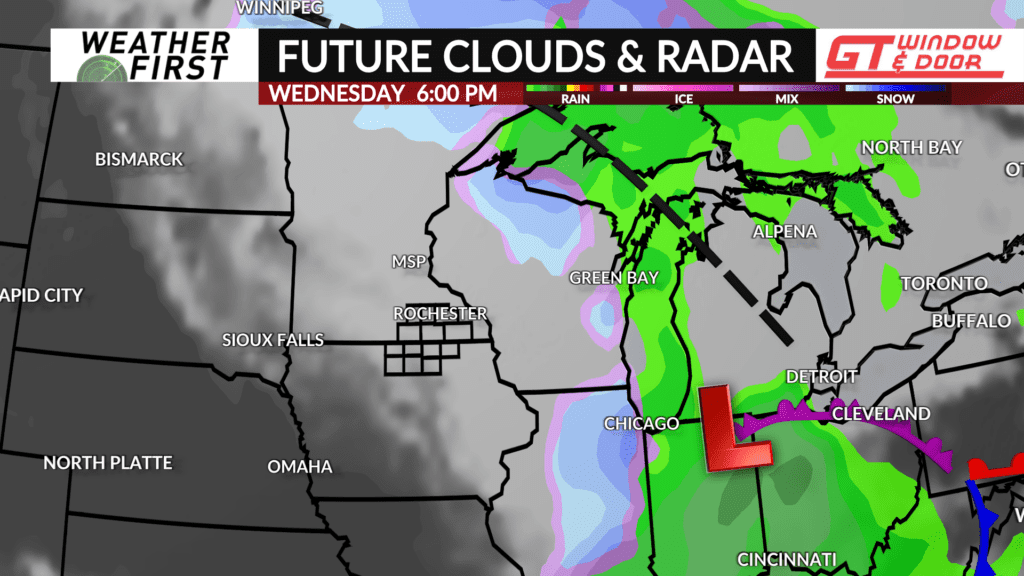
Temperatures tank on Wednesday, with a high of only 40F. There is the chance for a few rain showers around the area through the day Wednesday, but the chance is on the lower side at this time.
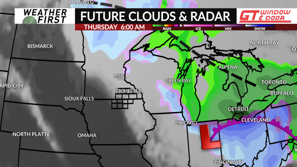
With temperatures dropping into the 30F’s and 20F’s Wednesday night and lasting through Thursday, any precipitation falling across the area certainly has the potential to be in the form of snow. Current model guidance indicates that the heaviest precipitation may be well to our east or north by the time temperatures drop enough to permit snow to fall.
By the end of next week, any precipitation will come to an end, but temperatures will continue to drop behind the storm system. Highs next Friday will only be in the upper 30F’s, with next weekend featuring mid 30F’s for highs. BRRRRR.
