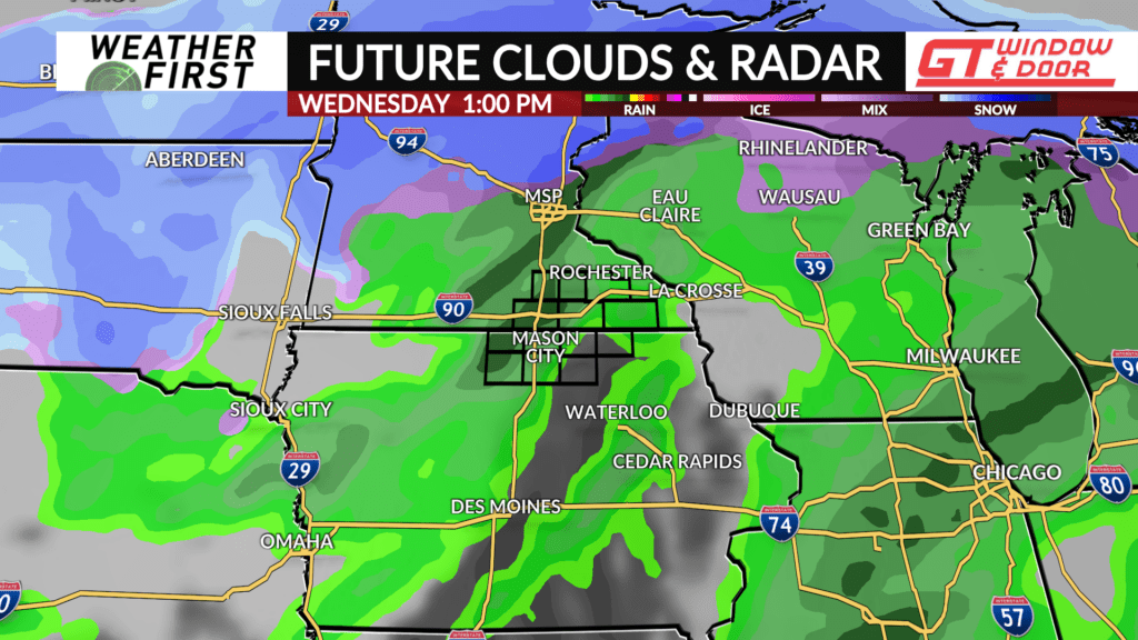
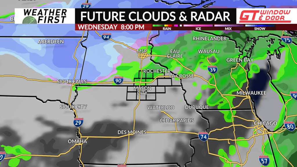
Rain/snow chances return Tuesday/Wednesday
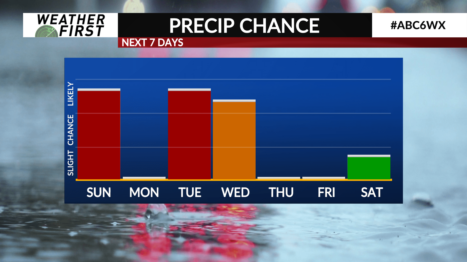
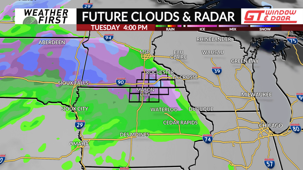
We won’t get much of a break between this weekends storm system and the next one! Model guidance is in fair agreement that Tuesday and Wednesday will feature the return of widespread precipitation, with both rain and snow likely.
Precipitation chances begin Tuesday afternoon, but the type of precipitation that falls is still up in the air, no pun intended. Model guidance is teetering between a rain/snow mix and a purely snow solution during the day on Tuesday, with accumulating snow expected.
Given the potential for temperatures to drop once precipitation begins, have gone with a snowier solution during the day on Tuesday, with an inch or two of snow accumulation possible. Details can change between now and then, however, so stay tuned!
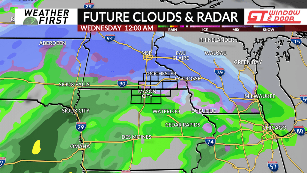
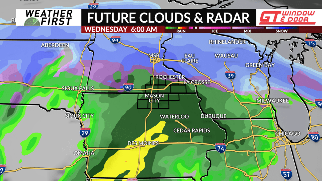
Temperatures will actually rise Tuesday night into Wednesday as a warm front pushes through and southerly winds transport warmer air northward. This will result in temperatures well above freezing through a fair chunk of Tuesday night and Wednesday morning.
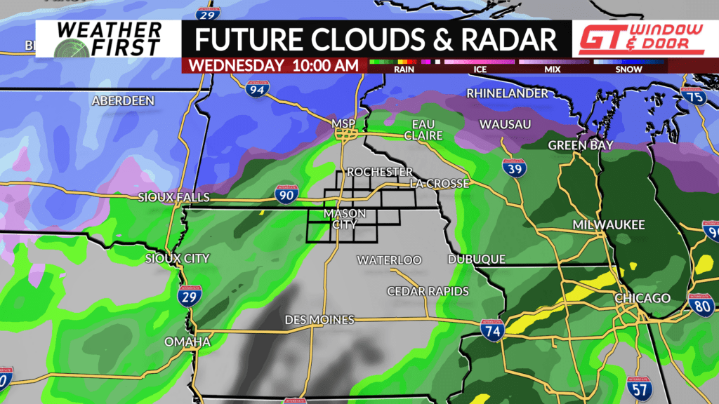
Rain will begin to mix in Tuesday night, becoming all rain by Wednesday morning. Precipitation chances look to continue through most of the day Wednesday. A thunderstorm or two cannot be ruled out either on Wednesday at this time, given the chances for instability to make it into southern Minnesota and northern Iowa.
There is still some uncertainty with this system, however. Model guidance showing the low further south have more snow for us locally, while model guidance further north has less snow. A lot will hinge on where the low tracks, which is not something we will have a better idea of until Monday.
