Saturday’s (3/8/2025) Almanac

While snow limited temperatures just to our west, it was still a gorgeous day across southeastern Minnesota and northern Iowa!
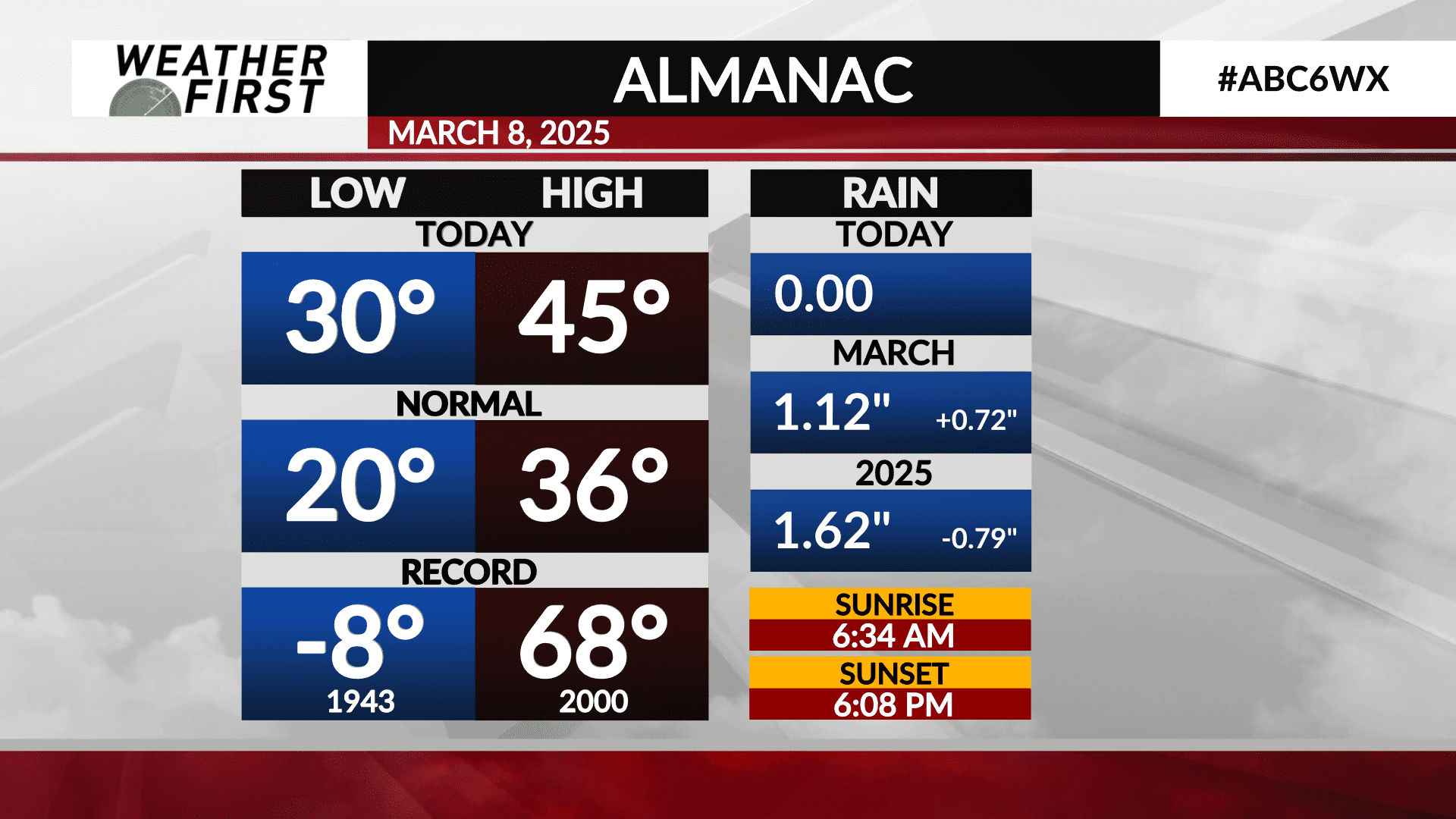
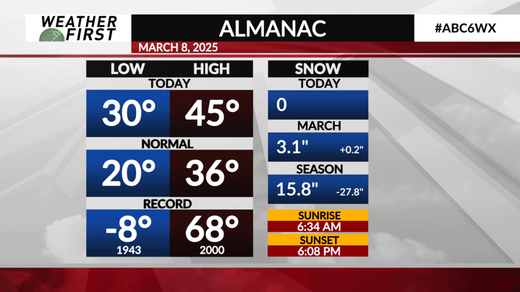
The observed high temperature today in Rochester was 45F, which falls 9F above the long term average for March 8th of 36F. The observed low was 30F, which falls 10F above the long term low for March 8th.
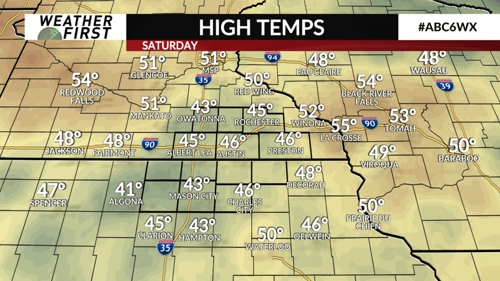
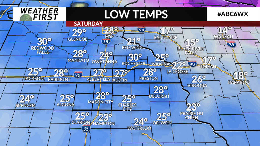
Regionally, the areas that still have snowpack are fairly evident just from observing today’s high temperatures. Owatonna was cooler at 43F, as was Mason City. Overnight lows were not as effected by the snow cover, with Rochester seeing the warmest overnight low region wide.
No precipitation fell across southeastern Minnesota and northern Iowa today. There was plenty of sunshine and only a few passing clouds as a cold front passed the region by well to the northeast.
Monthly, Rochester is currently above average in terms of both snowfall and rainfall. Rochester is currently running ahead in terms of snow by 0.2″, with other locations further west likely well above average in terms of monthly snowfall thus far.
Rochester is also above average regarding rainfall, with over 1″ of rain already in the books, which is 0.72″ of rain above average for this time of month. Hopefully we can stay above the curve regarding precipitation across the area this month, especially after the last several months of very dry conditions!


