Severe Storms possible Monday, with quiet weather returning by midweek
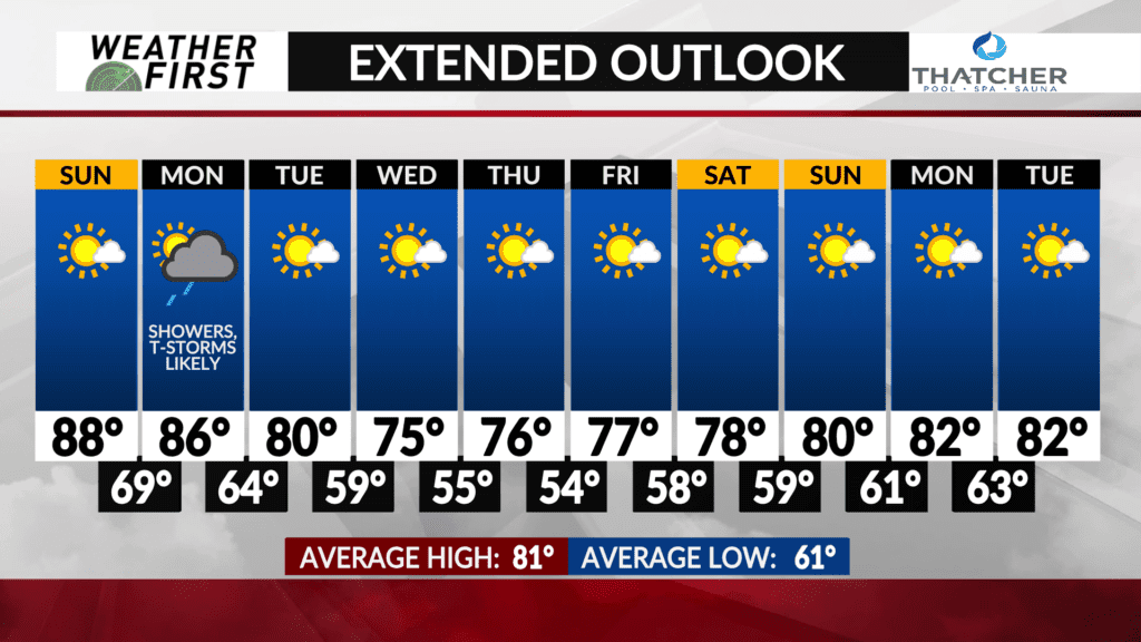
There is a lot to talk about weather wise for the beginning of this next week. Thankfully, by the middle of the week things really quiet down as well as to close out the week, which will make for a nice change after what we have seen this weekend so far.
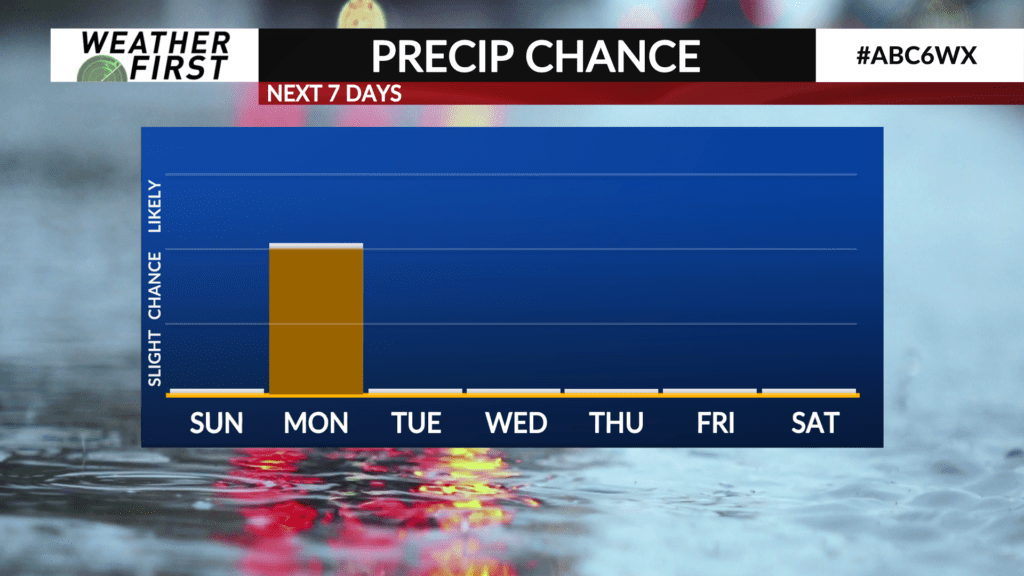
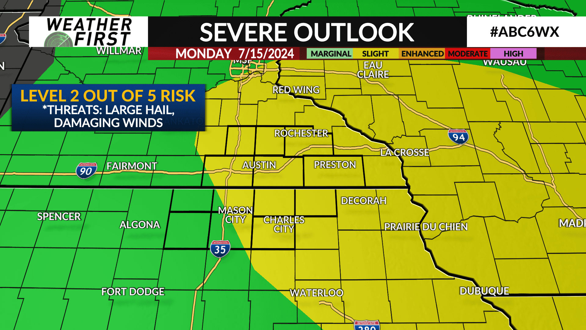
Monday widespread thunderstorms, some strong to severe, appear likely at this time. A cold front will be passing through by late Monday afternoon through the evening hours. There could very well be multiple rounds of showers and t-storms throughout the day, but the best chance will be along the cold front in the mid to late afternoon.
The Storm Prediction Center has issued a slight risk for severe weather (level 2 out of 5) for most of the viewing area for Monday. That said, the main threats with these storms will be damaging winds, large hail and heavy rain.
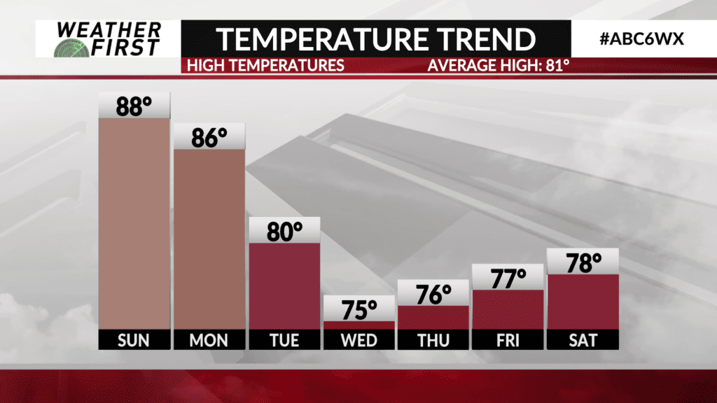
We will also have very humid and warm conditions sticking with us through the day on Monday. Highs are expected to be in the low to mid 80F’s, with dew points still in the soupy range of the mid 70F’s.
Tuesday, highs will likely be in the low 80F’s and even better, dew points will likely be continuing to drop! This will make for a much more comfortable day with plenty of sunshine!
Wednesday through Friday, highs will be in the mid to upper 70F’s which plenty of sunshine on each day! Yes, slightly cooler than average for this time of year, but it will be welcome after the warmth and mugginess of this weekend through Monday.