Showers damper the northern lights show, continue into Sunday
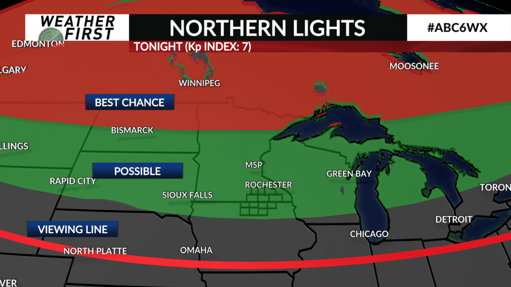
Sure, the cloud cover and rain chances HAVE to return the night a northern lights show is looking promising!
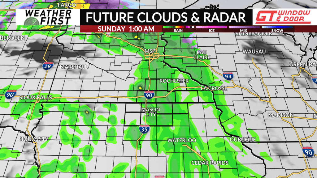
It has been a gorgeous late March day across the area, but the cirrostratus clouds are increasing quickly from the west as another storm system approaches. Low pressure tracking across central South Dakota will continue east tonight, passing over central Minnesota on Sunday. This will bring plenty of cloud cover, and a chance of rain, to the area through Sunday afternoon.
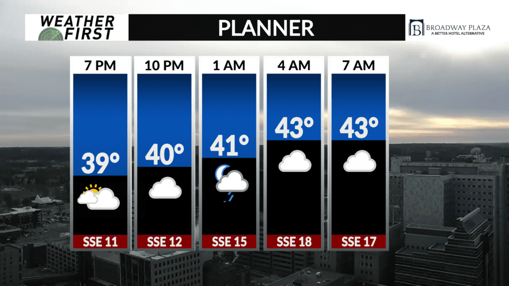
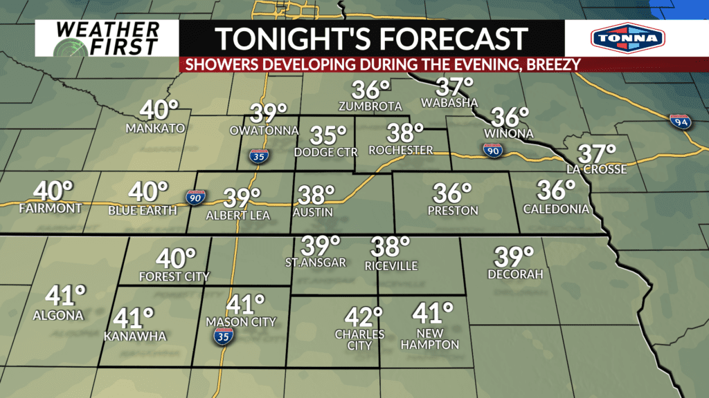
If you are heading out earlier this evening, most of the area will still be dry. Rain chances increase as the evening progresses, however. The warm front passing through tonight will be where we see the most widespread rain of this event. Even still, no significant rainfall accumulations will result, with most locations only picking up a tenth of an inch at most.
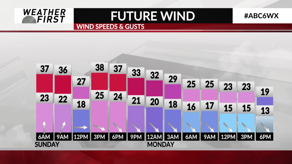
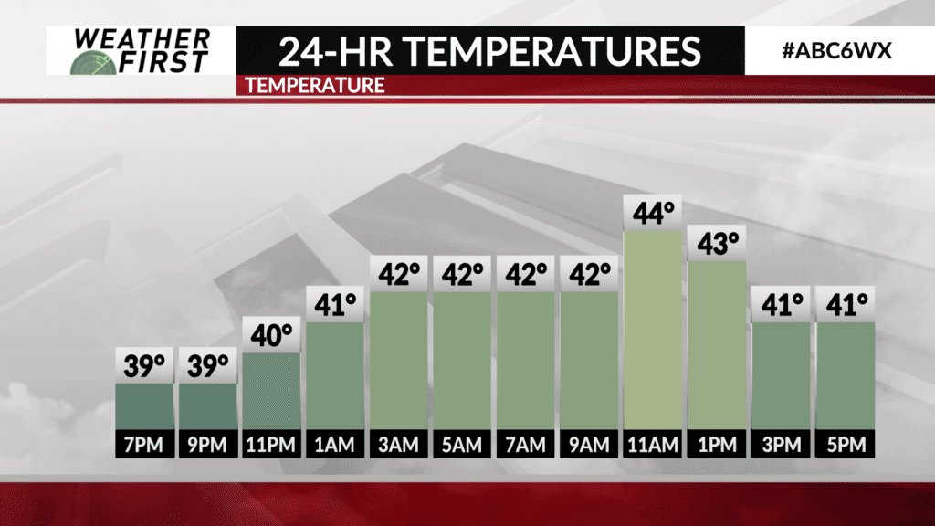
Temperatures decrease slightly into the upper 30F’s this evening, before climbing back into the lower 40F’s overnight, thanks to increased cloud cover and southerly winds. It will become quite breezy, with a southerly wind between 10 to 20 mph, gusting up to 30 mph at times.
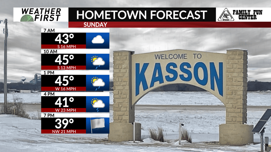
Southerly winds will increase heading into Sunday, ranging between 20 to 25 mph by the afternoon, with gusts up to 40 mph.
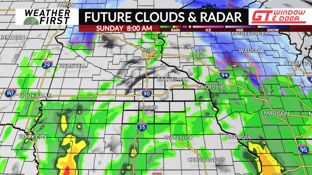
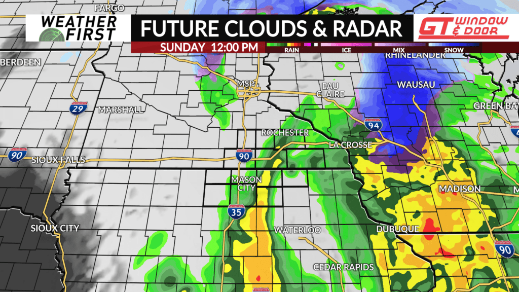
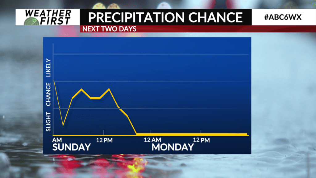
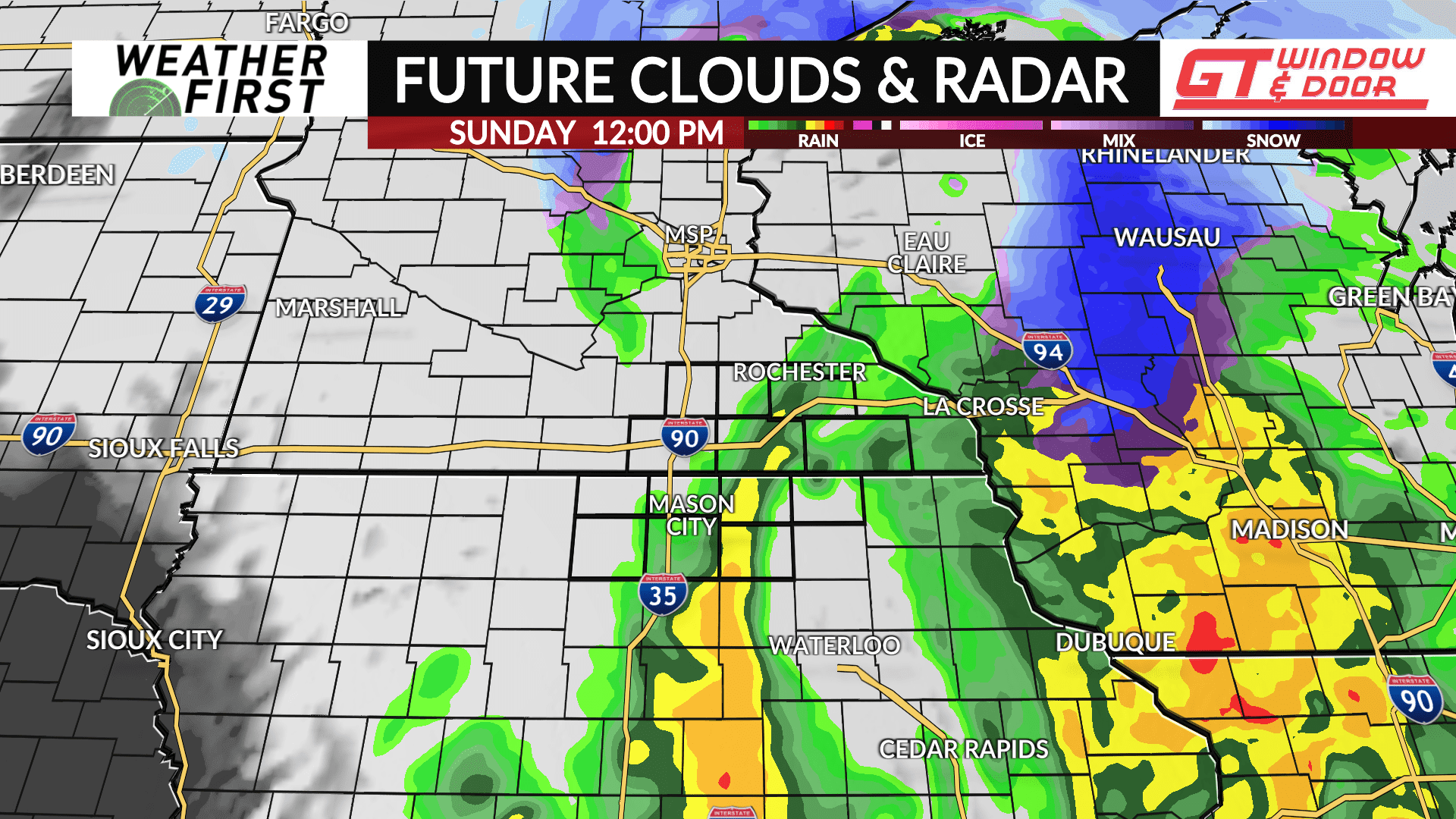
Shower chances continue through the day on Sunday, with the best chance for more widespread rain being during the morning hours. Even during the morning, however, low and mid level dry air will limit the coverage and intensity of shower activity across southeastern Minnesota and northern Iowa.
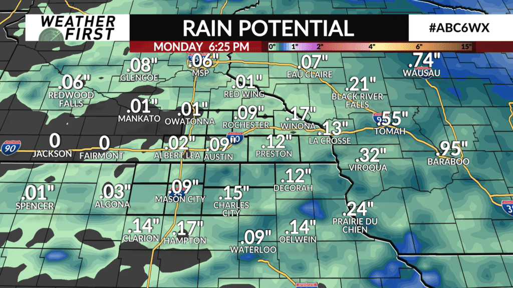
As a result, rainfall accumulations will once again be limited to a tenth of an inch at most, with some locations hardly seeing any rain at all. Not exactly a top 10 rainfall event for our area to say the least, but you’ll want to have the umbrella with you tomorrow!
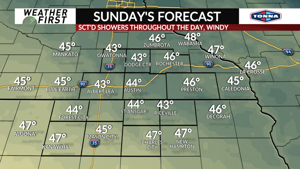
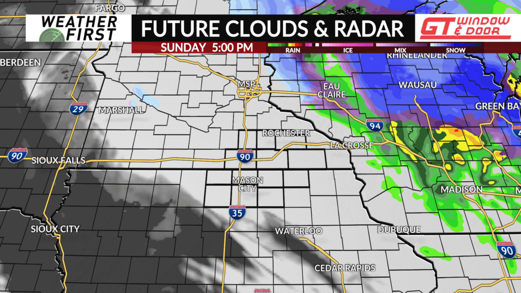
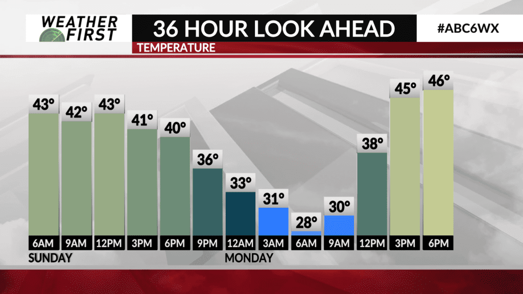
Temperatures peak in the mid 40F’s during the morning hours, before gradually dropping during the afternoon behind the cold front. These cooling temperatures may allow for a few snowflakes to mix in with rain during the afternoon, especially north of I-90. Any snow accumulation will remain limited to a light dusting on grassy surfaces at the most.
While precipitation will not be noteworthy, it will be enough for Sunday to be a soggy day across the area, and dash hopes for northern lights viewing Saturday night.