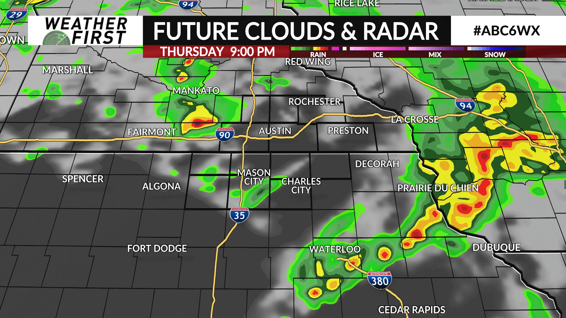
Strong thunderstorms ending from west to east
The Fourth of July will be the beginning of an active stretch of weather with multiple chances for rain through at least the middle of next week.
The round of stronger storms we have been tracking this afternoon is moving east, with much of the viewing area either seeing rain beginning to taper off or are seeing sunshine return.
A spotty shower or thunderstorm is possible overnight, however many places may end up staying dry.
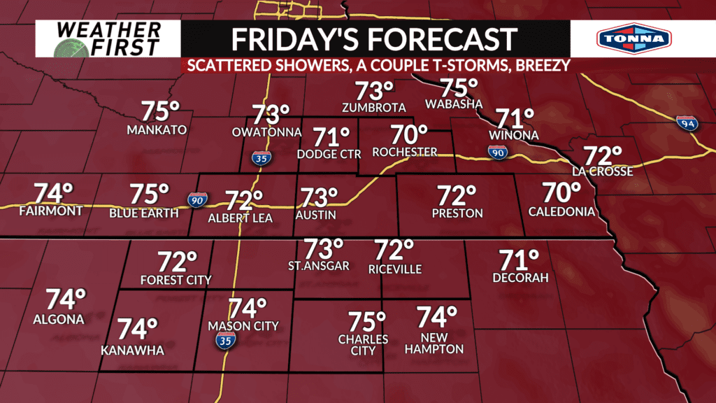
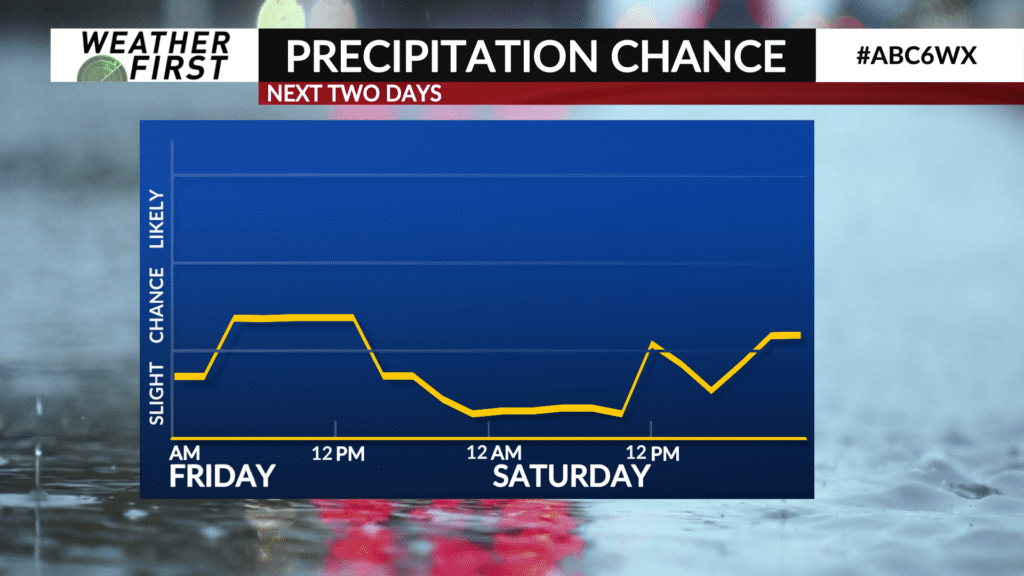
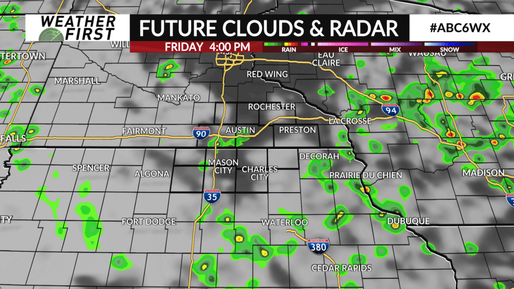
Occasional showers and thunderstorms are possible from Friday through Sunday. These storms will be less potent and more scattered compared to the storms that rolled through today.