Snow likely this Saturday
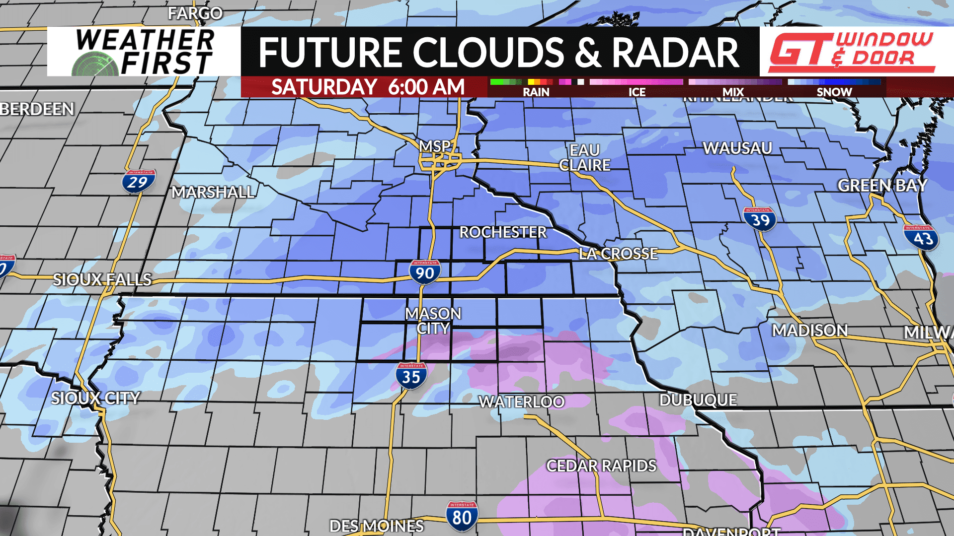
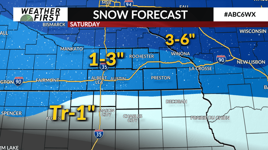
First, the good news: after the least snowiest January on record and continued, dry conditions, we’re finally in for some snow Saturday. So far, it still looks like it’s going to be a shovel-able, plowable snow for southern/southeast Minnesota.
Now, the bad news: snowfall totals will drop quickly from north to south, and at this time it’s looking like we’ll see minimal amounts of snow in north Iowa. Totals will likely range from about a trace to an inch in north Iowa. Amounts in southern Minnesota don’t look to be much either, but will likely be at least in the 1 to 3 inch range.
The majority of guidance available is pointing toward a lower-end snow event in far southern Minnesota. The highest snowfall totals Saturday are likely to fall in central Minnesota to near the Twin Cities, to west-central Wisconsin along the I-94 corridor.
There will likely be some adjustments to the going forecast on Friday as more data continues to come in and the storm becomes more clear.


Here is just some of the model guidance that has gone into our snowfall forecast for Saturday:
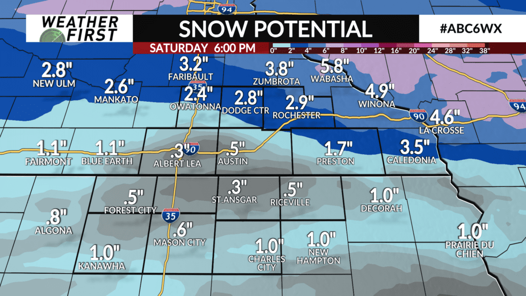
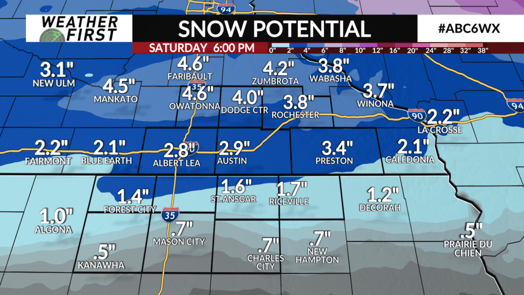
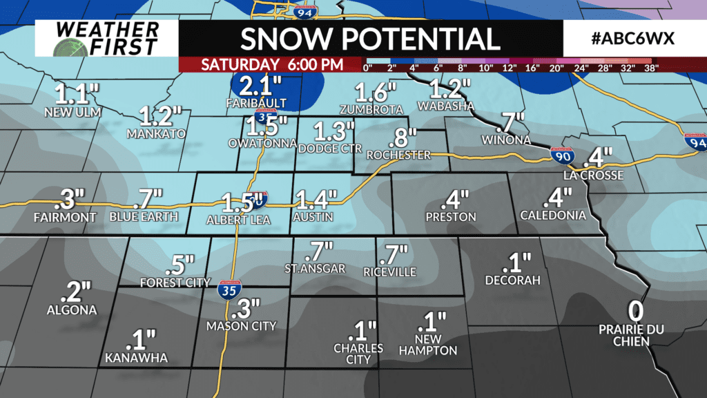
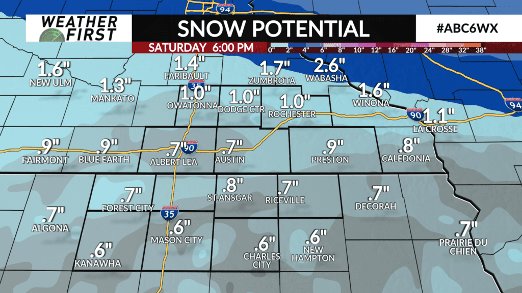

As you can see, there are some wide variations in forecast snowfall totals by model guidance. There is a majority pointing toward a “dry slot” on the leading edge of this storm system that might take until late Saturday morning to be overcome. However, there is some hope in the higher snowfall totals as the snow-making process in the atmosphere will likely be very efficient with a high snow to liquid ratio. What does that mean? It will take less moisture to make more snow, and the snow will accumulate faster. That’s the very fluffy snow we will often see from some clippers and colder winter storm systems.
We’ll keep watching the guidance and the trends with this storm system and will update the forecast as necessary.