Snow showers remain likely this evening
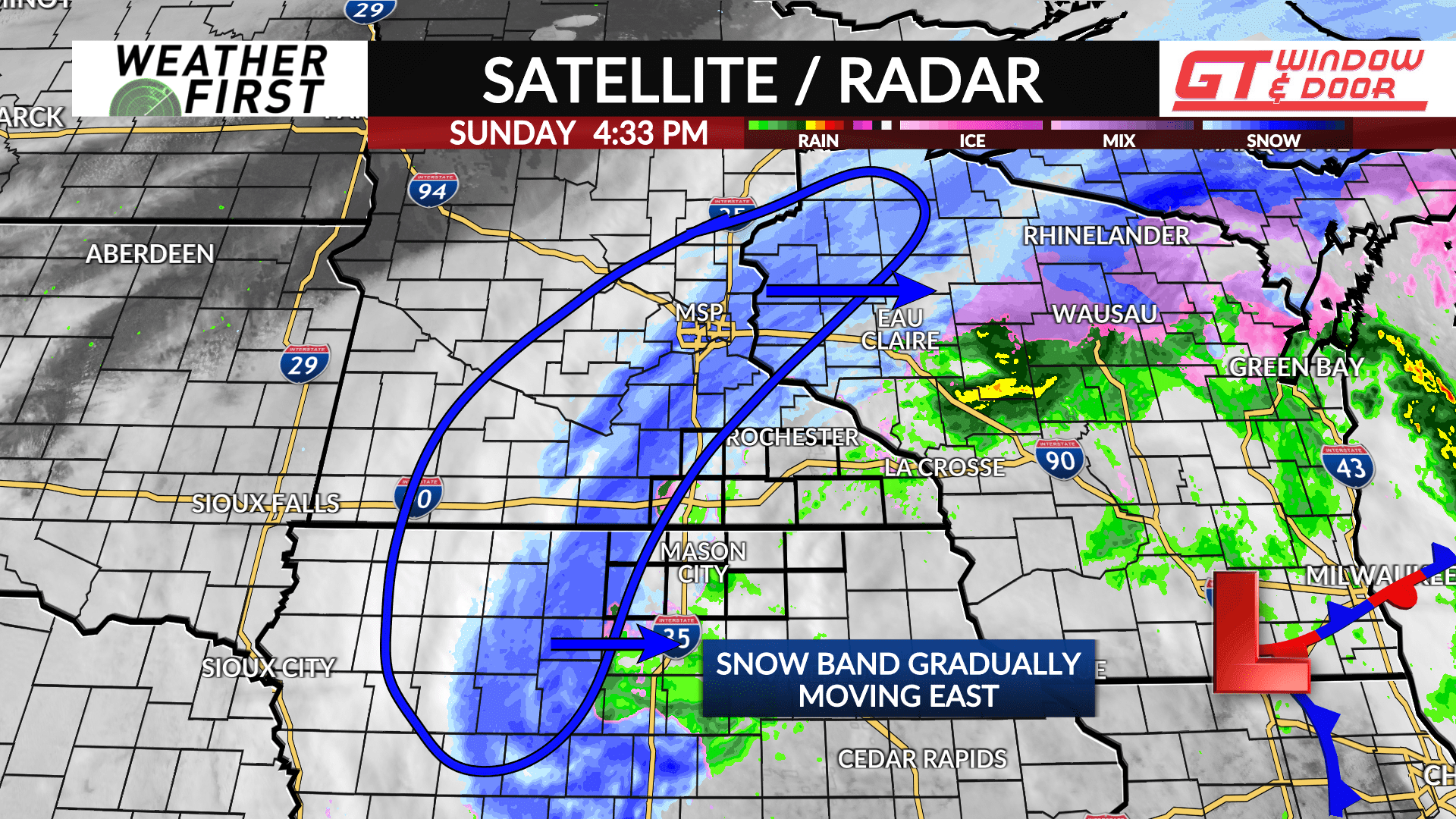
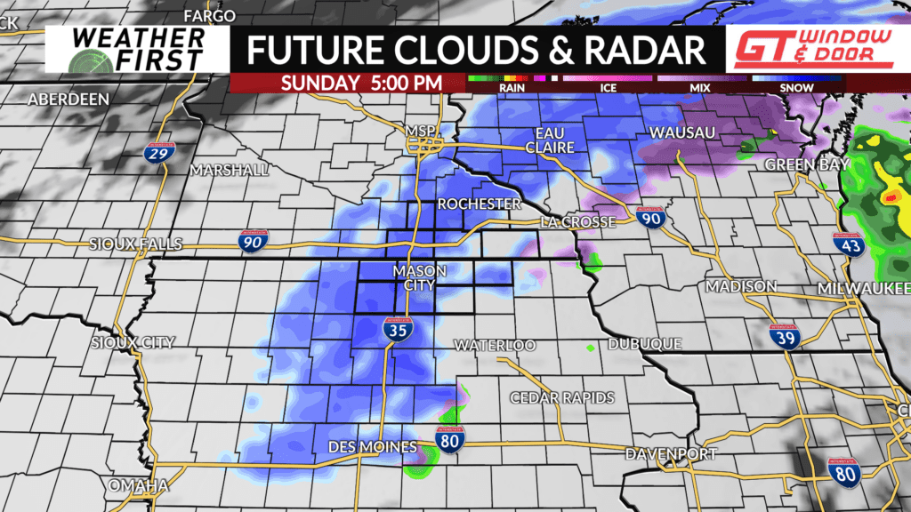
Snow showers are beginning to track into the viewing area, and will continue eastward through the remainder of the afternoon and evening.
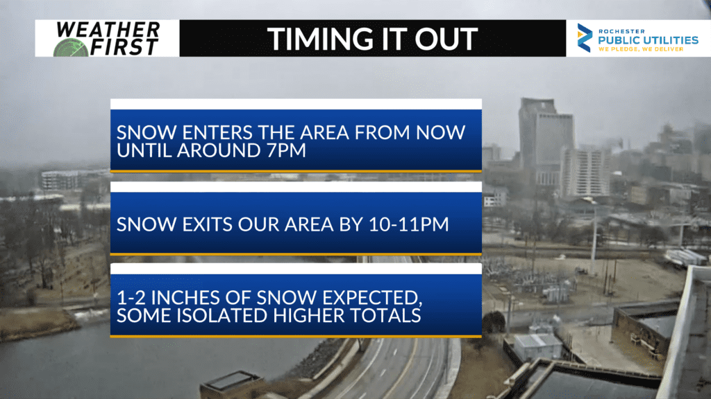
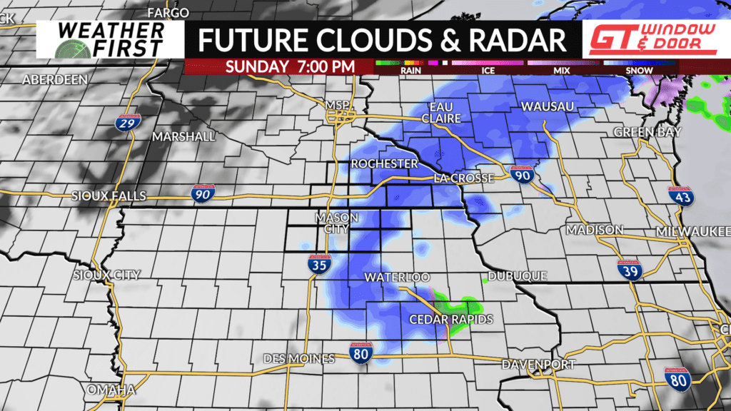
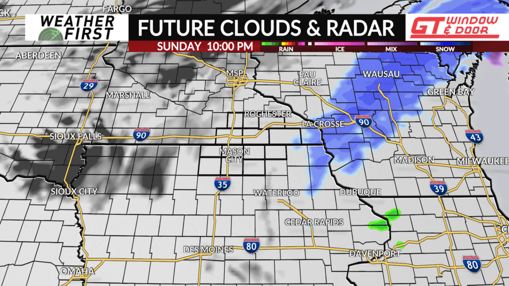
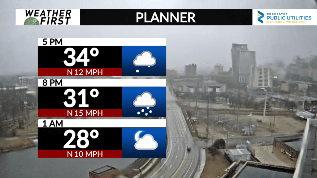
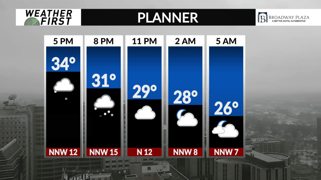
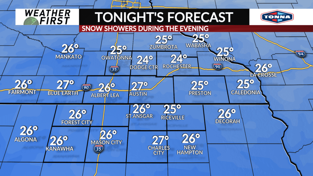
As far as timing goes, our western viewing area will see snow begin between 4:00-5:00 PM, with the remainder of the viewing area seeing snow onset between 5:00 PM-7:00 PM. Snow will continue across most of the region until 8:00 PM-9:00 PM or so. By 10:00 PM, snow is expected to have exited the viewing area, giving way to mostly cloudy skies overnight.
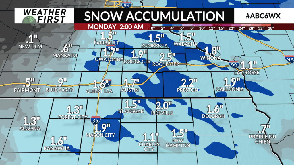
Snow accumulations are expected to be within the 1″-2″ range across all of southeastern Minnesota and northern Iowa.
Radar indicates that there are heavier pockets of snow embedded within a broad band of snow stretching from northwestern Wisconsin, down to south central Iowa. Snow rates in these heavier bands may result in isolated higher totals of snow accumulation, between 2″-3″.
Snow will have a difficult time accumulating to pavement at snow onset, but as the afternoon and evening progress, and temperatures continue to drop, accumulation on roads will become more likely.
Snowfall may result in slick spots on the roads later in the evening. Melted snow will refreeze to road surfaces overnight as temperatures drop well below freezing, leading to slick spots on the roads into Monday morning.
With that said, drive cautiously this evening through Monday morning, and be mindful of any icy spots on the roads!
