Soaking rain arrives Wednesday afternoon through evening
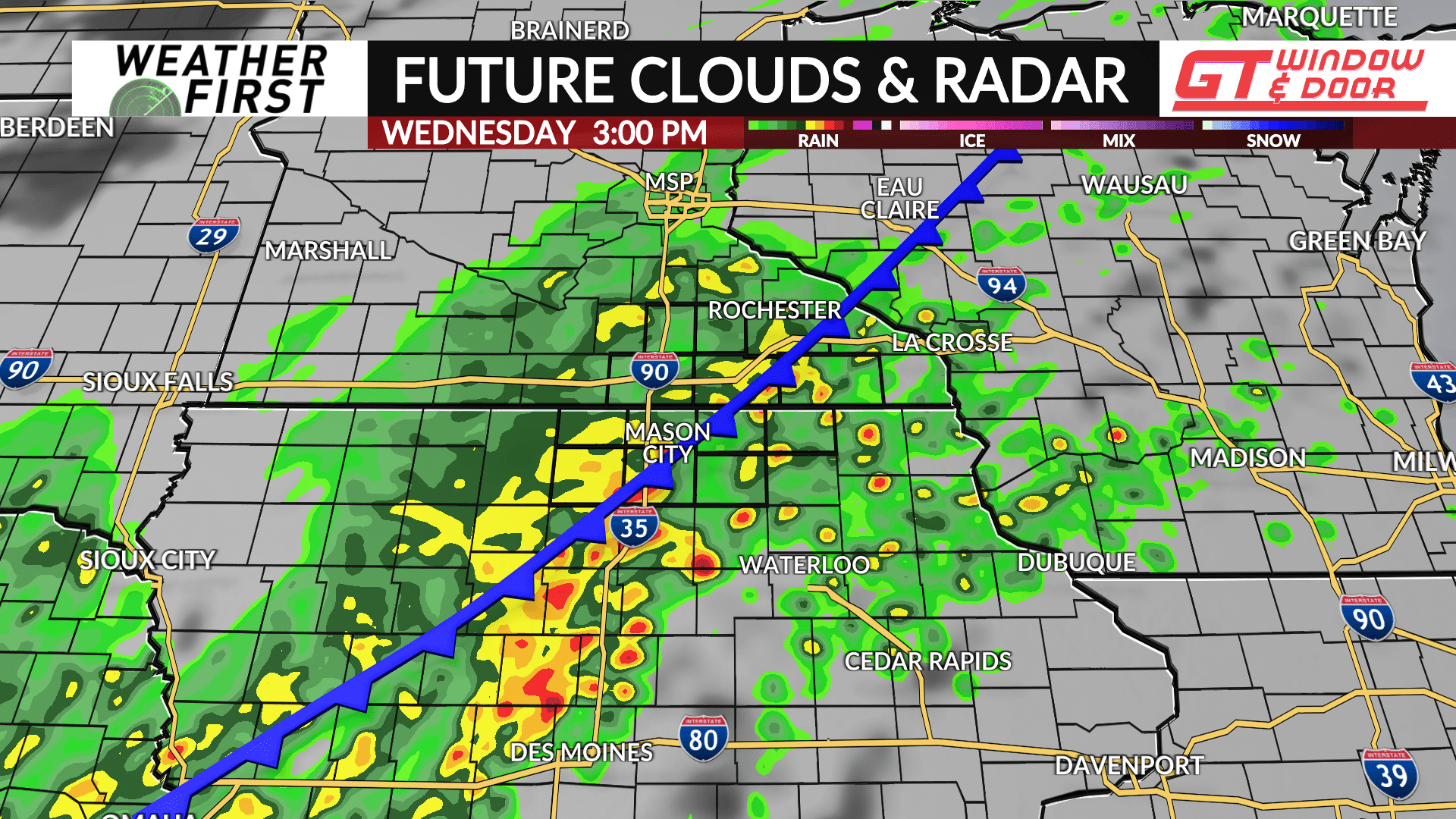
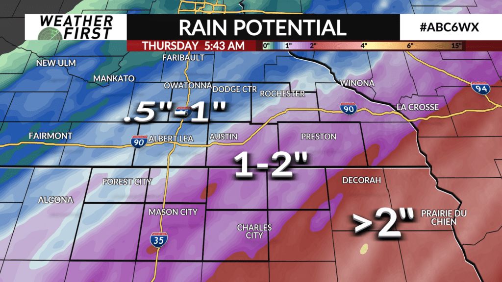
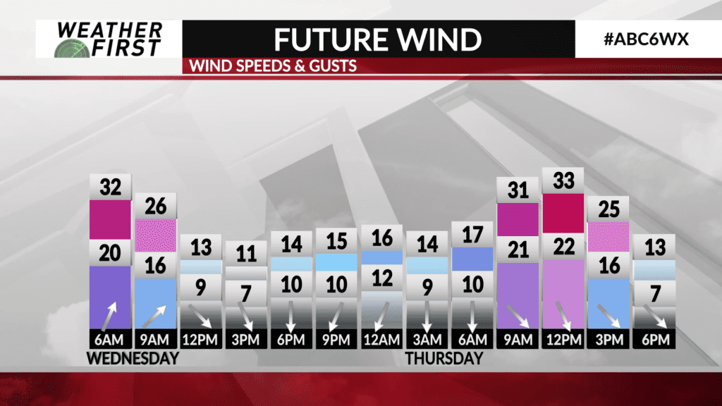
An upper level storm system is located over the central Rocky Mountains as of Tuesday evening, and it’s going to bring significant changes to us from Wednesday into Thursday. A cold front will move through southern Minnesota and northern Iowa Wednesday afternoon, bringing quite a bit of rain with it.
By late October standards, it’s looking to be an unusual amount of rain with the possibility of some record daily rainfall totals for the 30th of October.
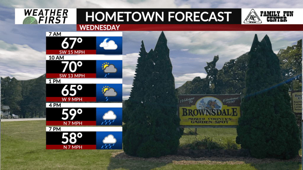
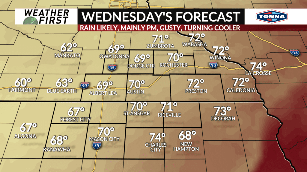
Wednesday’s high temperatures will occur in the morning, and temperatures will fall through the afternoon. That trend will continue through Thursday, making for a chilly night for trick-or-treaters.
While showers continue into Thursday, they should wrap up by the early afternoon. Don’t be shocked if you see a few snowflakes in the mix. No accumulating snow is expected.
