Storm chances return this weekend, some storms may be severe
There is a bit more clarity on how t-storm activity may play out this weekend and into early next week across southeastern Minnesota and northern Iowa. There are still unknowns though, so while it would be a good idea to keep an eye on the weather and radar this weekend, I wouldn’t cancel any outdoor plans yet.
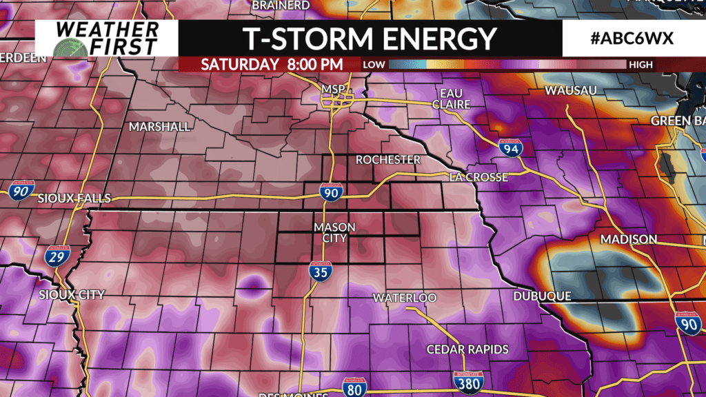
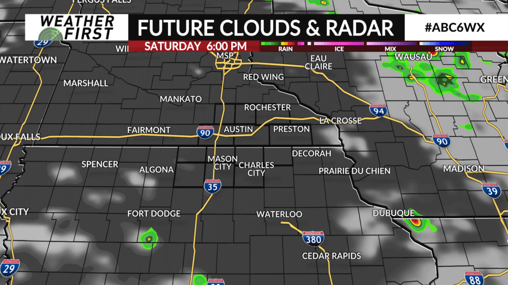
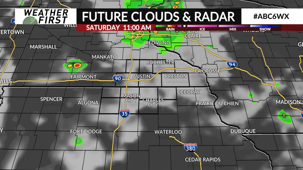
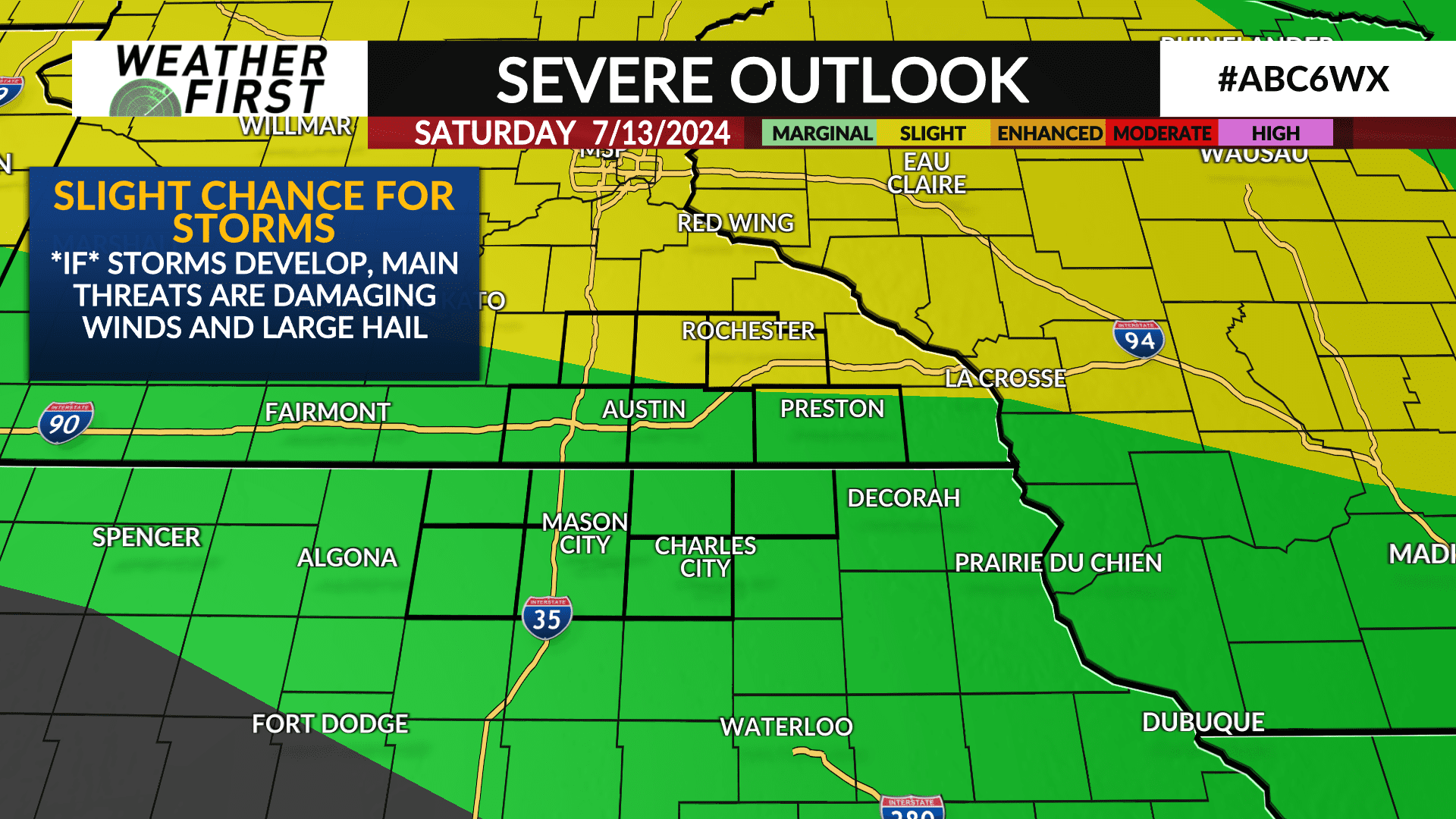
For Saturday, there is the possibility of a t-storm complex passing by to the north across central Minnesota during the morning and into the early afternoon. There is a fair chance that this disturbance just passes us on by but cannot rule out some late morning or early afternoon storm activity, especially north of I-90.
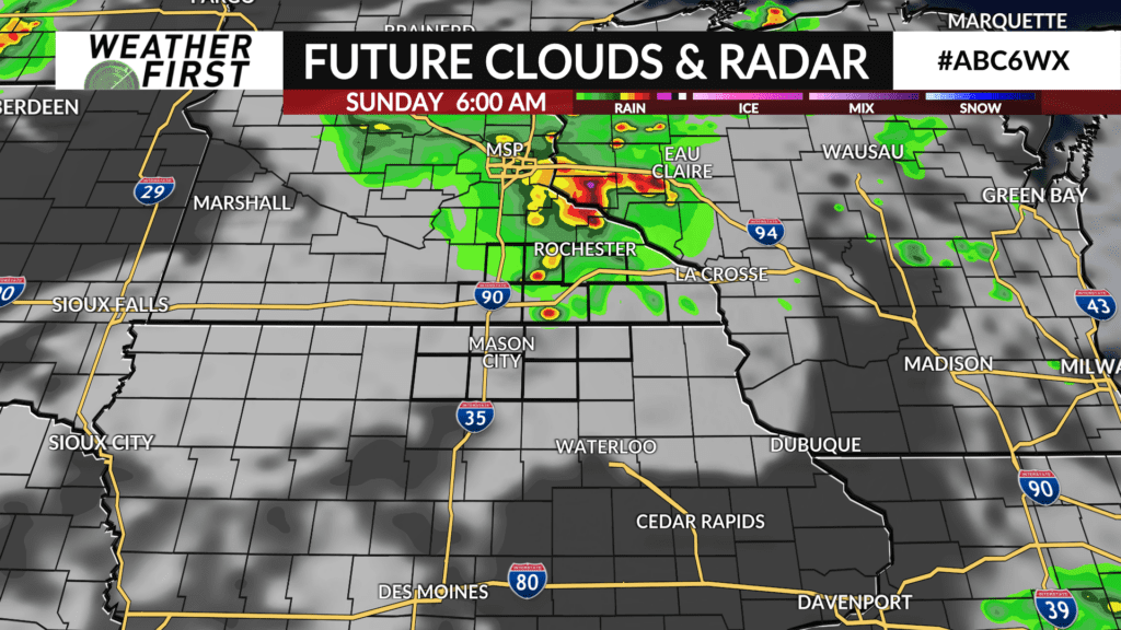
There appears to be a better chance for stronger t-storms very late Saturday night into early Sunday morning. The best chance for storms will once again be north of I-90, but chances can certainly not be ruled out for northern Iowa as well.
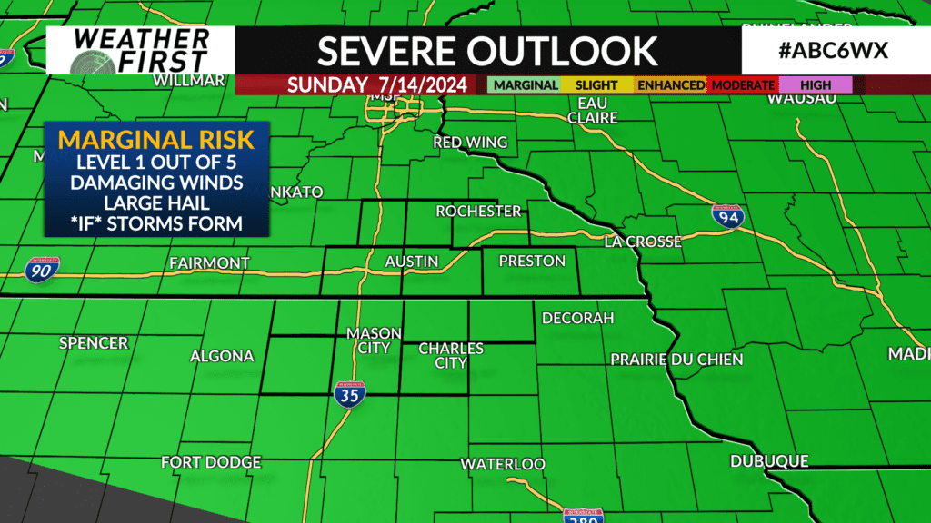
Sunday afternoon looks mostly dry at this point although it depends on how long any morning activity may stick around.
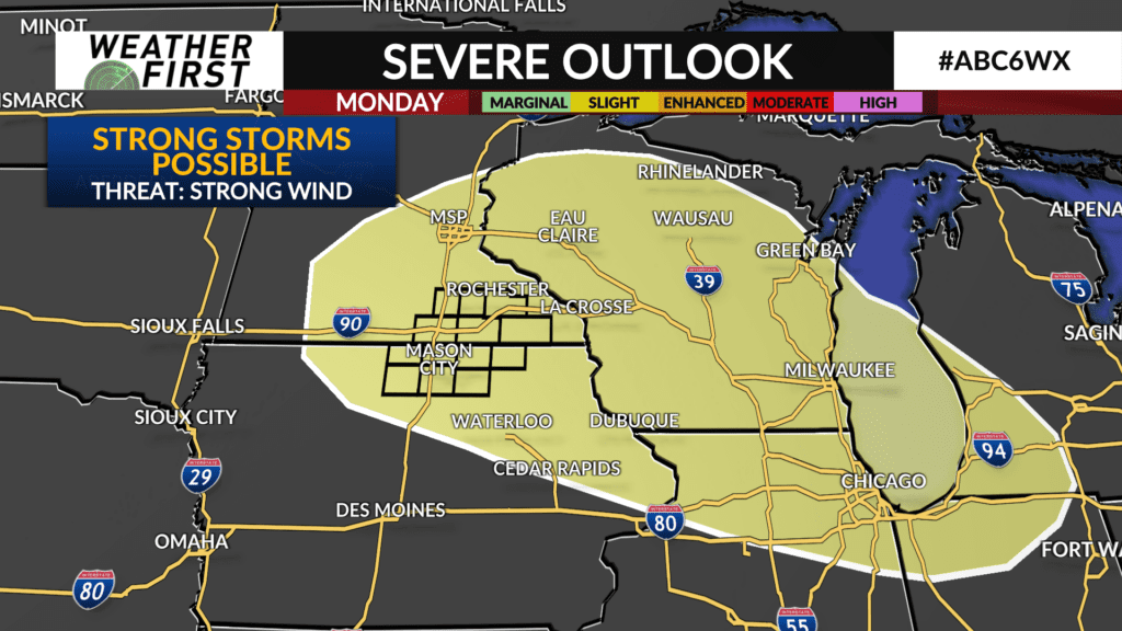
Monday is the best chance for storms at this point in time. There will be a far more favorable jet stream pattern that may force t-storms, some strong to severe, to develop across Minnesota and track southeastward. There is still uncertainty with timing and placement of the storms for Monday though, so it will be important to check back for more updates as the weekend goes by.
With the amount of heat and humidity around this weekend and into early next week, any storms that are able to develop may quickly become strong to severe. The main severe weather hazards at this time are large hail and damaging winds.