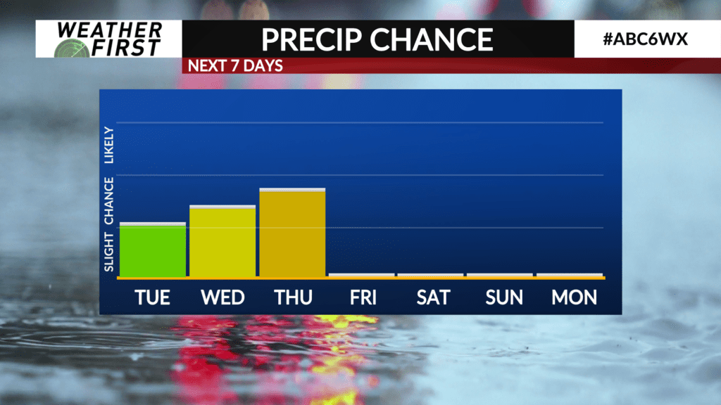
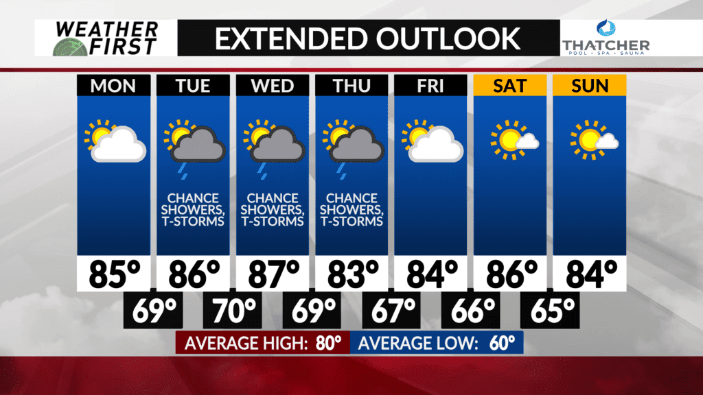
Storm chances stick through mid week
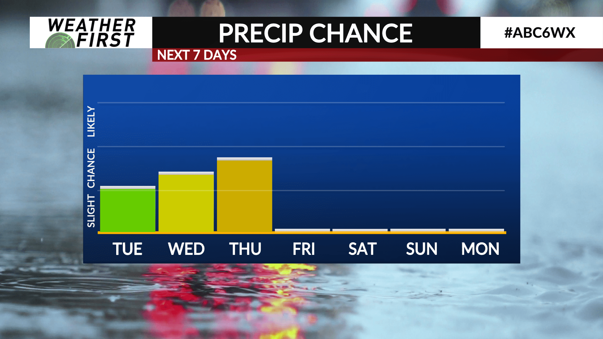
There will be at least a slight chance of showers and t-storms Tuesday, Wednesday, and Thursday across our area. Some of those storms may be severe on Tuesday and Wednesday.
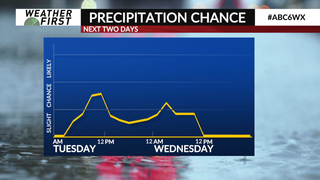
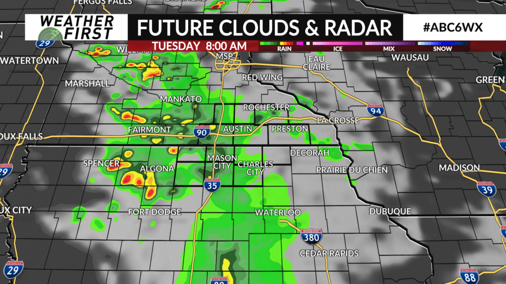
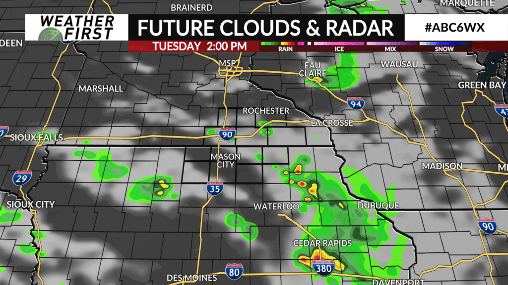
Tuesday morning should start out dry across our area, but dry conditions may not last long for portions of our area. There is increasing confidence in a mid to late morning round of showers and t-storms moving in from the west. Once this round passes through, additional development may be possible during the afternoon, but this is not a guarantee, nor is everyone guaranteed to see rain.
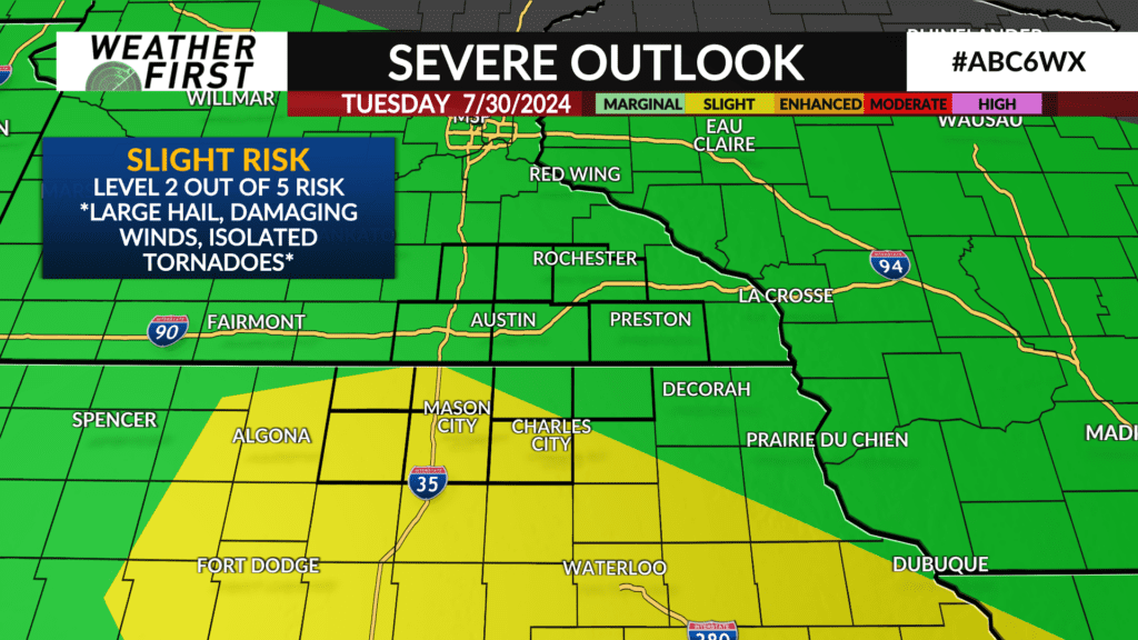
The Storm Prediction Center has issued a slight risk (level 2 out of 5) of severe weather for the southern portion of our viewing area for Tuesday. All modes of severe weather are possible at this time, including large hail, damaging winds, and even a few isolated tornadoes.
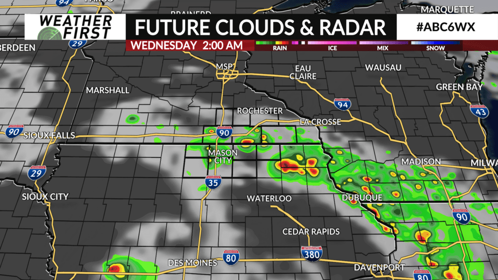
Precipitation chances Tuesday night into Wednesday are a wild card, and will be dependent on if there are any leftover boundaries in place from Tuesdays storms for additional storms to fire up along. Odds currently favor a dry day on Wednesday, but a storm or two cannot be ruled out.
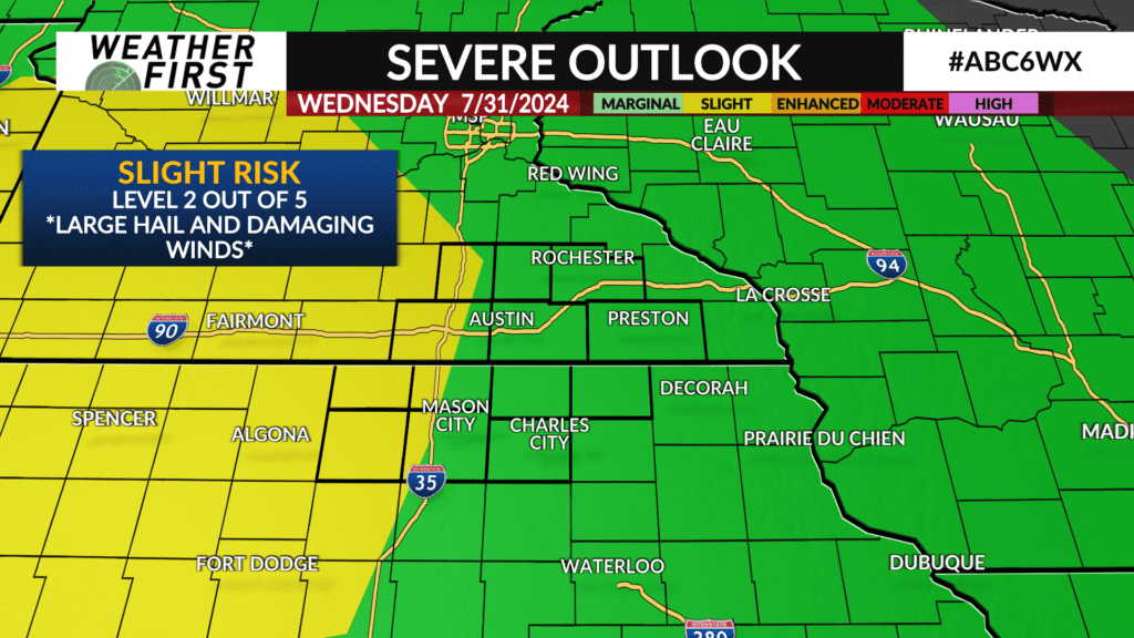
The Storm Prediction Center has a slight risk for severe weather once again across western portions of our viewing area on Wednesday. Large hail and damaging winds are the main threats to watch for at this time. The best storm chances arrive later Wednesday night into early Thursday morning.
Storm chances stick around on Thursday, although details are once again dependent on any pre-existing boundaries from Wednesday nights storms.