ALERT DAY: Severe thunderstorms possible Thursday evening

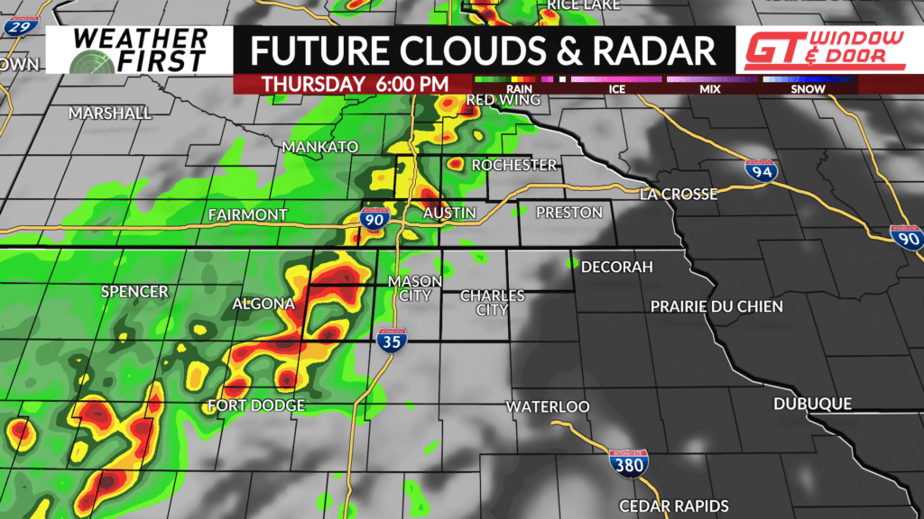
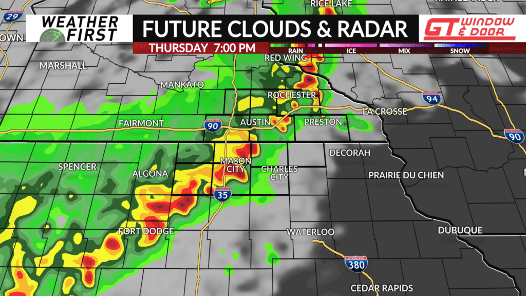
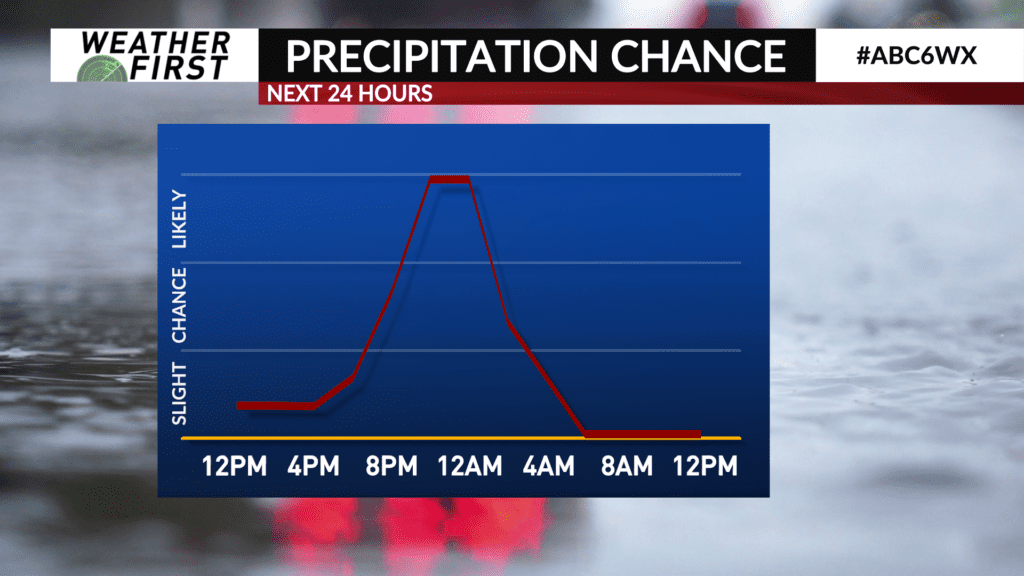
Showers and thunderstorms will be likely on Thursday evening with the possibility of strong-to-severe thunderstorms.
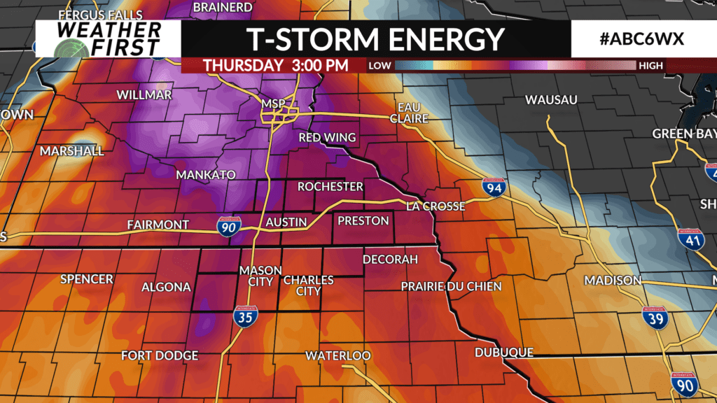
A warm front will lift north through the area as the day moves along resulting in a warm, humid and unstable airmass developing which will provide fuel for showers and thunderstorms on Thursday evening as a cold front advances across the area from west-to-east.
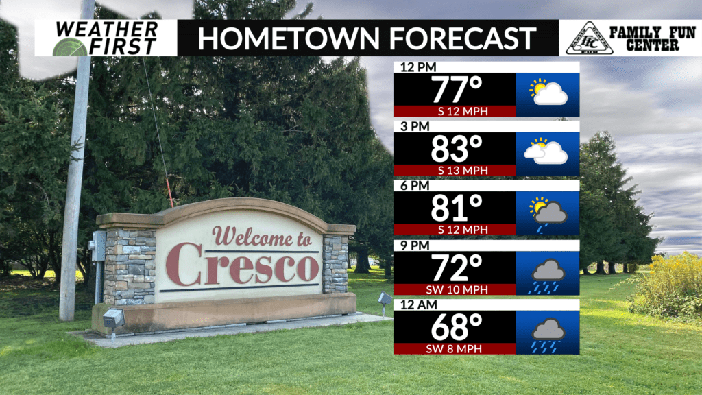
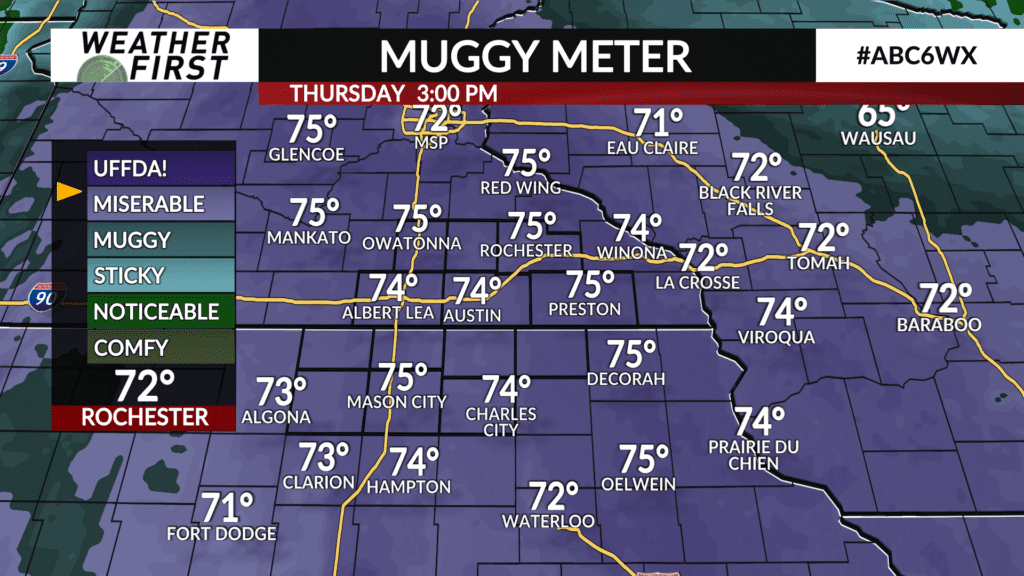
Temperatures will be plenty warm as they are expected to climb into the mid-to-upper 80s. Dew point temperatures will surge into the low-to-middle 70s leading to a muggy day as the heat index, or feels-like temperature, approaches or exceeds 90° for most areas.
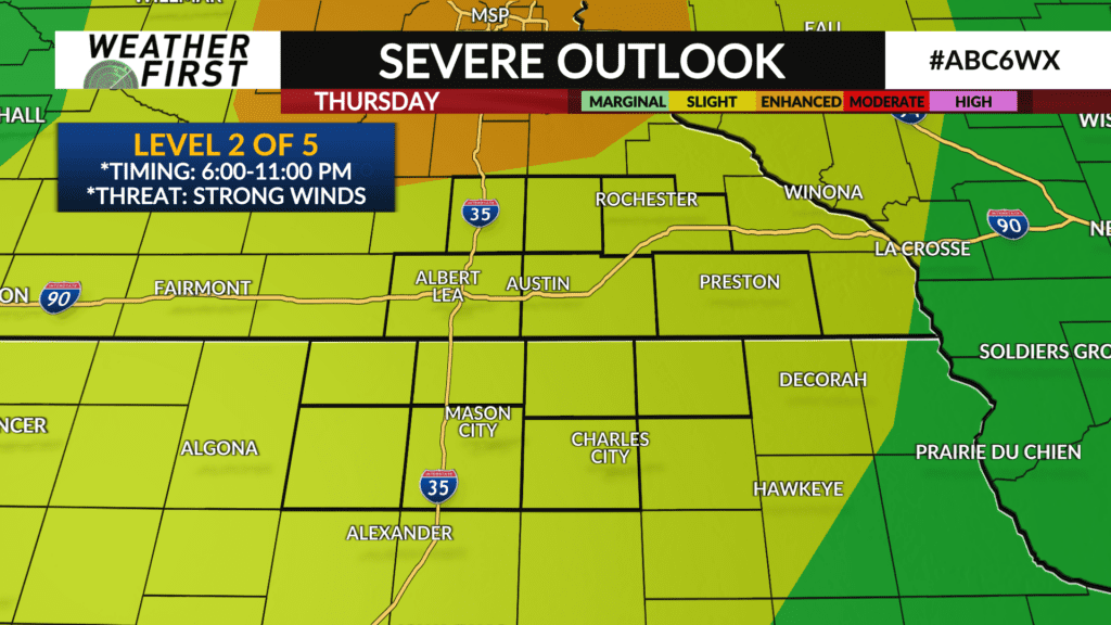
Showers and thunderstorms will be likely sometime after 6:00 PM. A few isolated cells may pop ahead of an advancing line of thunderstorms and may produce an initial hail and tornado threat, but thunderstorms are expected to form into a line as it pushes east through the area leading to strong wind gusts of 60+ MPH as the main threat. The higher wind and tornado threat is expected to be further north of a Mankato to Red Wing line where a Level 3 (orange) of 5 risk for severe weather is in place. A Level 2 of 5 risk is in place for the entire Weather First area, per the Storm Prediction Center.
Locally heavy rain is also possible which may lead to some localized flooding.
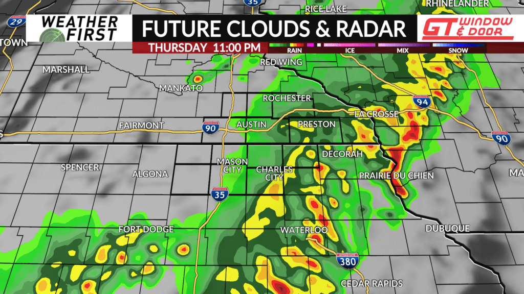
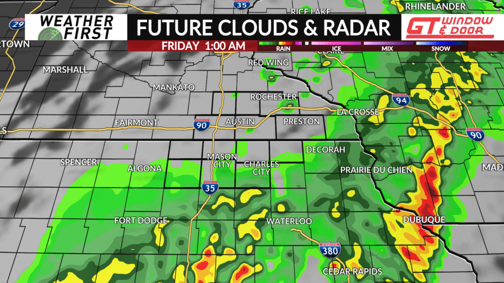
Showers and thunderstorms will wind down late evening into the overnight and should be out of the area around 3:00 AM.
Download the ABC 6 News app to stay updated on the latest forecast, follow the radar, and have to receive warnings if any are issued.