Strong storm possible next week with rain and snow
All eyes are on a potential strong storm by the early-to-middle portions of next week that will bring some rain and possibly snow to the Weather First area.
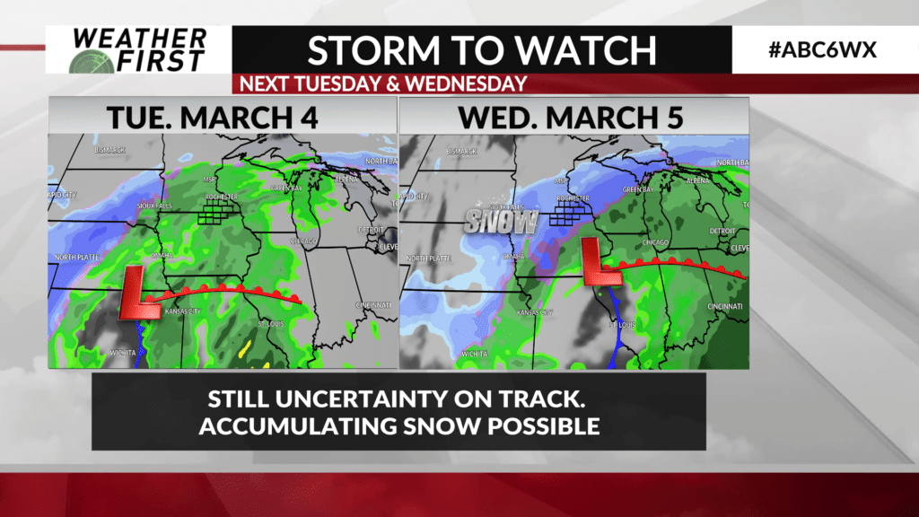
A surface low pressure system will develop in the Central Plains and pull moisture northward from the Gulf as it makes its way northeast toward our area on Tuesday. Temperatures will be warm enough for rain to be the precipitation type.
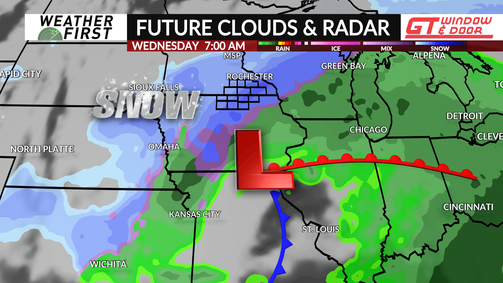
Data continues to show the storm tracking south of the area across north-central Missouri into western Illinois which would put our area on the colder, northwest side of the storm. If enough colder air is in place, any rain would likely change to snow on Wednesday with some accumulations possible.
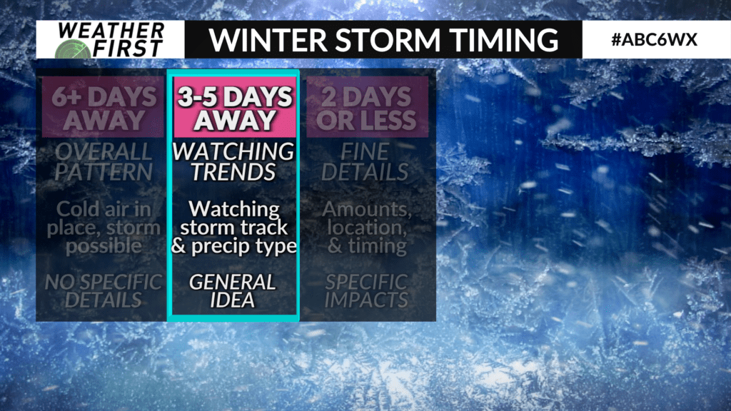
Given this system is several days away, there is still uncertainty on its track. Usually this far out, we look at the overall trends within model data along with the possible storm track and precipitation type to get a general idea. Expect more specifics over the weekend as it gets closer.