Sun returns Monday, remaining blustery
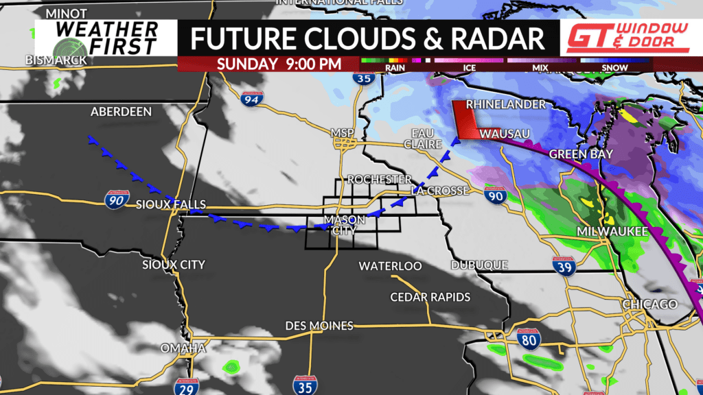
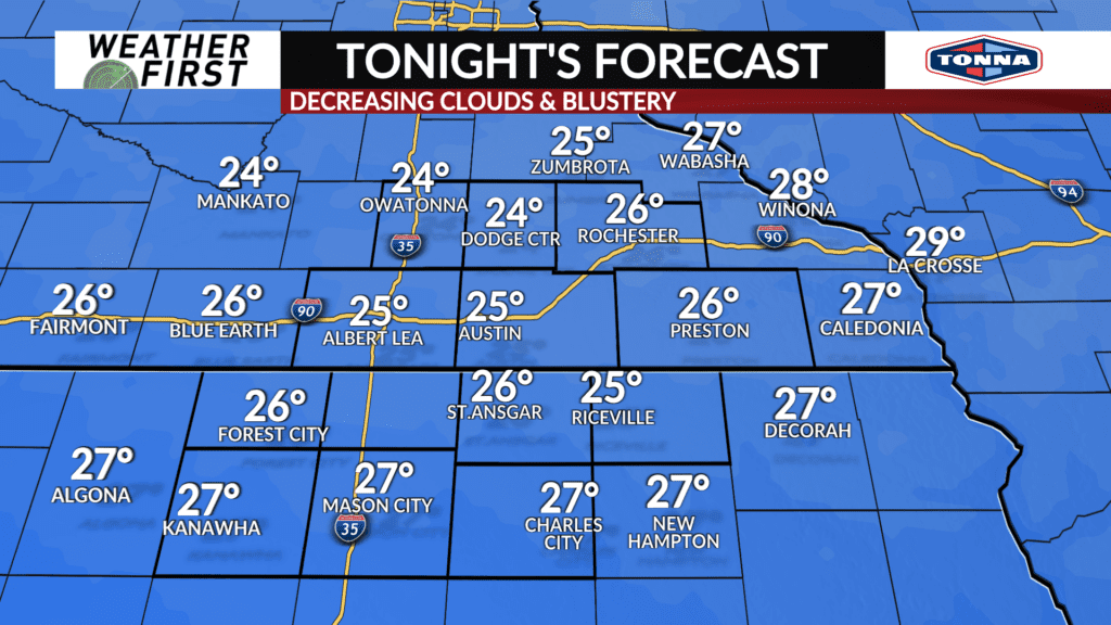
While showers have exited the area, there is still a considerable amount of cloud cover leftover across Minnesota and Iowa. Winds remain blustery out of the northwest as well, leading to a WIND ADVISORY for portions of the viewing area.
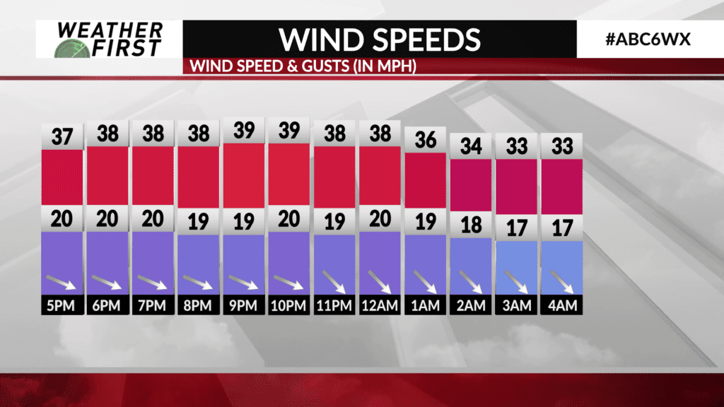
A WIND ADVISORY remains in effect for Winnebago, Worth, Cerro Gordo, and Hancock counties until 7:00PM CDT. Wind gusts of up to 45 mph will be possible into the evening hours, with gusts up to 35-40 mph remaining possible overnight.
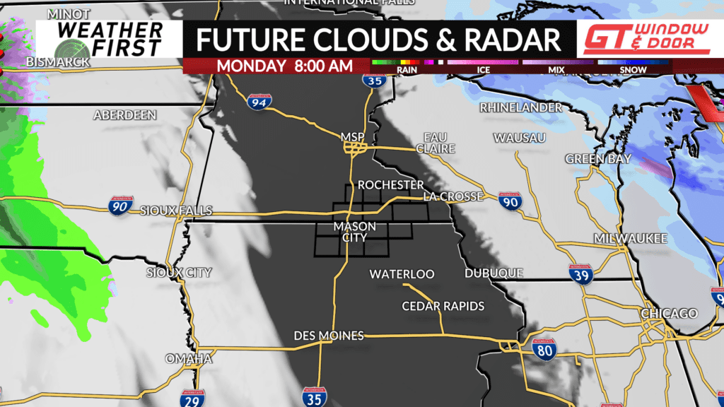
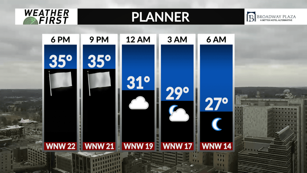
Clouds will eventually begin to decrease from west to east later tonight as a weak area of high pressure approaches from the west. Winds remain blustery through the night, with sustained winds of 15 to 25 mph, and gusts up to 40 mph at times. Temperatures will dip down into the mid 20F’s by early Monday morning, right around average for this time of year.
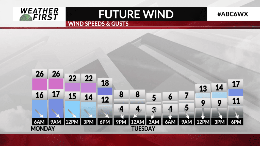
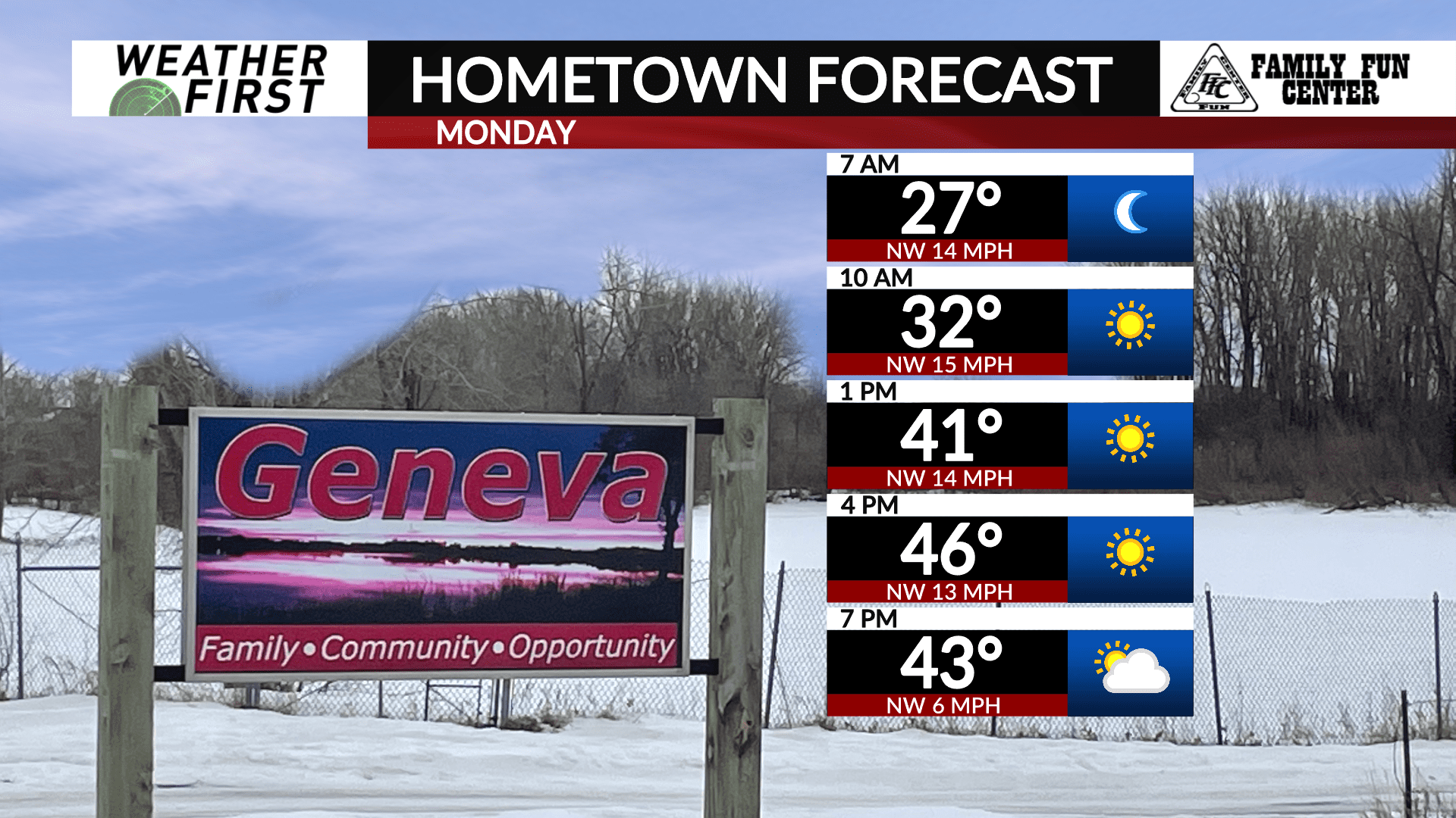
Skies will start out mainly sunny Monday morning, with plenty of sunshine continuing into the early afternoon. Winds will remain breezy out of the northwest, between 10 to 20 mph, gusting up to 25 mph at times.
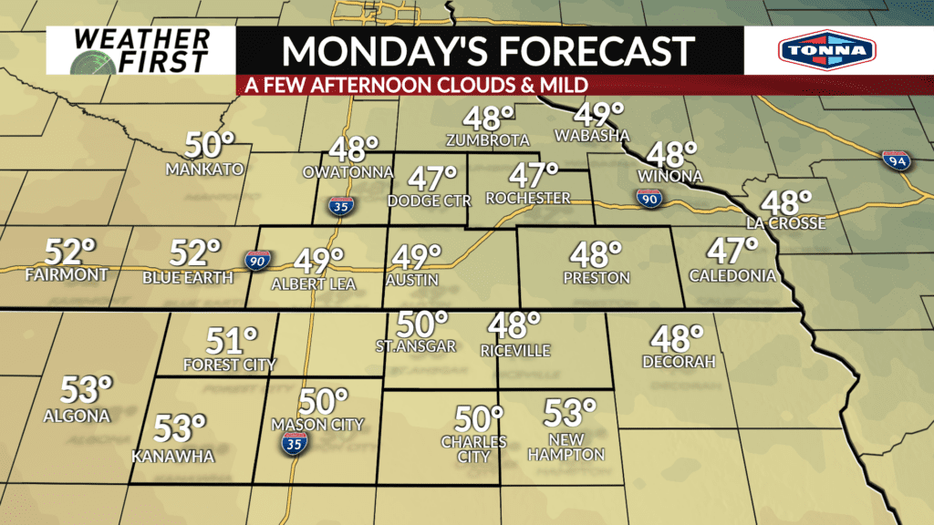
While northwesterly winds will be blowing cooler air southward throughout the day Monday, plenty of sunshine will allow high temperatures to climb into the mid to upper 40F’s across southeastern Minnesota. Temperatures across northern Iowa will be slightly warmer, nearing 50F.
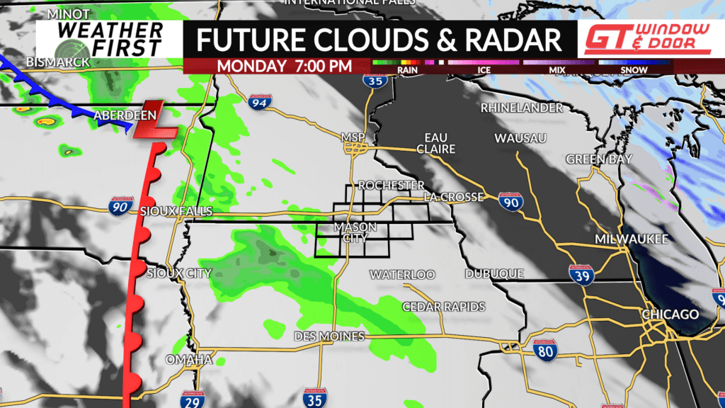
Clouds eventually increase later in the afternoon as a weak ripple of upper level energy approaches Minnesota and Iowa from the northwest. No precipitation is expected across the area until later Monday night and into Tuesday.
With that said, Monday is shaping up to be a fairly decent day across the region!