Temperatures dip Tuesday, rebound Wednesday

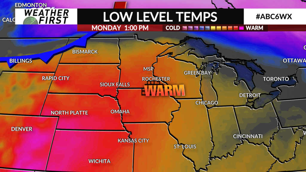
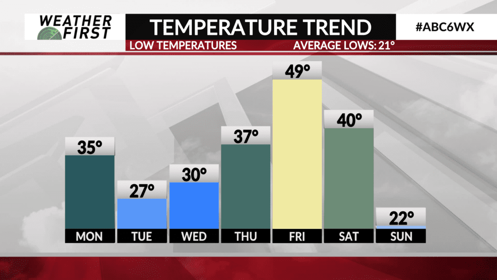
A cold front will track through the area Monday night, into early Tuesday, knocking our temperatures down quite a bit, but for a limited time…
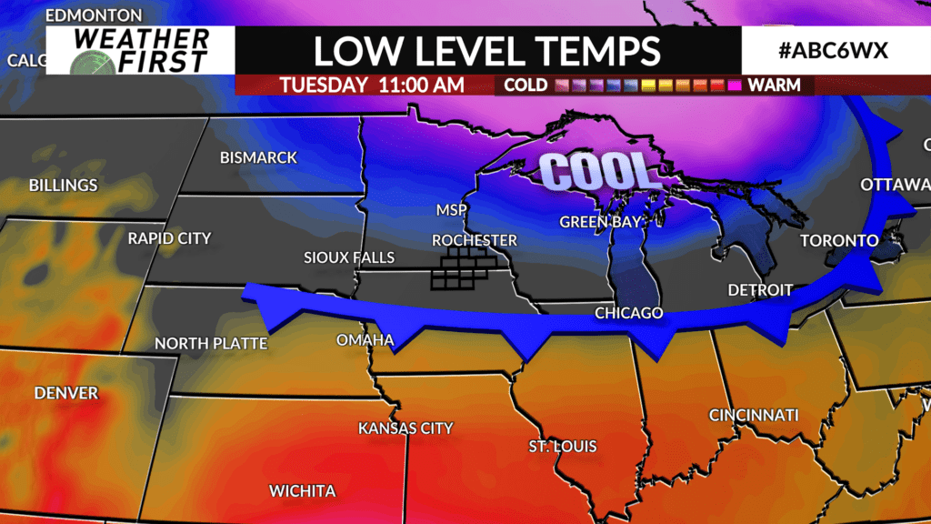
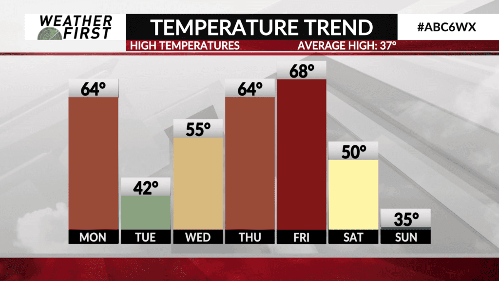
High pressure builds into the area Tuesday morning from the northwest, with northerly winds helping to bring colder air southward. This will result in high temperatures on Tuesday “only” making it into the low to mid 40F’s.
While these temperatures seem a lot colder compared to Monday, they are still a good 5F-8F above average for this time of year!
Winds shift to out of a more southerly direction Wednesday, bringing warmer air back north into southeastern Minnesota and northern Iowa. High temperatures will quickly rebound into the 50F’s Wednesday afternoon, thanks to plenty of sun and light southerly winds.
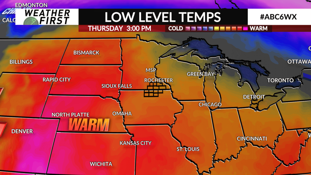
A trough of low pressure tracking eastward across the western United States will help to impose southerly flow across our neck of the woods through the end of the workweek. This will result in high temperatures making it back into the 60F’s on Thursday!
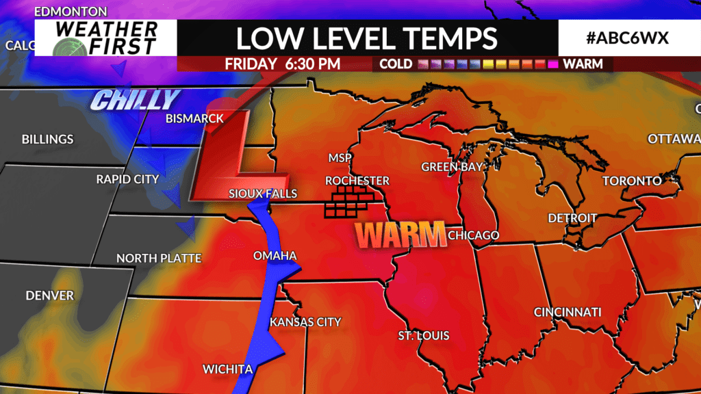
Even warmer air arrives Friday, with highs in the upper 60F’s for most locations. In fact, there appears to be a legitimate possibility some locations could reach 70F, but this is not a guarantee.
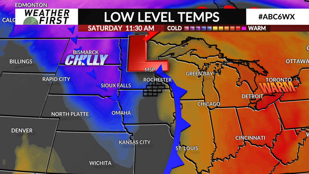
A powerful storm system will sweep through Friday night through Saturday, bringing much colder air into the region from the northwest. Resulting daytime highs will drop into the 50F’s for Saturday, then into the 30F’s for Sunday.
Ignoring the weekend cool down for now, we have a beautiful stretch of spring like weather ahead of us!