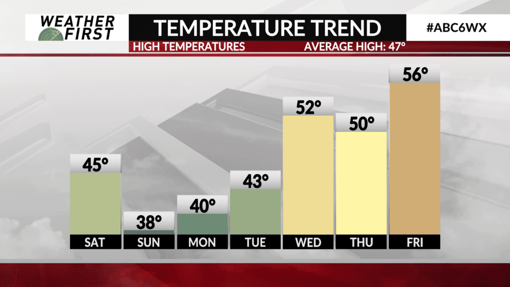
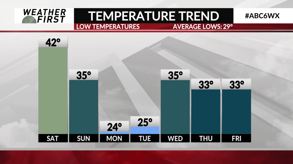
Temperatures plunge this weekend, slowly recover next week
We are in the midst of experiencing every season over the course of 72 hours across southeastern Minnesota and northern Iowa. From the record breaking warmth to snow, we are in the process of experiencing it all!
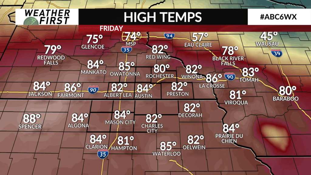
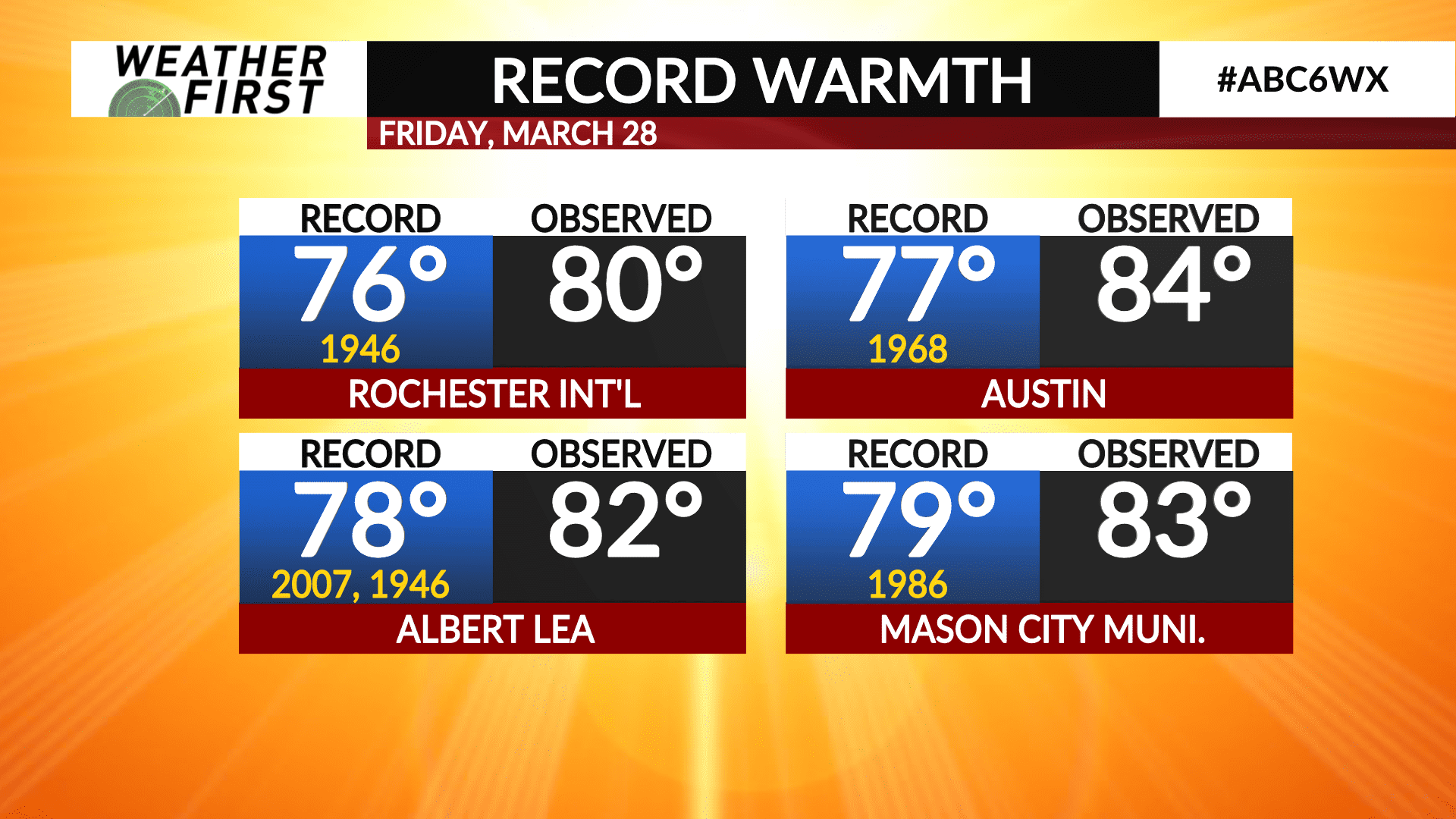
Rochester broke its old record high temperature of 76F set back in 1946, replacing it with 80F today! Austin, MN shattered it’s old record high of 77F, set back in 1968, replacing it with 84F! Mason City and Albert Lea also broke there previous record highs by 4F. Talk about an early taste of summer!
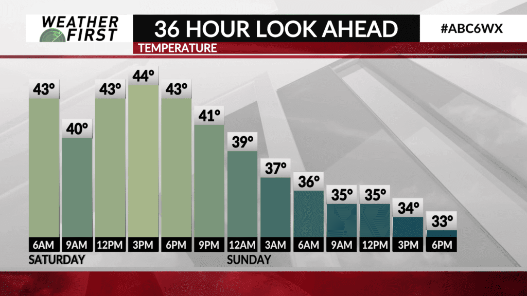
Temperatures will drop significantly overnight tonight and into early Saturday morning. Lows will be in the lower 40F’s across most of southeastern Minnesota and northern Iowa.
Due to the cold front sagging southward tonight and Saturday, high temperatures will not recover much. High temperatures will only be in the mid 40F’s, with northerly winds transporting colder air southward.
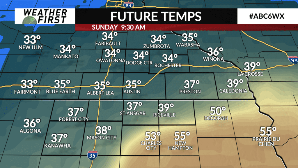
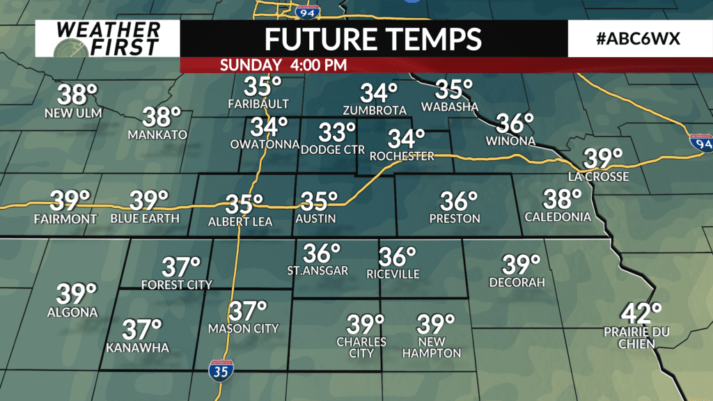
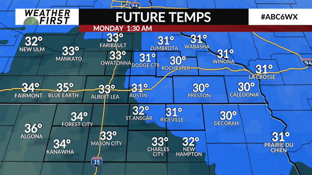
Temperatures drop further Saturday night and Sunday, with 30F’s making their return. We reach rock bottom Sunday night into early Monday morning, with lows in the low to mid 20F’s across the area. BRRRR!
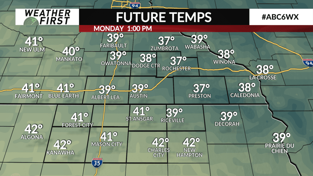
Temperatures rebound into the 40F’s Monday and Tuesday, which is still below average for this time of year, but certainly better than the 30F’s! Warmer temperatures arrive next Thursday and Friday, with highs in the lower 50F’s across southeastern Minnesota and northern Iowa.