Temperatures surge, then plunge

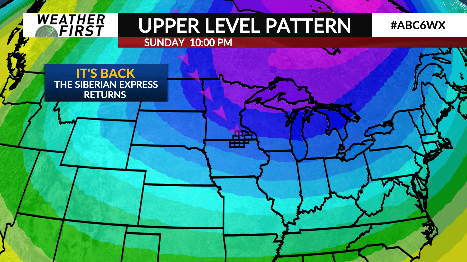
Most of us know that living in Minnesota comes with the joys of major temperature swings, but that doesn’t make them any less impressive when they happen. It’s fair to say we are in for a few impressive swings the next several days, thanks to a persistent pattern we may not shake for quite some time.
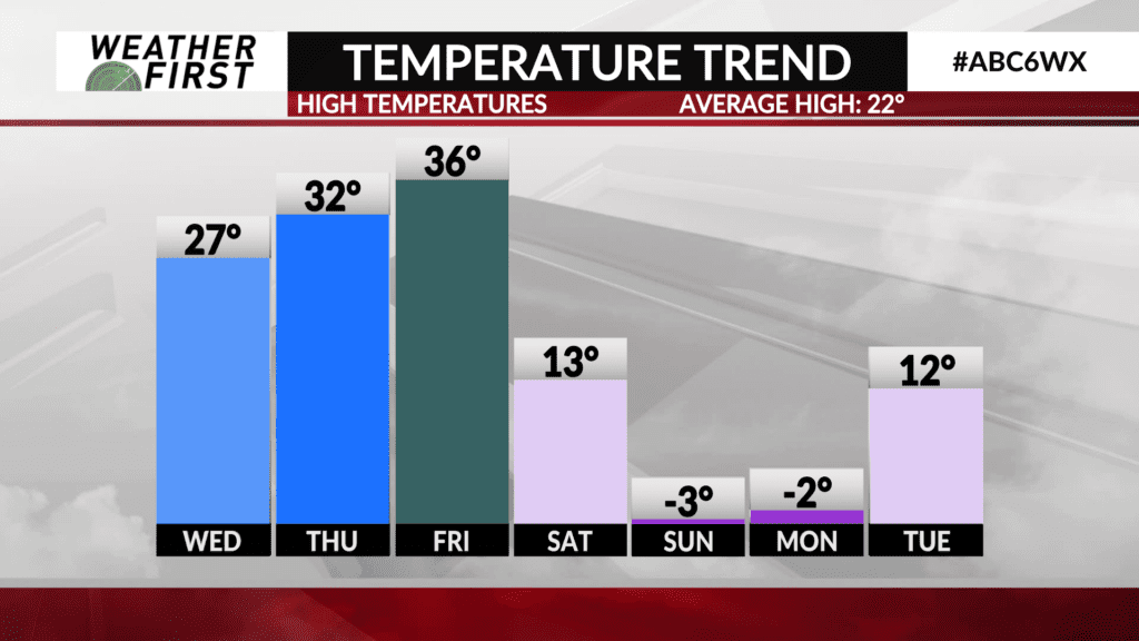
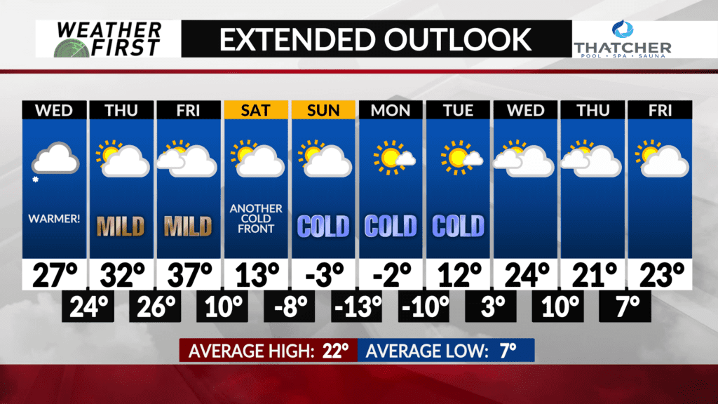
Bitterly cold temperatures are finally slotted to exit our area Wednesday during the afternoon, allowing temperatures to climb into the mid to upper 20F’s for most locations.
Thursday and Friday will be even warmer, with highs in the low to mid 30F’s Thursday, and mid to upper 30F’s Friday. Some locations across northern Iowa may even reach into the low 40F’s Friday afternoon!
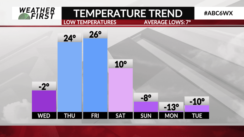
It all comes to an abrupt end Friday night and Saturday, as another powerful arctic cold front passes through Minnesota and Iowa, sending the thermometer plunging. Highs on Saturday only make in into the low teens, with temperatures dropping into the negative single digits Saturday Night.
Next Sunday and Monday highs may not even reach 0F across a fair portion of our area, with nighttime lows in the negative teens for some. BRRRRRRRR.
There are two silver linings with the cold, however. The first, the sun will be out during it! The second, it doesn’t last too long, with highs in the 20F’s returning by the middle of next week. If we had more snow on the ground though, it would be a completely different story, and the cold would much longer, and be more intense!


