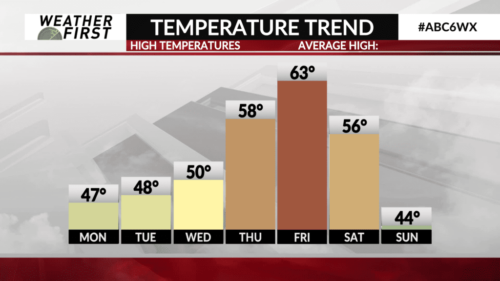
Temperatures warm by weeks end
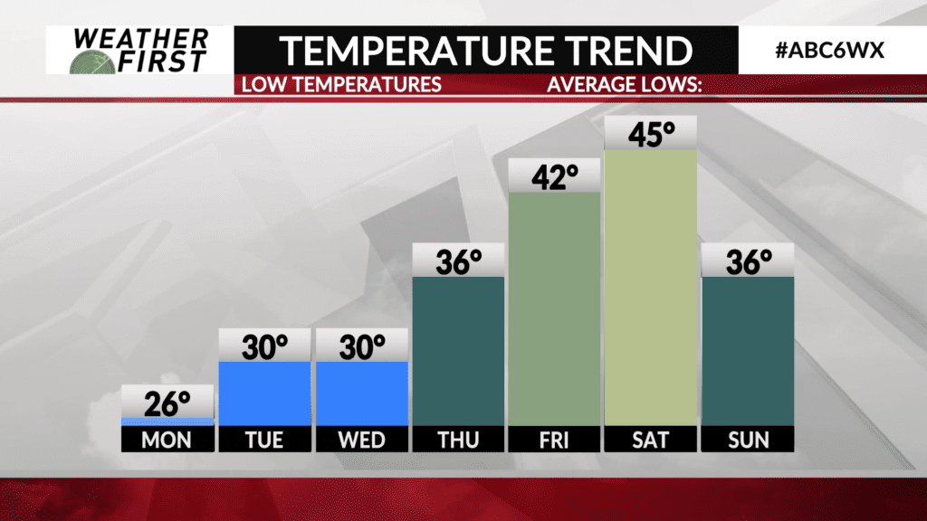
Cooler temperatures are working their way southward behind an area of low pressure that brought precipitation to the area earlier today. However, these cooler temperatures will only lead temperatures Sunday night into Monday to dip down to near average for this time of year.
For the remainder of the week, temperatures will be near average for the first half of the week, then climb above average by the second half of the week.
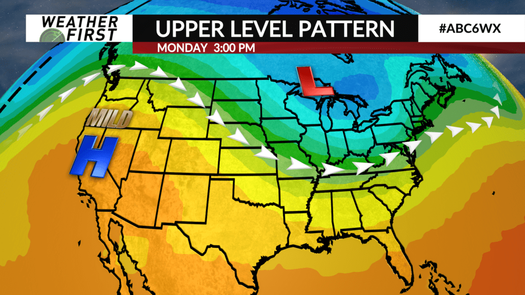
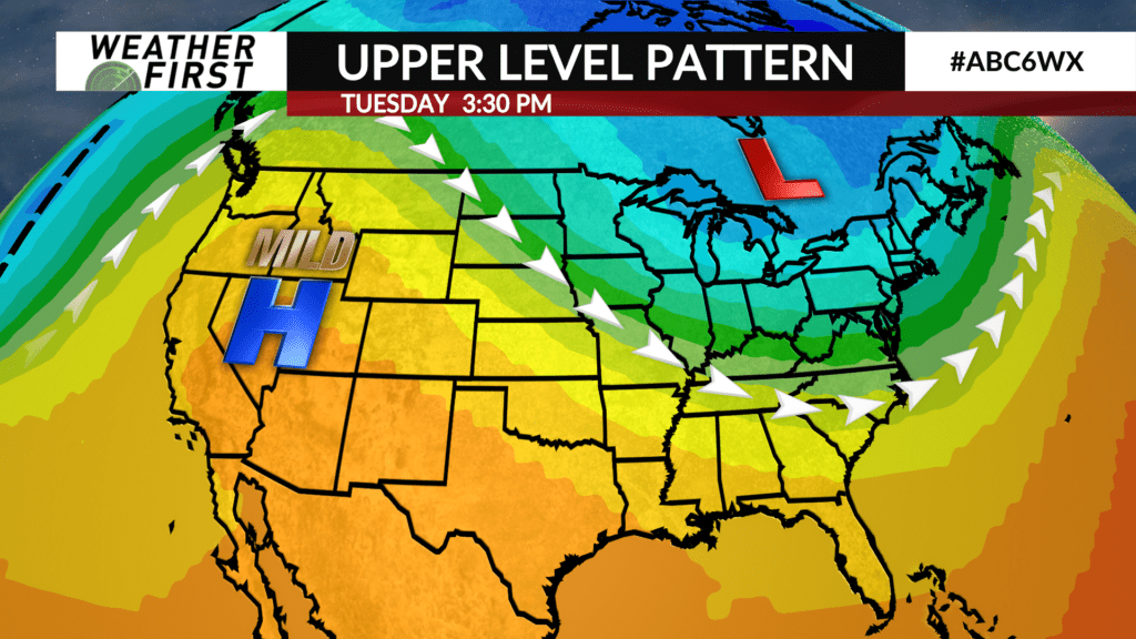
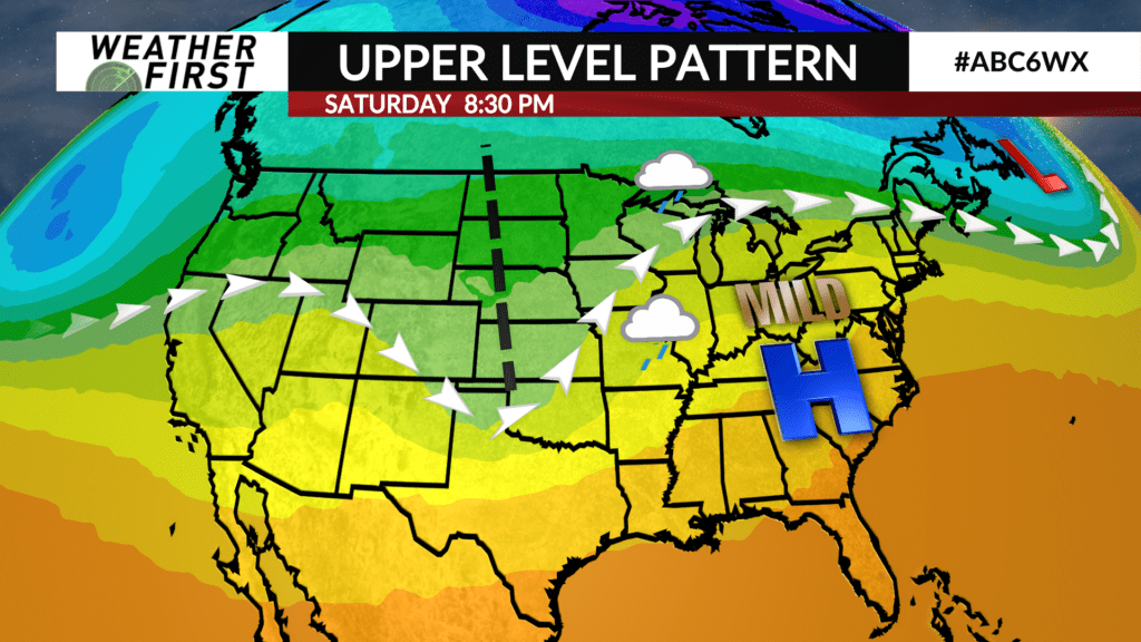
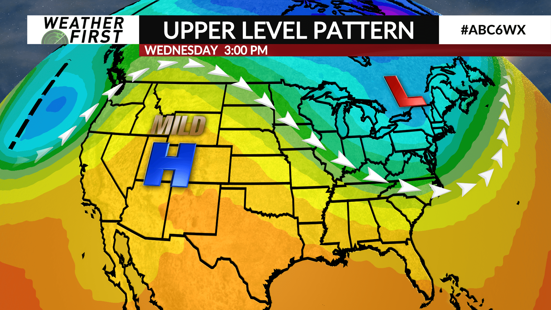
Upper level ridging is beginning to build across the western United States this weekend. This ridge of high pressure will continue to build into the beginning of the week, while slowly sliding eastward.
As a result, temperatures will gradually increase each day starting around midweek. Highs will be in the mid to upper 40F’s for most Monday, Tuesday and Wednesday, with a few 50F’s possible, especially across northern Iowa, each day.
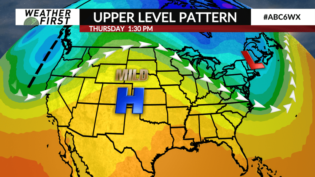
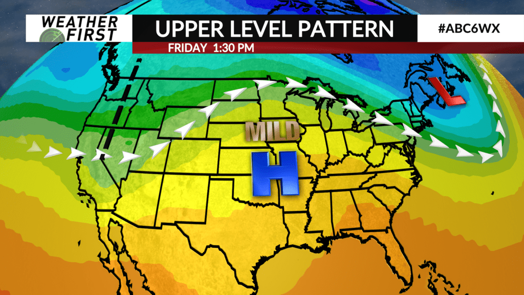
By Thursday, a more pronounced warm up will begin, with highs jumping up into the upper 50F’s to 60F. Friday will be even warmer, with high temperatures in the low to mid 60F’s. This comes as upper level ridging passes overhead, and tracks east of the area. A trough of low pressure will approach the area late week, ramping up moisture and temperature return northward, resulting in the warmer temperatures.
Warmer temperatures have a chance of sticking around into next Saturday, depending on where a surface low pressure tracks. By the end of the weekend, cooler air will begin to wrap around the backside of whatever storm system tracks through, sending highs back down into the 40F’s.
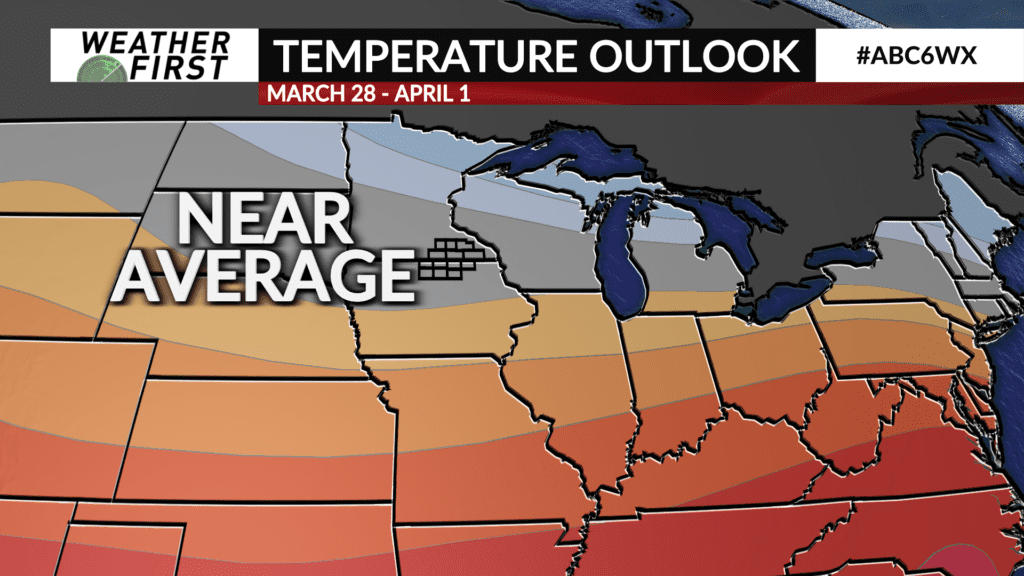
By next weekend, highs in the mid 40F’s will be “near average”! We’re getting closer to more comfortable average temperatures!