The heat and humidity build this weekend
No changes have been made to the idea that we are in for a warm and muggy weekend here across the Weather First area!
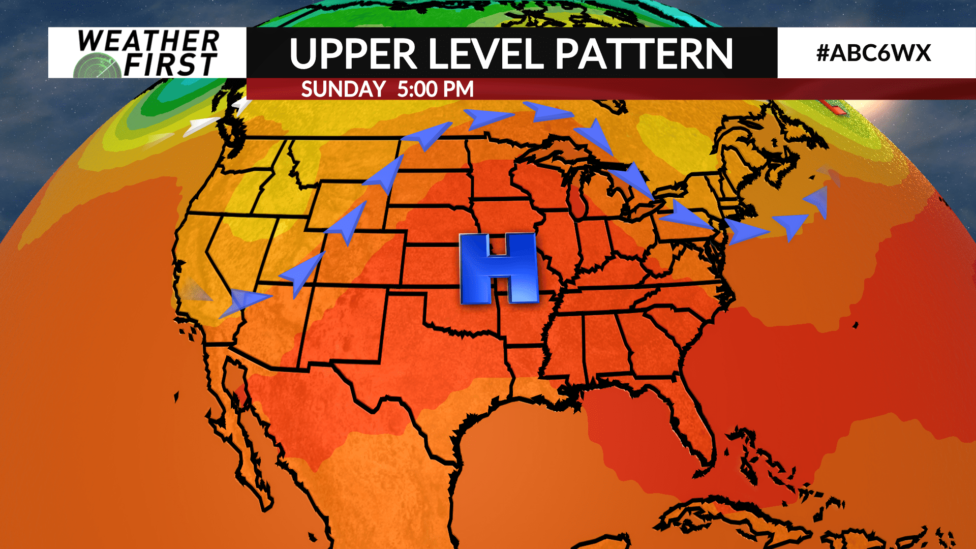
The upper level pattern the next few days will feature a building ridge of high pressure to the southwest. This ridge will gradually extend northward across portions of the Upper Midwest, forcing the subtropical jet stream north into Canada. The result? Warmer and soupy weather on the way.
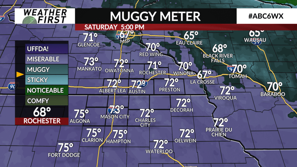
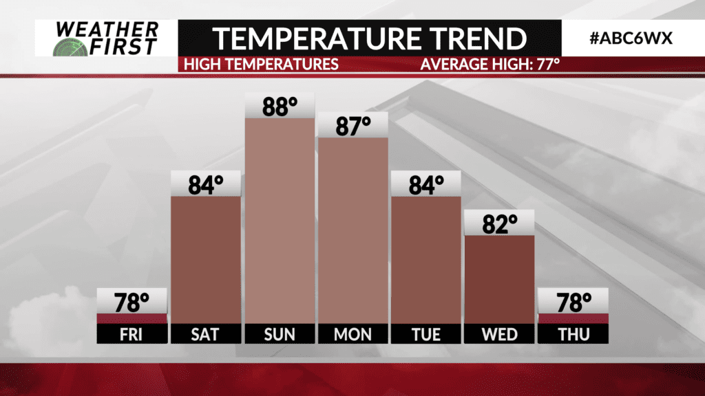
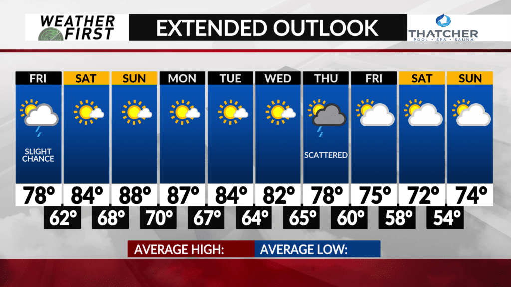
Temperatures will climb into the mid 80F’s for the area on Saturday, as dew points reach into the lower 70F’s by Saturday afternoon. Looking at plenty of sunshine, so it will feel very warm.
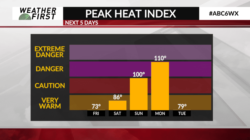
Sunday will be even warmer, with highs around 88F. Dew points are likely going to be in the low to mid 70F’s under plenty of sunshine Sunday. Combine the temperatures, dew points and sun, we may be looking at heat index values of well over 100F!
Monday won’t be much better. The ridge continues to sit right over us, keeping the warmth and humidity around. Highs will be in the mid to upper 80F’s again, with dew points once again in the 70F’s.
This is the type of heat that is dangerous to be outside in for long periods of time. Taking frequent water and shade breaks will be very important steps to prevent heat related illnesses!
There may be a few hit or miss shower and t-storm chances throughout the weekend and into early next week, but chances are very low and nothing to be concerned about at this time.