Toasty weekend ahead with a chance for thunderstorms
Heat and humidity are on the move and will grip the Weather First area this weekend. It’ll also bring the chance of showers and thunderstorms.
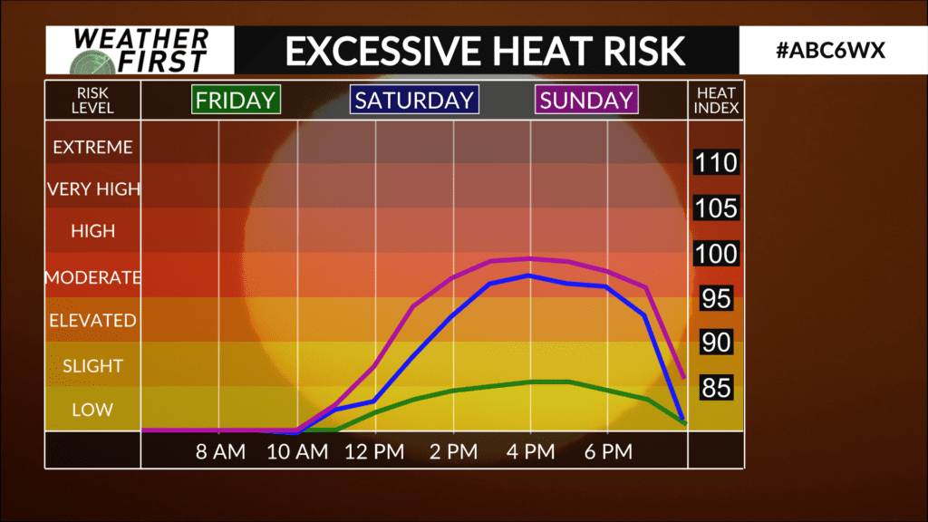
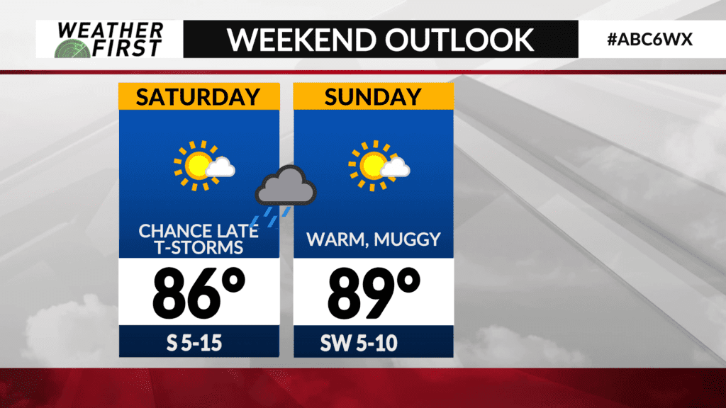
High temperatures are expected to climb into the mid-to-upper 80s on Saturday and upper 80s to lower 90s on Sunday leading to some of the warmest temperatures of the summer season so far.
Moisture will increase due to southerly winds leading to dew point temperatures surging into the 70s making for a muggy weekend.
While we’ve certainly had worse in previous summers, it’s important for anyone spending a long period of time outdoors to drink plenty of water and seek shade at times.
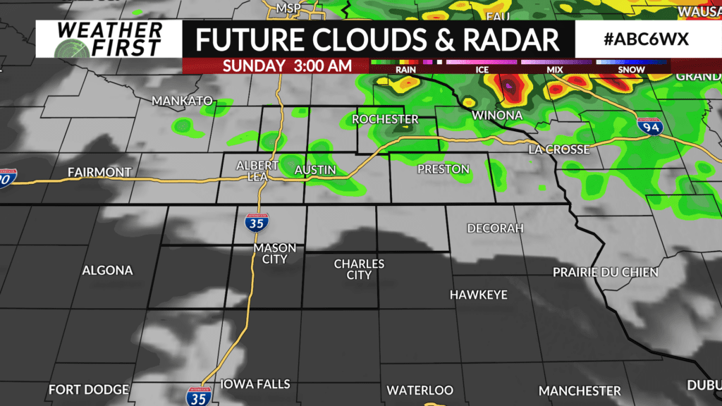
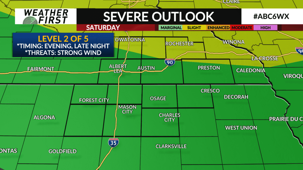
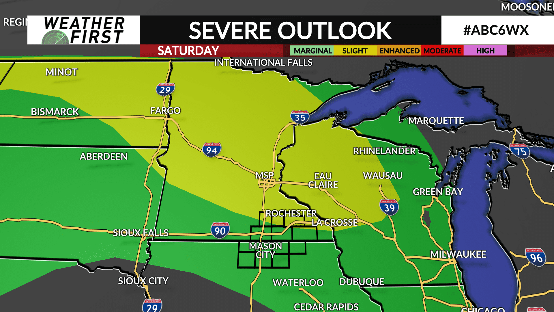
Showers and thunderstorms will track into north-central Minnesota late Friday night and should stay out of the area, but they will likely push a front further south, and with some leftover boundaries and another system coming through Saturday night, it may pop some showers and thunderstorms. There is still some uncertainty on location, but the latest trends are most likely thunderstorms will stay north and east, however it’s possible some will extend further west into southeast Minnesota.
If any thunderstorms develop, a strong thunderstorm is possible due to the high amounts of energy that will be in place with strong damaging winds as the main threat. The Storm Prediction Center has a Level 2 of 5 risk for areas near and north of I-90.
Additional chances for thunderstorms are possible on Monday.