Today’s Almanac
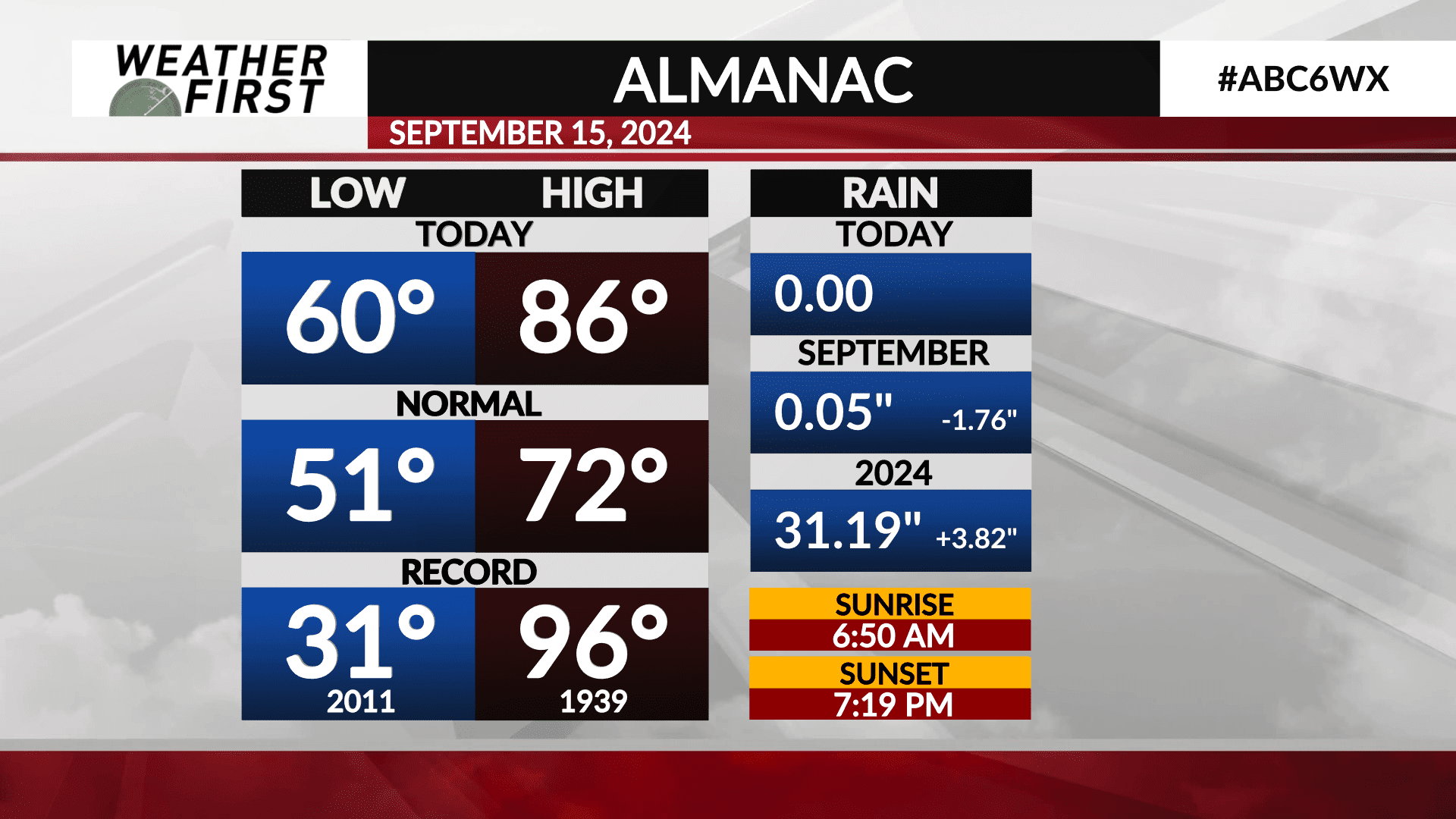
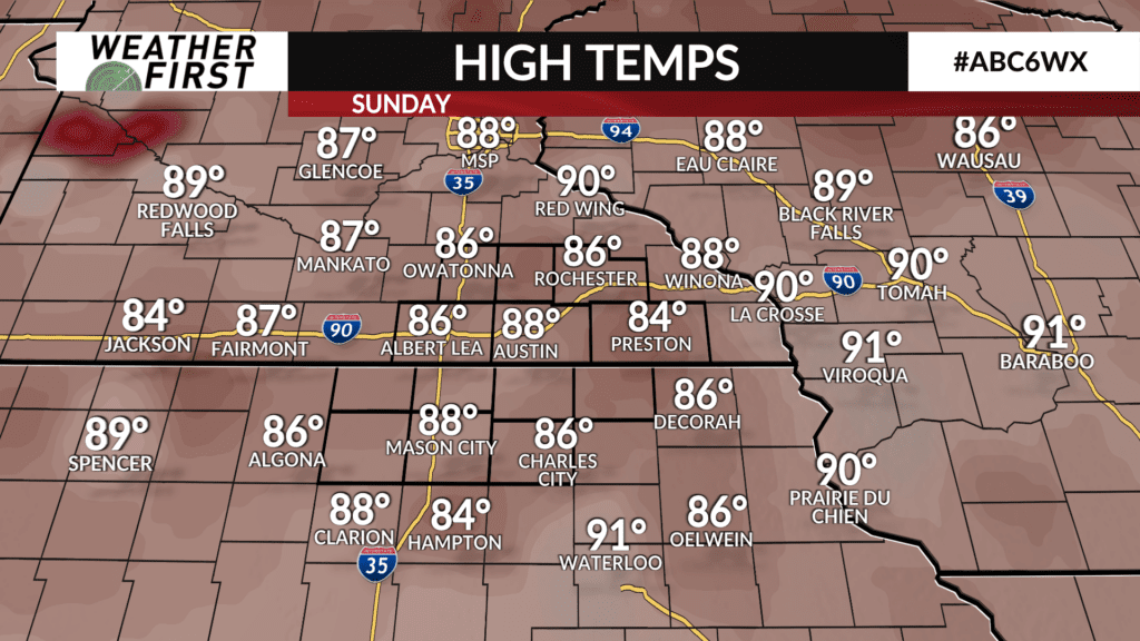
Today was another very warm and summerlike day across the Weather First area. Highs in Rochester today reaches, 86F, with upper 80F’s being recorded in areas such as Austin and Mason City. Dew points were also in the mid to upper 60F’s, making it feel like the middle of summer.
But it’s not the middle of summer. It’s the middle of September, and the temperatures we have been seeing as of late far exceed the average highs for this time of year. The average high for today is 72F, with the average low being 51F. Here in Rochester, reaching 86F placed us 14F above the long term average for this time of year! Our daytime low was almost 10F above the average low for this time of year.
Even more noteworthy, is that we were closer to the record high of 96F set back in 1939 than we were to the average high today! Our daytime low was almost 30F above the record low of 31F set back in 2011. To sum it all up…yes, it was a warm day across the area!
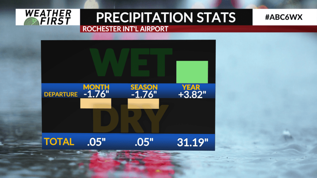
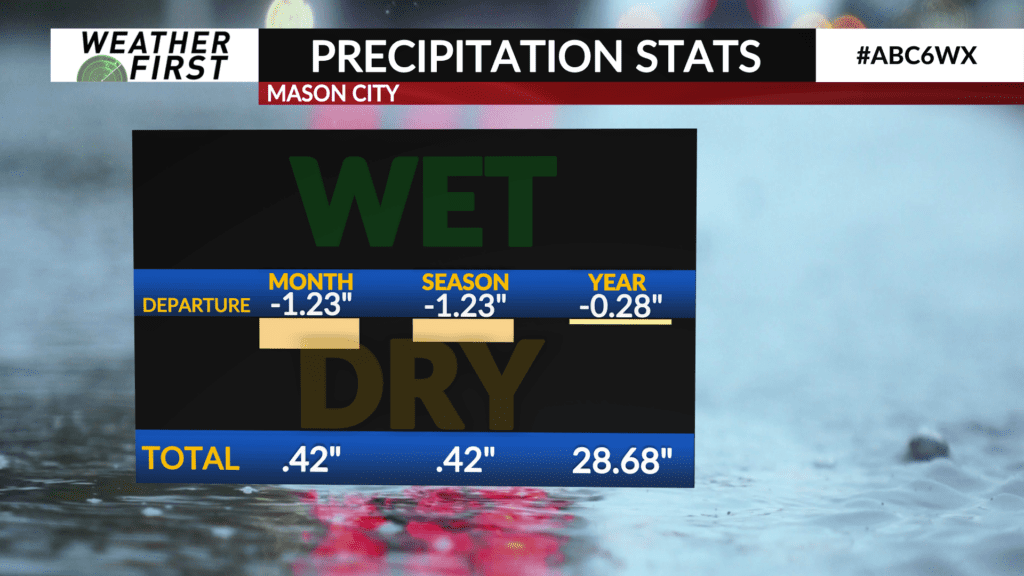
When it comes to precipitation, we are really starting to see any surplus we had from earlier this summer dwindle away during these dry September days. We have only seen 0.05″ of rain in Rochester since September 1st, which is 1.76″ below where we should be for this time. In Mason City, only 0.42″ of rain have fallen since September 1st, which is 1.23″ inches below average for this time of the month. In short, it’s been very dry around here.
Looking at the extended forecast, above average temperatures are expected the next 2 weeks across the weather first area. We also may see more beneficial rains going into next weekend as a stronger storm system passes through the area. Only time will tell, however, on whether we see the rainfall we need from this next system, or if we get passed on by.