Today’s almanac, let’s talk rain
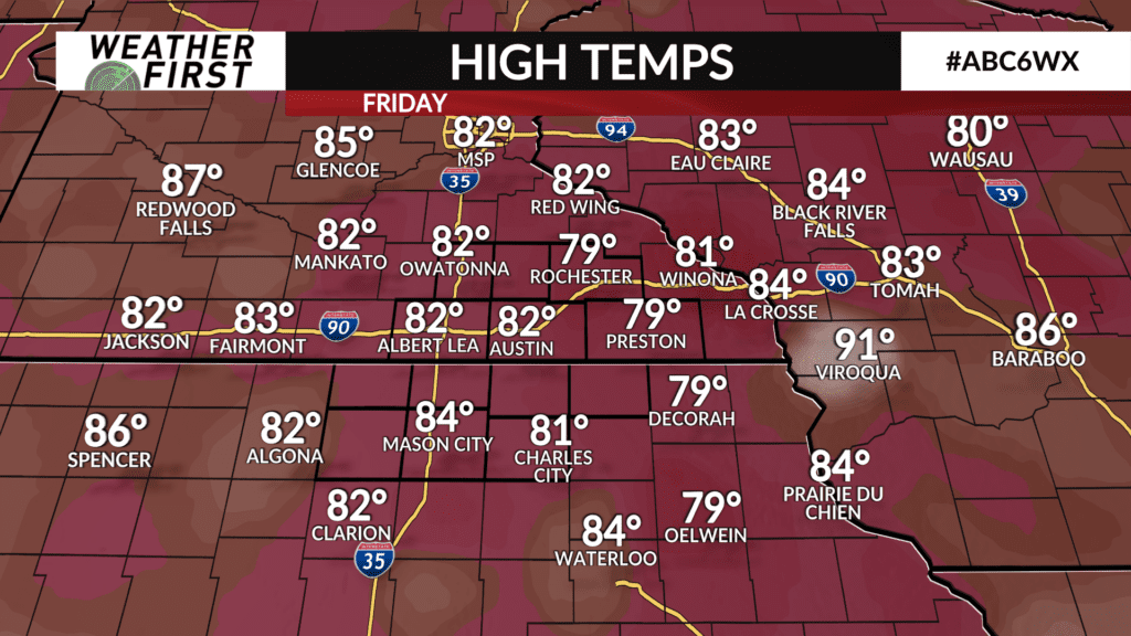
Today was yet another day across southeastern Minnesota and northern Iowa where temperatures were above the average daily high temperature for this time of year. No complaints though, the snow will be flying soon enough, best to take advantage of the warmer weather while we have it!
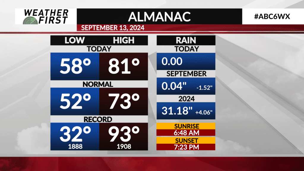
The average high today for Rochester is 73F, with the average low being 52F. We reached 81F this afternoon, and the morning low was 58F. Quite a bit warmer than “normal” across the board temperature wise. Precipitation wise…well, that is a different story.
While we are not in a drought across southeastern Minnesota, northern Iowa falls into the “abnormally dry” category of the Climate Prediction Centers drought monitor. Abnormally dry doesn’t mean drought either, but it is the next step closer to it.
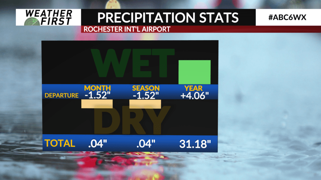
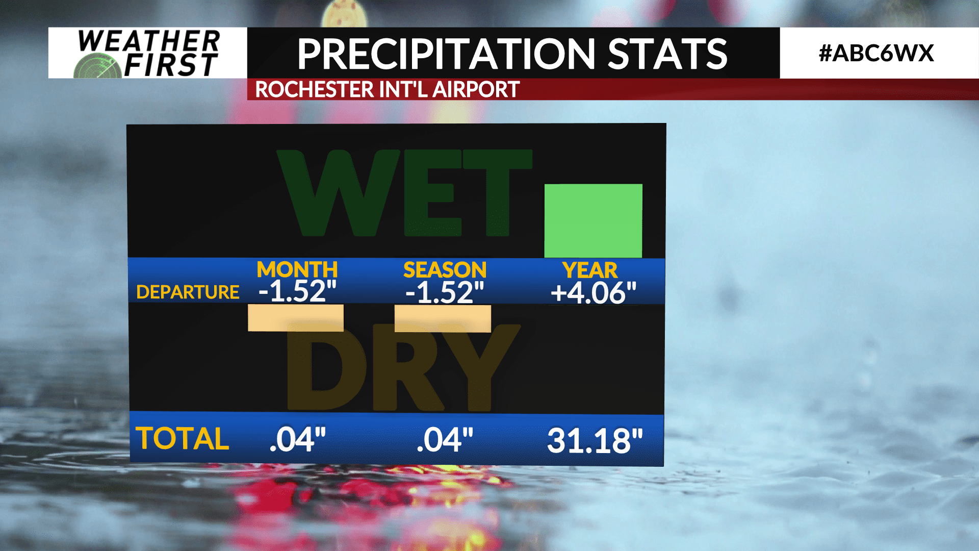
September has been a very dry month so far across the Weather First area. Very little rain has fallen, with only 0.04″ of rain falling over a week ago here in Rochester. This puts our monthly rainfall deficit at -1.52″ as well as our seasonal rainfall deficit.
As far as yearly precipitation goes, however, we are still above average by quite a bit! Rochester has seen 4.06″ of extra rainfall so far this year, with much of the above normal rainfall totals coming in June and August.
While there are chances of rain in the extended forecast, they are on the lower end and do not look like widespread, beneficial rainfall events. With that said, it is reasonable to assume we don’t add much to that monthly rainfall total anytime soon.