Tracking Our Next Winter Storm Thu-Fri

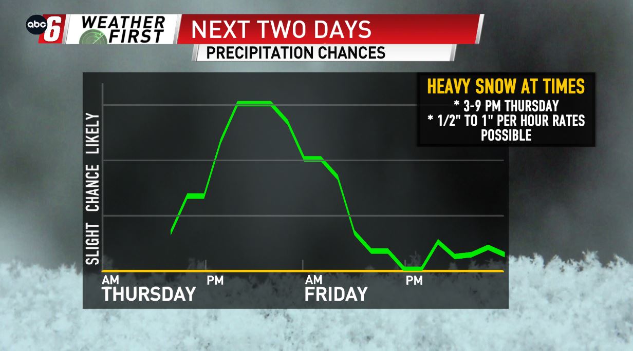
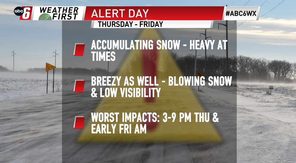
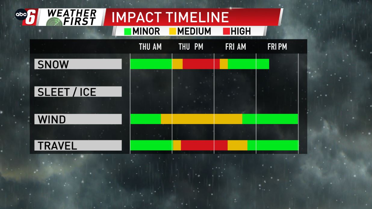
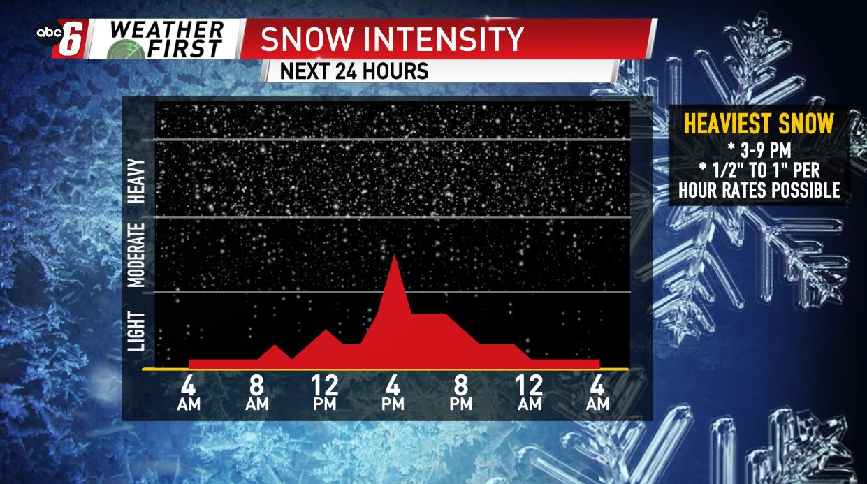
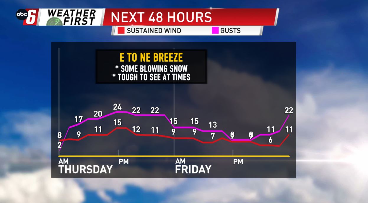
A large-scale winter storm will bring heavy snow to the area at times today. Snow moves in shortly after sunrise, and will pick up in coverage & in intensity, with snowfall rates in the 1/2″ to 1″ per hour range possible Thursday afternoon & evening. Snow will wrap up by sunrise on Friday, with 4-6″ looking likely area-wide. A few communities along and south of I-90 & east of I-35 may exceed this range by an inch or two. Impacts to the travel scene are expected, as the heavy snow falls along with a breeze out of the E/NE. This will be the case Thursday afternoon, evening, & overnight into early Friday morning.