Tracking Tuesday’s Snow, ALERT DAY
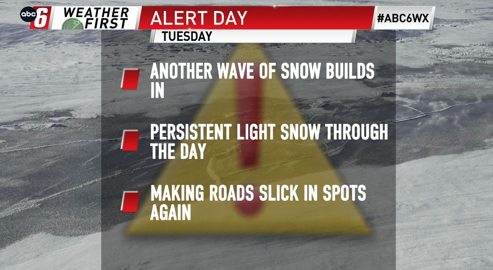
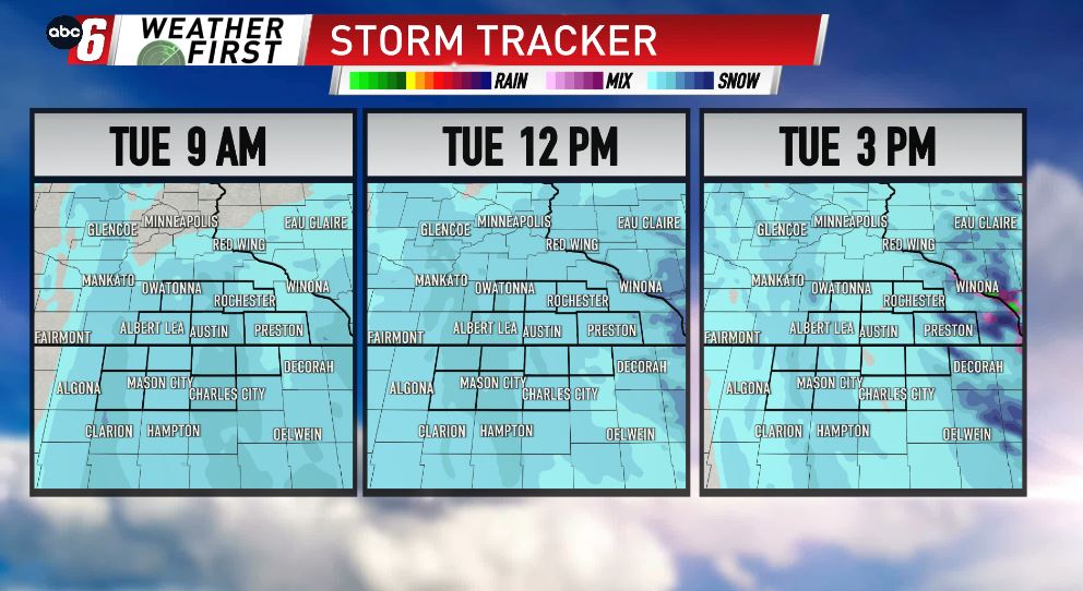
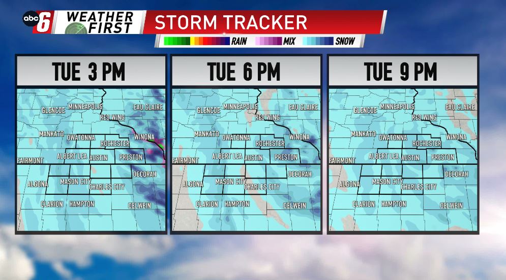
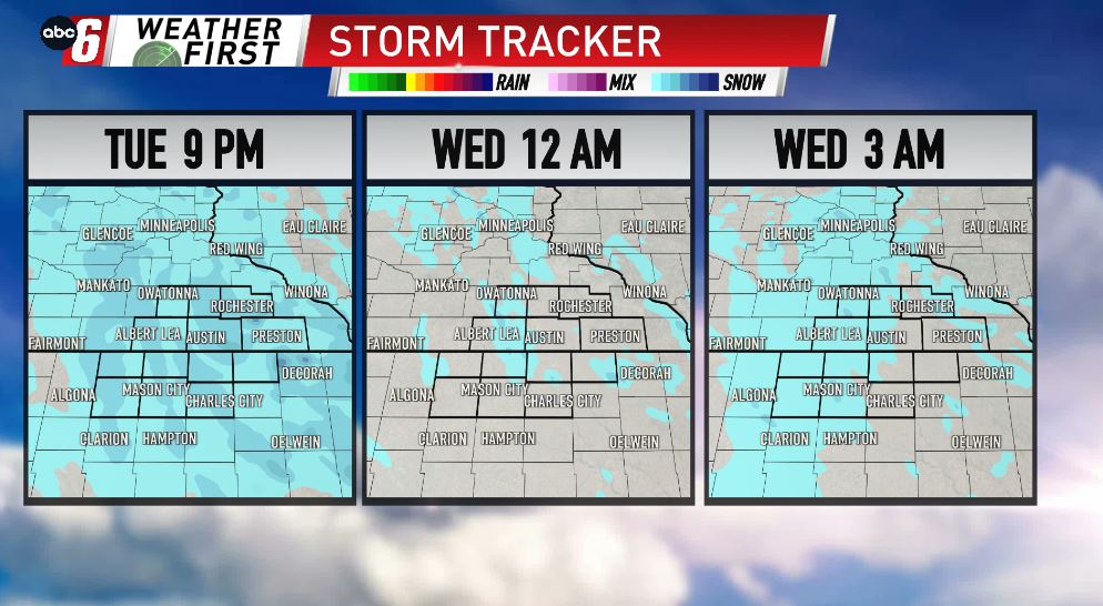
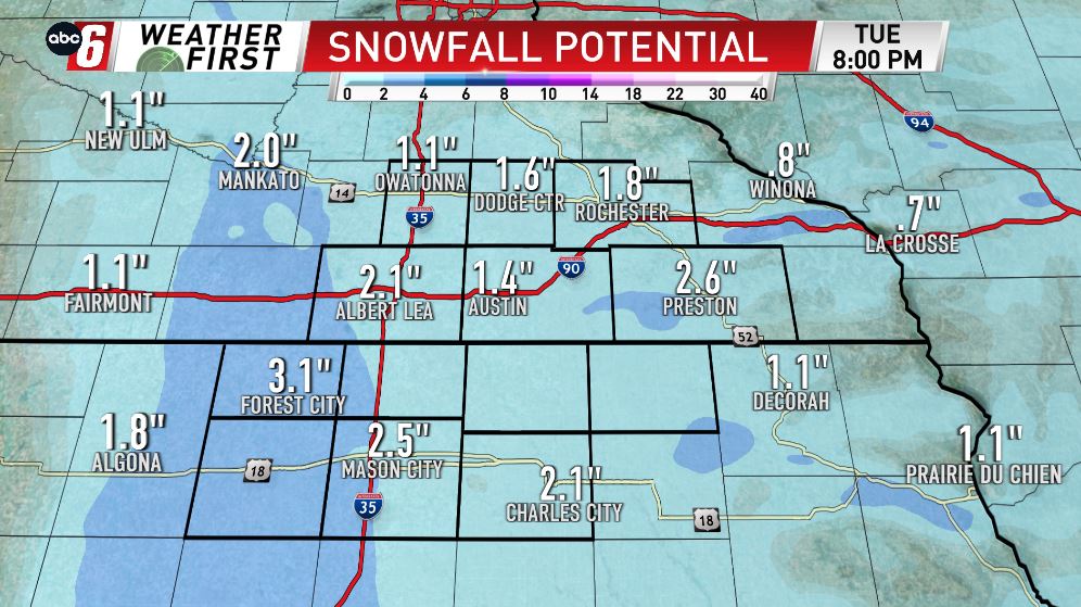
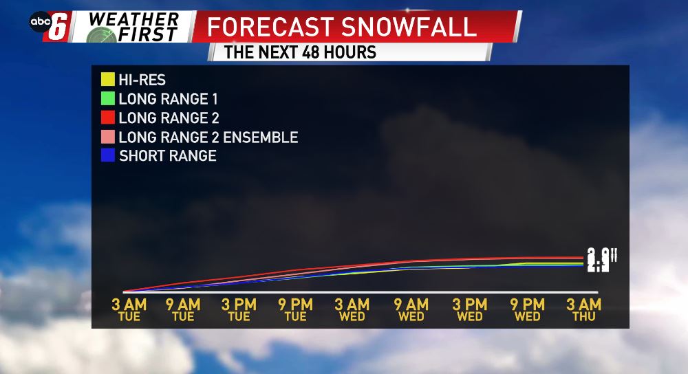
We have another ALERT DAY status in place for Tuesday, as our next round of steady, light snow continues throughout the area. 1-2″ of snow is expected for the majority of the area, with the highest totals, close to 3″, lining up along and west of I-35, as well as clipping SE MN, just west of the Mississippi River. It’s not a ton of snow, however it will be enough to make it a little tough to see & to get the roads a little slick once again. Go slow & keep your headlights on! Look for the light snow to carry over into the first part of Wednesday, before it slowly moves out of the area.