Tuesday – Wednesday Impacts
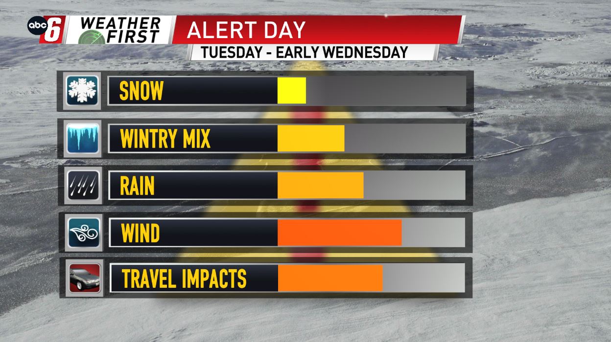
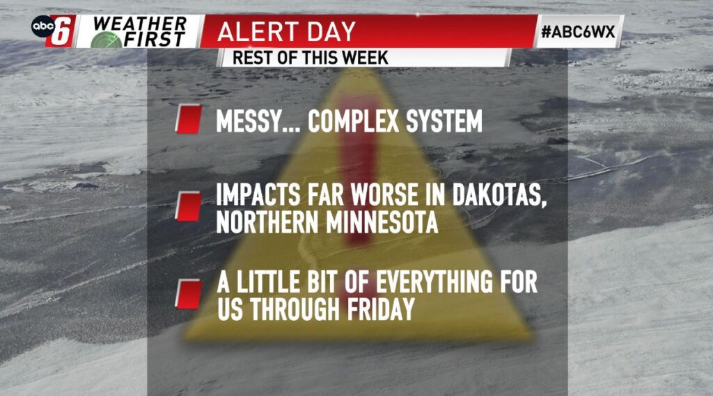
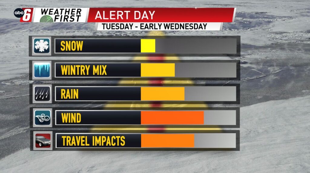
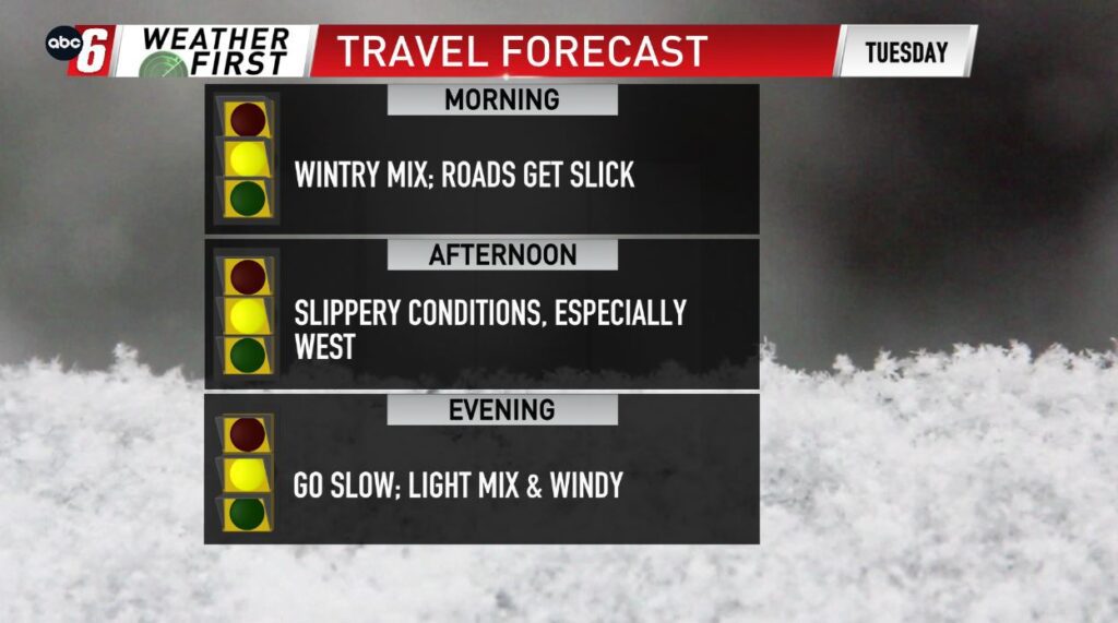
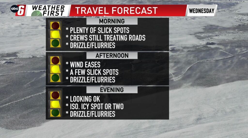
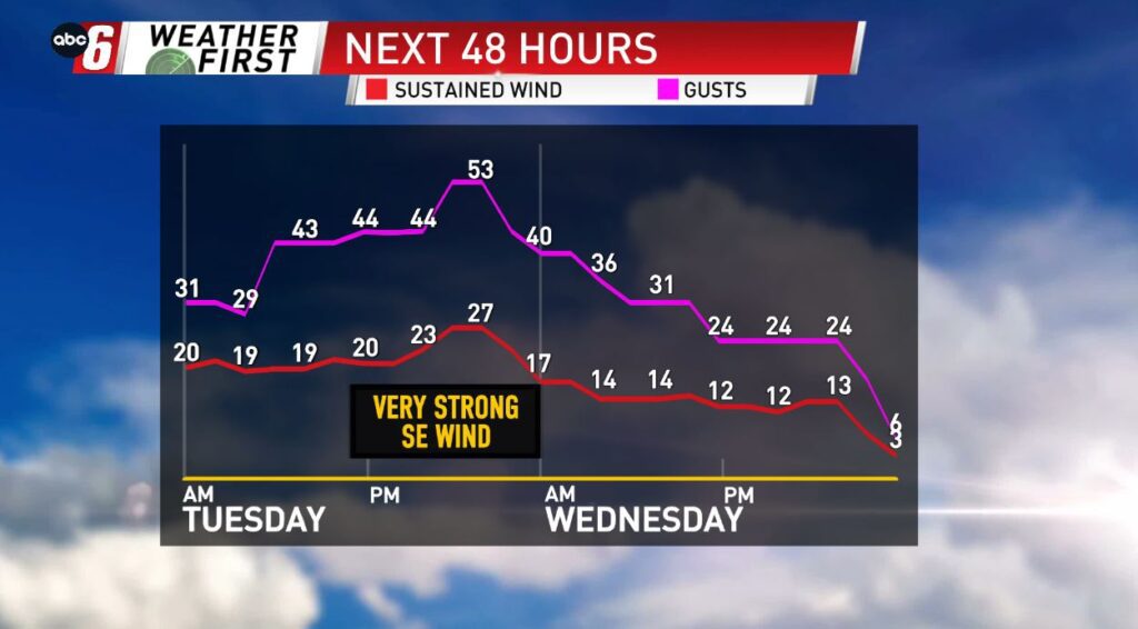
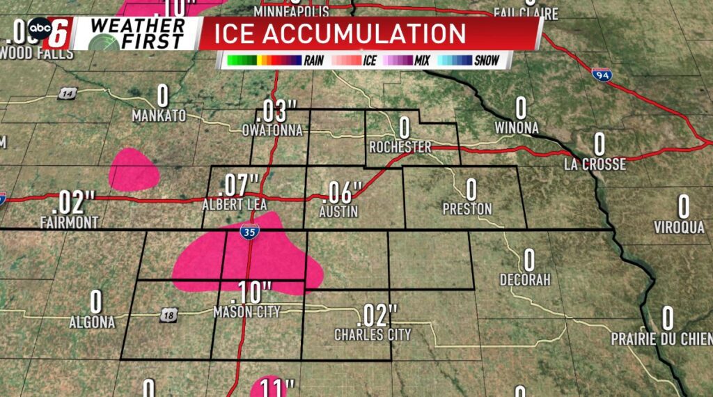
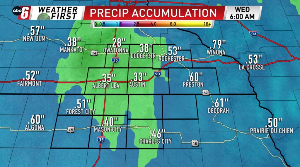
The very complex storm is here, and it will be causing issues throughout the area Tuesday – Wednesday, as we see a little of everything in terms of precipitation type, from sleet & freezing rain/drizzle early, to steady rain, and even a few snowflakes as well. What kind of precipitation we see will depend on our temperatures, and how warm or how far above freezing we can get. Icing looks best along and especially west of I-35, but a few locations just to the east of I-35 may also see a little icing. Timing will be to the west for the morning, and to the east later in the afternoon/evening, with rain likely in between. Any kind of mix/icing we see will be accompanied by a very strong SE wind, with gusts in the 40-50 mph range! This will may cause a few issues out on the roads, especially for the higher profile vehicles!