Warm weather on the way to start next week
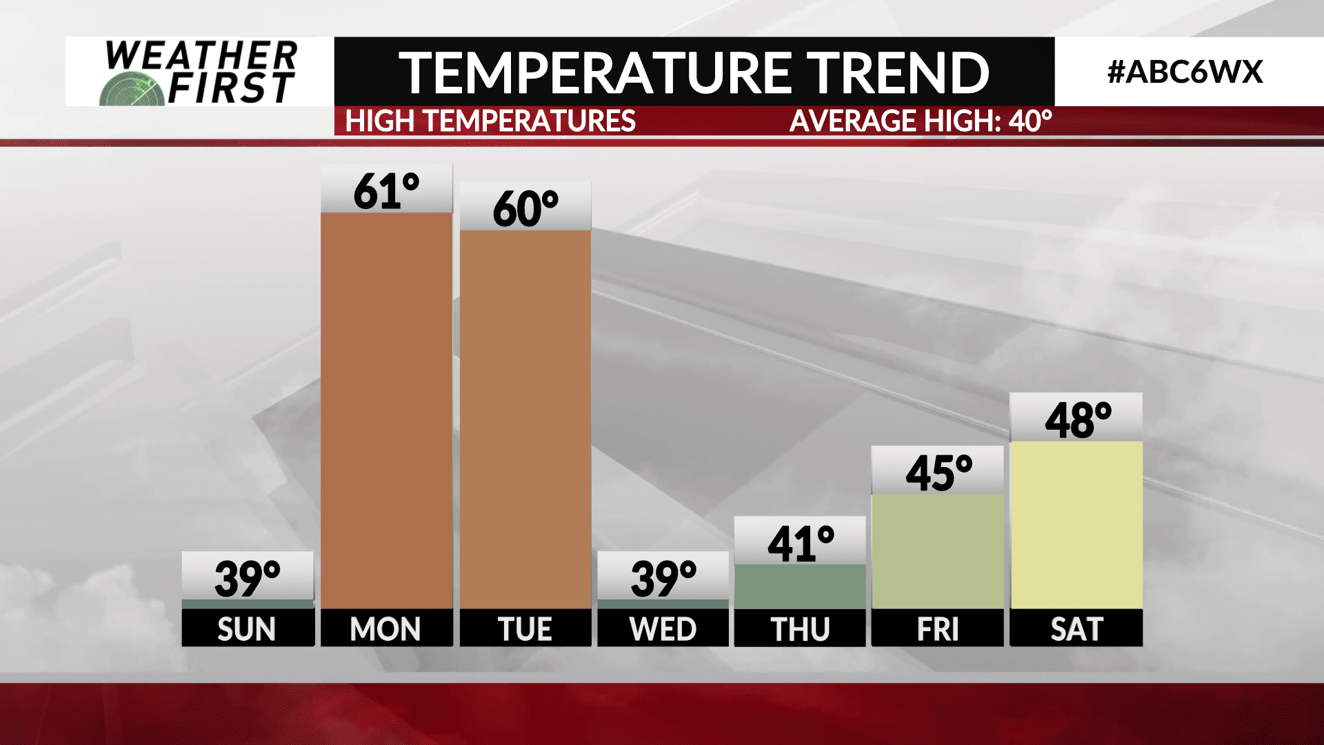
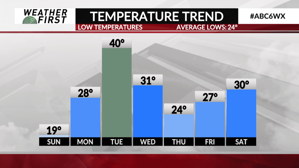
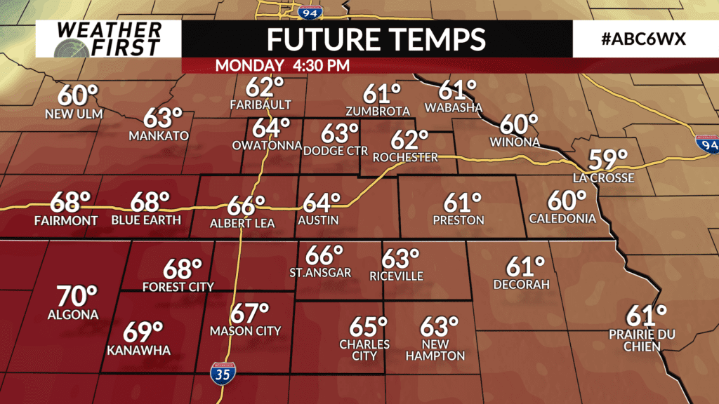
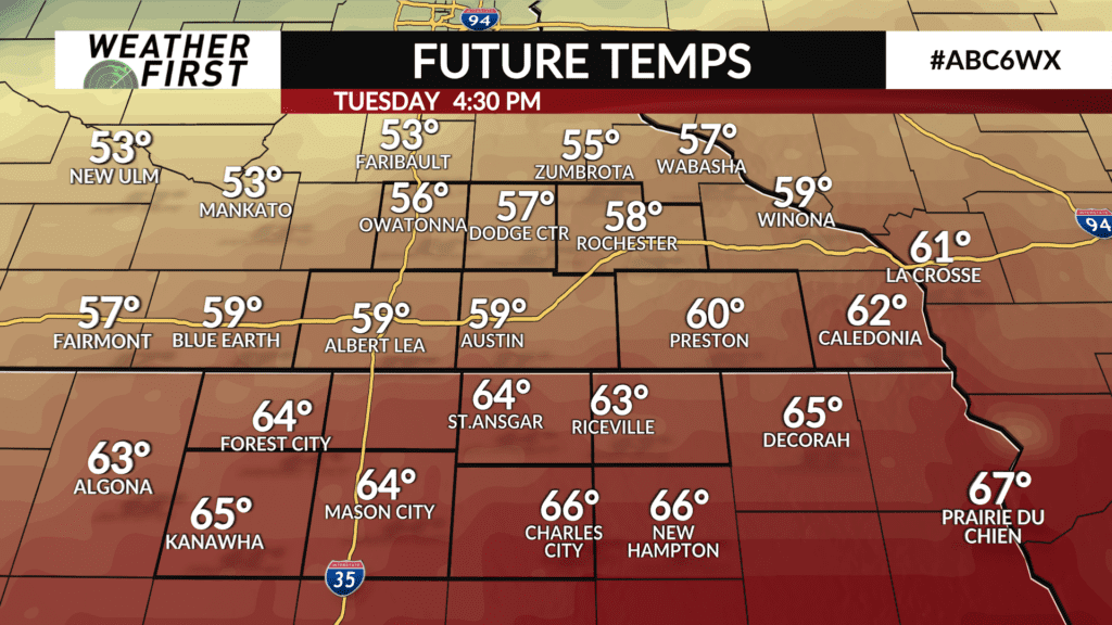
Temperatures will swing dramatically throughout the upcoming week, with highs in the 60F’s Monday and Tuesday, then much cooler weather for the second half of the week.
We will begin the week under the influence of a tight pressure gradient between an area of low pressure to the east, and an area of Canadian high pressure to the northwest. This will result in colder air being transported into the region through the day Saturday, leading to highs in the upper 30F’s to lower 40F’s. . Closer to average for this time of year!
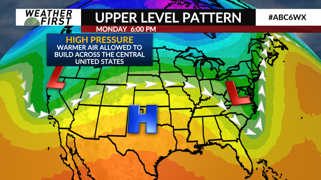
A ridge of high pressure will begin it’s trek across the southern United States from west to east Monday into Tuesday, leading to a surge of warmer air back northwards. Winds will be on the stronger side out of the south, between 10 to 20 mph, gusting up to 35 to 40 mph at times.
Because of the strong southerly winds, high temperatures will climb well into the 60F’s Monday and Tuesday. This upper level ridge will also result in plenty of sunshine during both days, making for a beautiful start to the week.
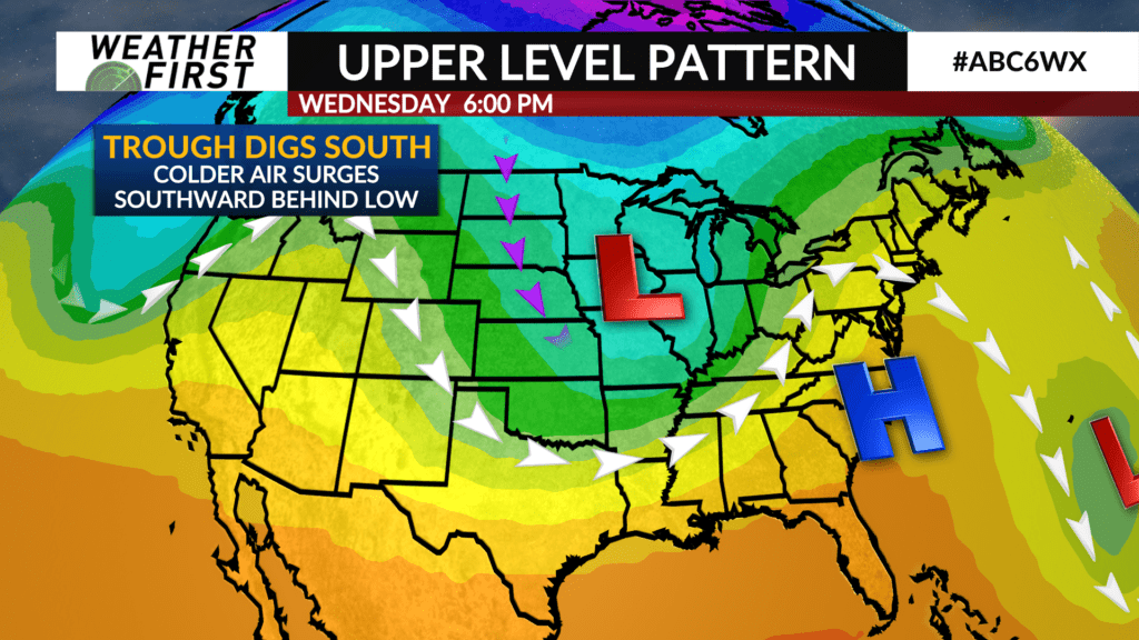
Things will take a dramatic turn Tuesday night into Wednesday, with a trough of low pressure passing through Wednesday and Thursday. Colder air will surge southward behind the trough, sending our daily high temperatures back down to around 40F for Wednesday.
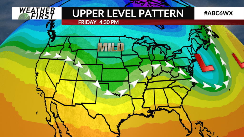
Luckily, this will be the brunt of the colder air, with high temperatures in the lower 40F’s returning by Thursday and Friday. Overnight lows this week will only drop into the 20F’s and 30F’s, which is right around to slightly above average for this time of year.
So while there will be plenty of dramatic temperature swings over the next week, high temperatures will remain near to above average!