Warmer temperatures and rain early next week

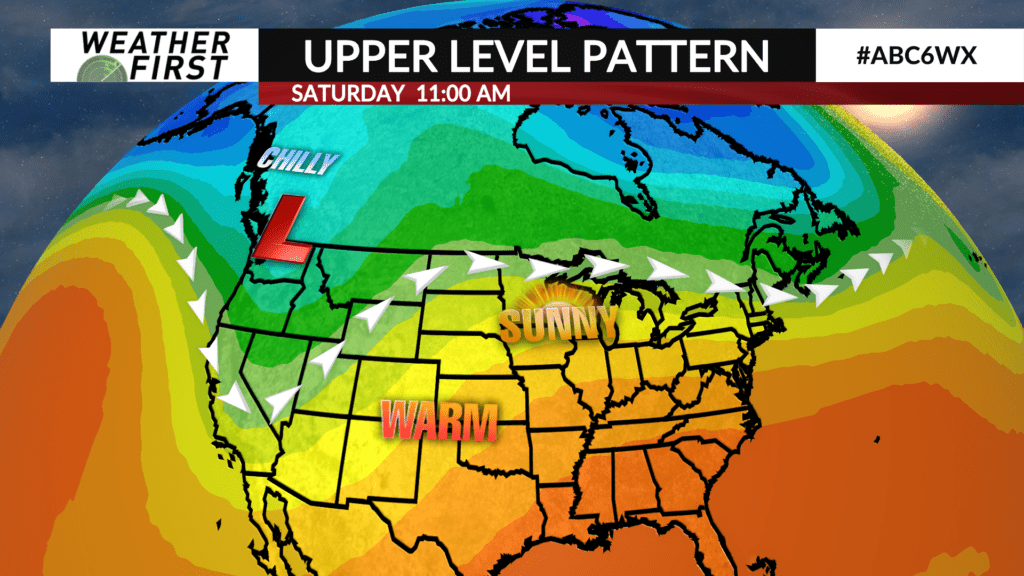
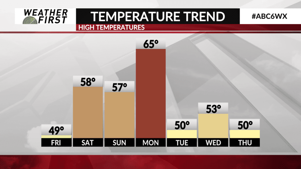
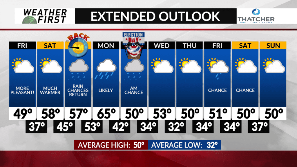
This weekend will start out absolutely beautiful for early November standards, with highs in the upper 50F’s Saturday and plenty of sunshine! High level cirrus cloud cover will be on the increase throughout the day, but no precipitation is in the forecast.
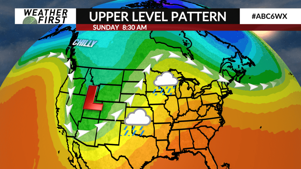
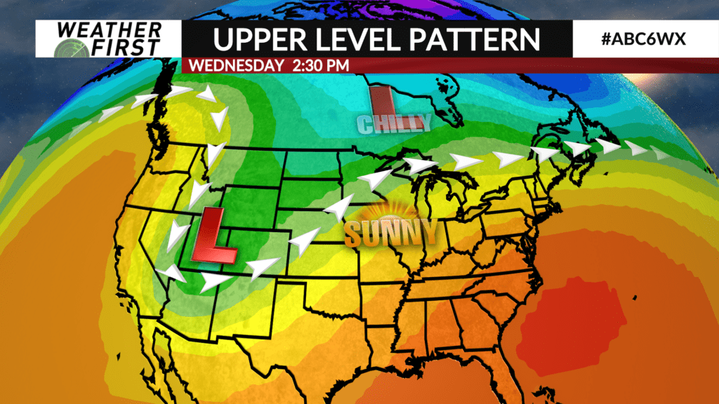
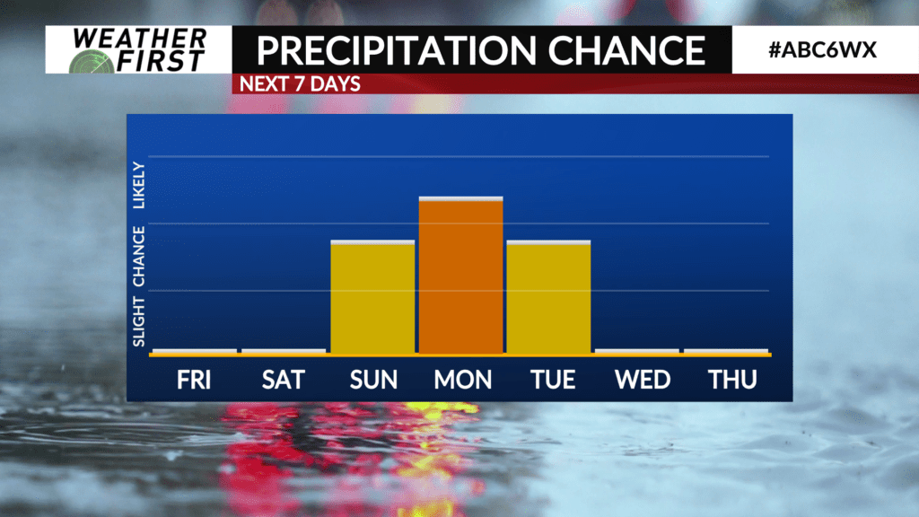
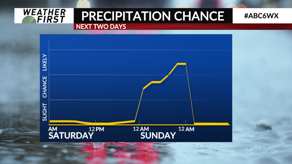
Rain chances increase heading into late Saturday night and early Sunday morning as an upper level trough approaches from the west. This trough will provide forcing for multiple rounds of precipitation over the course of Sunday through next Tuesday, with some uncertainty still on the timing and coverage of the rain.
Model guidance is still wrestling between not much in terms of rain activity across the area Sunday to a light rain across the area most of the day. With that said, have put in moderate rain chances to meet in the middle, and having an umbrella with you Sunday will be a good idea.
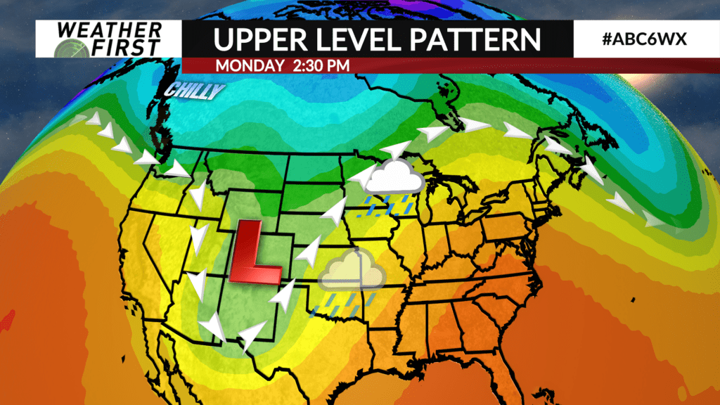
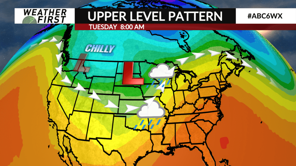
Regardless of how widespread the rain is Sunday, there is a high probability of more widespread rain making its way into our area Sunday night into Monday. This rain may last all the way through Tuesday morning depending on how quickly the trough of low pressure passes through our area.
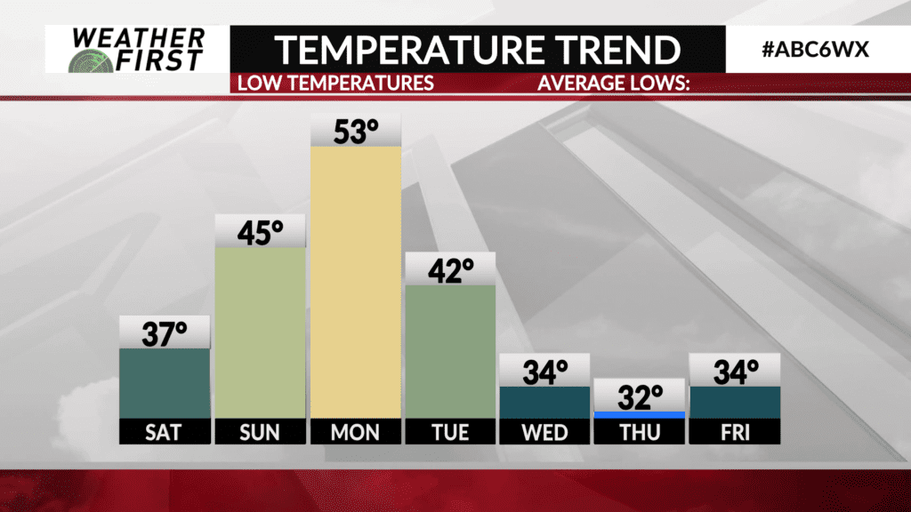
Despite the rainy weather that may impact the weekend and early next week, temperatures are going to climb well above the long term average for this time of year. Highs will be in the upper 50F’s both Saturday and Sunday, with temperatures climbing into the mid 60F’s on Monday! This would be at least 15F above the average high for November 4th!
Rain chances decrease through the day on Tuesday, with cooler temperatures arriving behind a cold front that will track through Monday. Highs will climb to around 50F next Tuesday, and into the low 50F’s for the middle of next week.
