Warmer to start next week

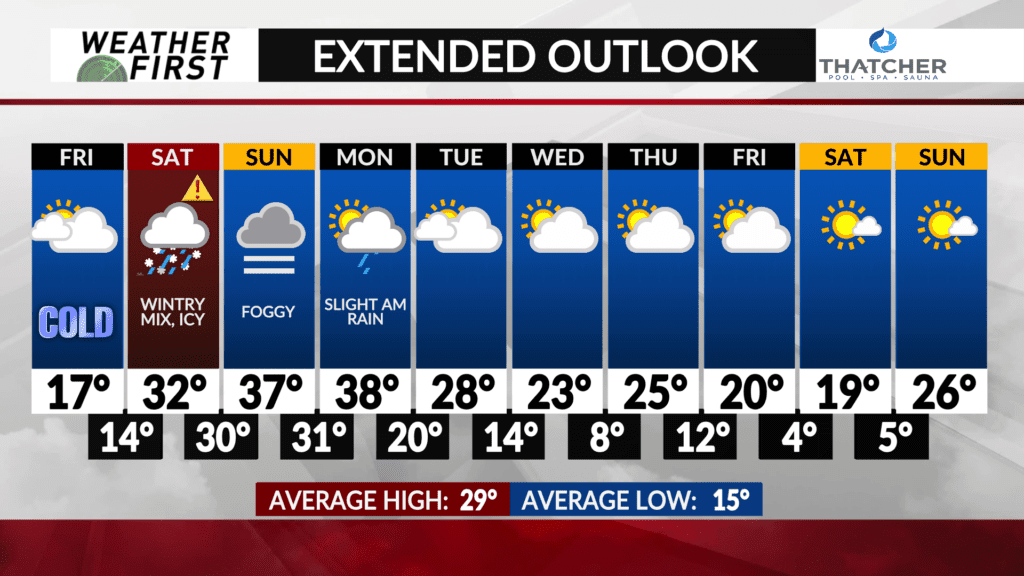
After the wintry mess moves out Saturday night, skies remain on the cloudy side for the second half of the weekend. On the plus side of things, temperatures warm to a somewhat more tolerable level the second half of this weekend!
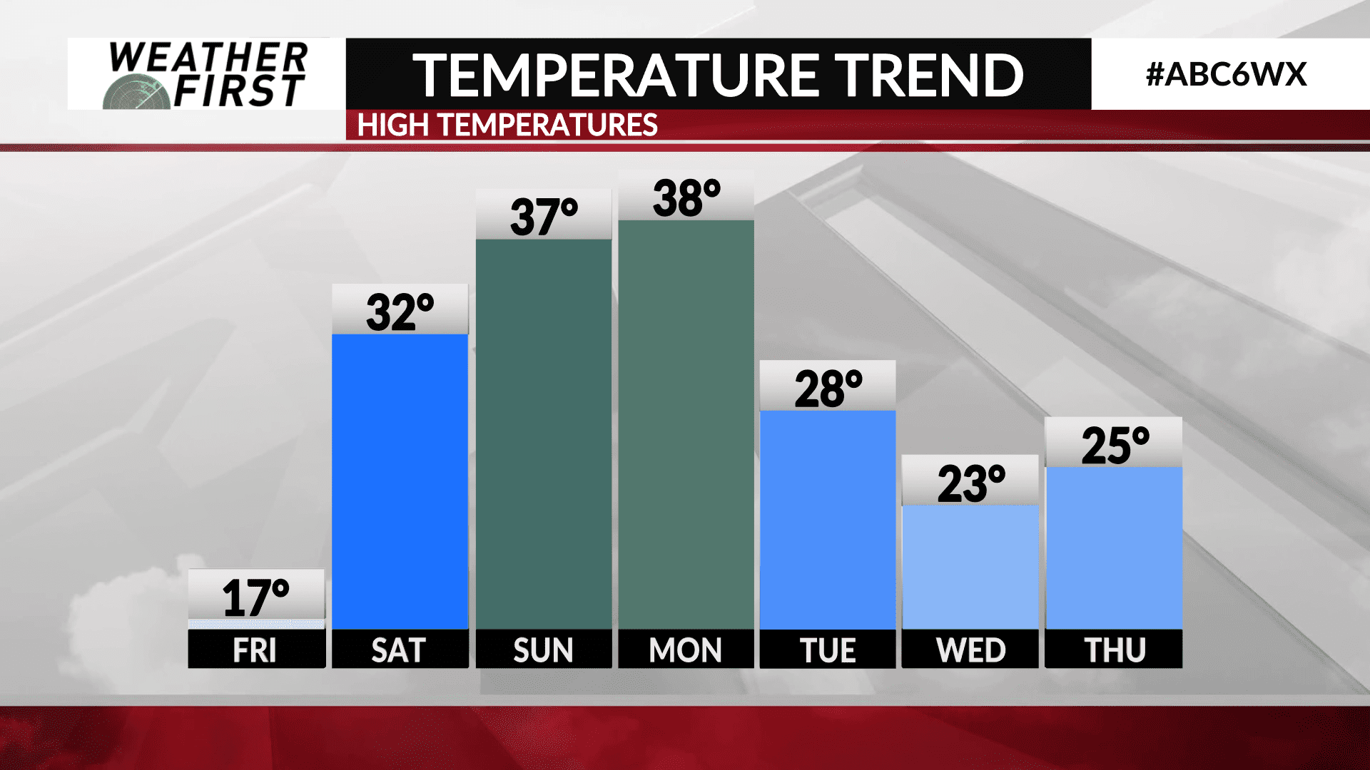
Highs will climb into the mid to upper 30F’s on Sunday, with plenty of cloud cover. There even is the potential for fog across the area if dew points are near the temperatures as advertised by model guidance currently.
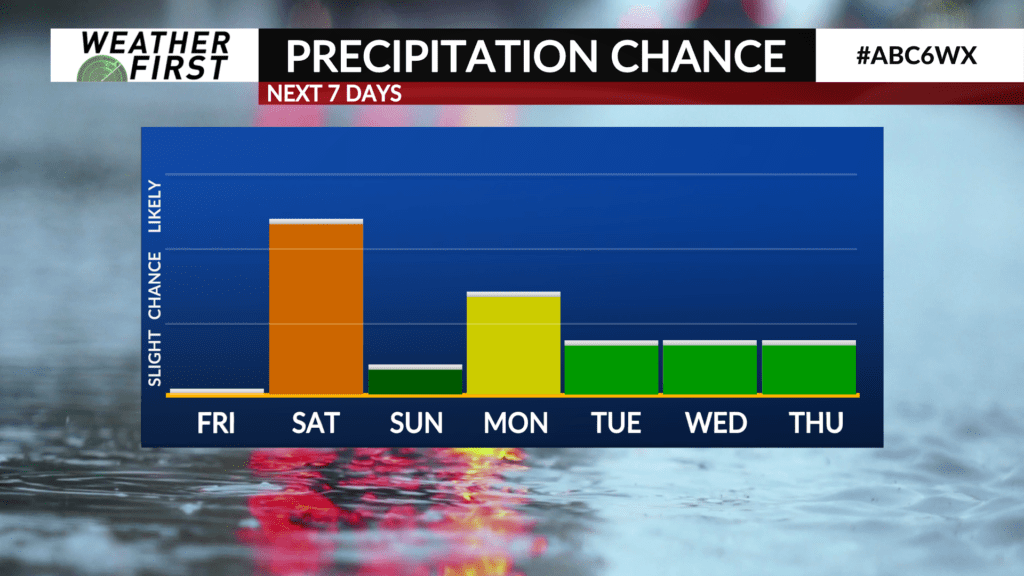
Highs will be in the upper 30F’s once again on Monday as an area of low pressure passes us by to the north. This low will bring a slight chance for a few light rain showers Monday morning, but it certainly does not look like everyone will see rain at this point.
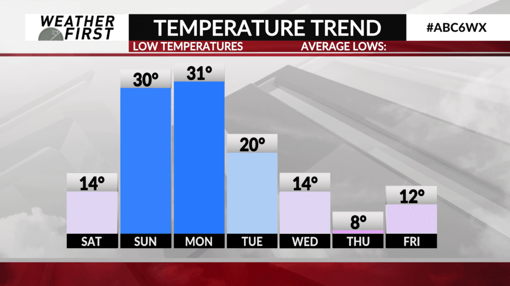
Clouds hang around on Tuesday, with highs in the upper 20F’s behind a cold front. Temperatures continue to drop throughout next week, with highs in the low 20F’s by the end of the week and lows in the single digits once again.
There are a few snow chances throughout the middle and end of next week, but due to high uncertainty on any storm tracks, it’s hard to pin down any specifics, so am keeping most of next week dry for now.
Regardless of precipitation chances, temperatures start off more mild next week, but gradually drop throughout the week and into the following weekend.


