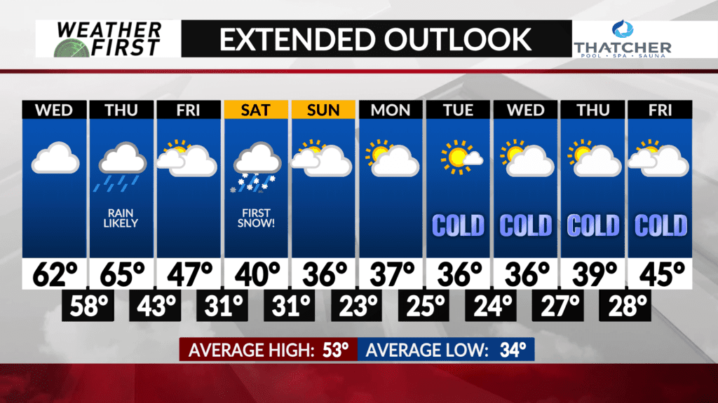
First snowflakes of the season this weekend?
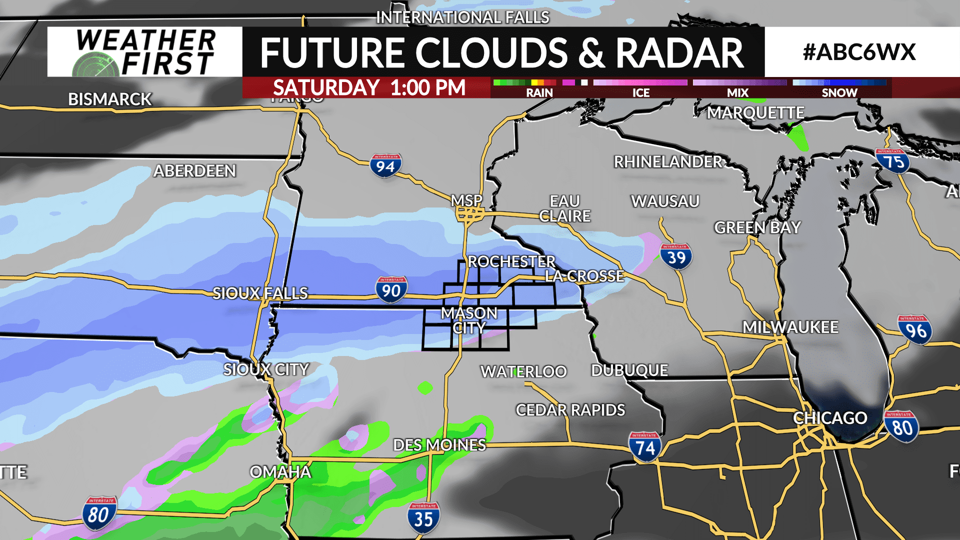
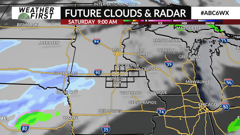
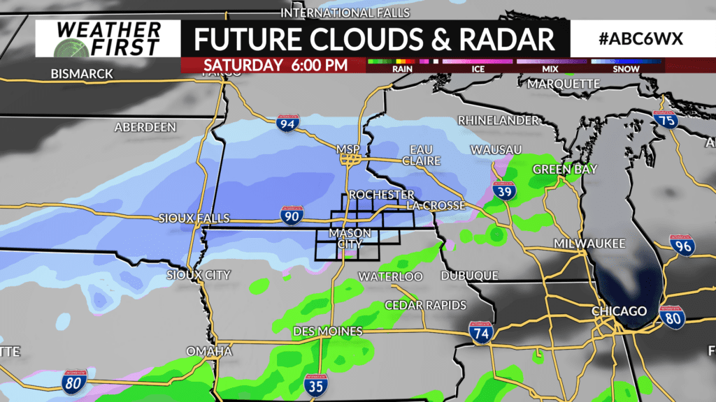
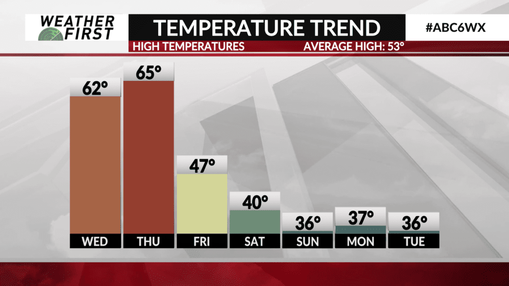
It sure looks like it! We’ve got another storm system rolling through Thursday, and that one will be providing some more heavy rain. That will be followed up by cooler air Friday, and yet another cold front will slide through Saturday. That wave looks to bring a round of snow to southern Minnesota and northern Iowa, along with some others in the upper Midwest. There’s good agreement between some different model guidance. The graphics here are from the European model. What is shown here is certain to be different from what actually happens Saturday – model guidance is rarely precise, but we use it to get in the ballpark. In this case, the ballpark looks like it might have a little accumulation in the grass.