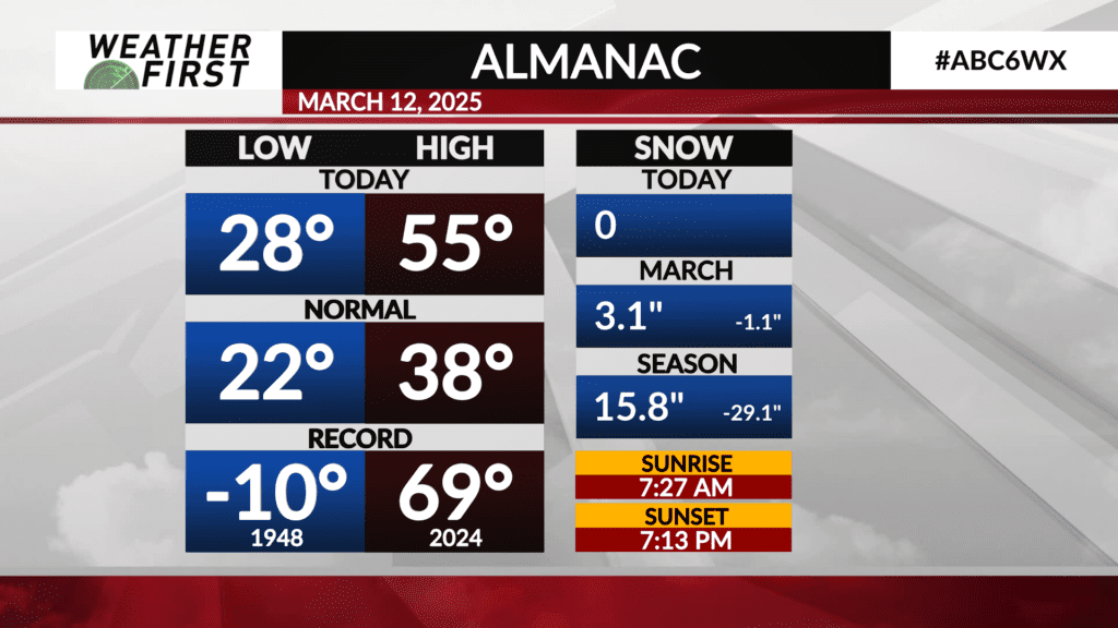
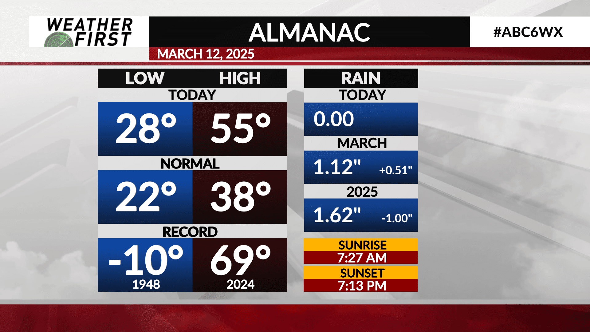
Wednesday’s (3/12/25) Almanac
Spring was in the air Wednesday across southeastern Minnesota and northern Iowa, with plenty of sun, light winds and warm temperatures relative to average for this time of year!
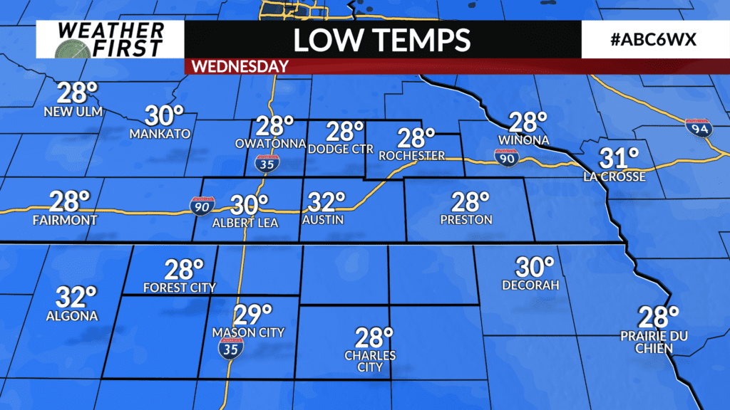
Wednesday began with a mainly clear sky that lasted through the entire day. Morning low temperatures were 6F above the average low for this time of year, coming in at 28F in Rochester, MN. The average low for the city on March 12th is 22F.
Elsewhere, morning lows were relatively similar, with a low of 28F in Owatonna, Forest City, Dodge Center, and Preston. Alberta Lea saw a morning low of 30F, while Austin saw a low of only 32F.
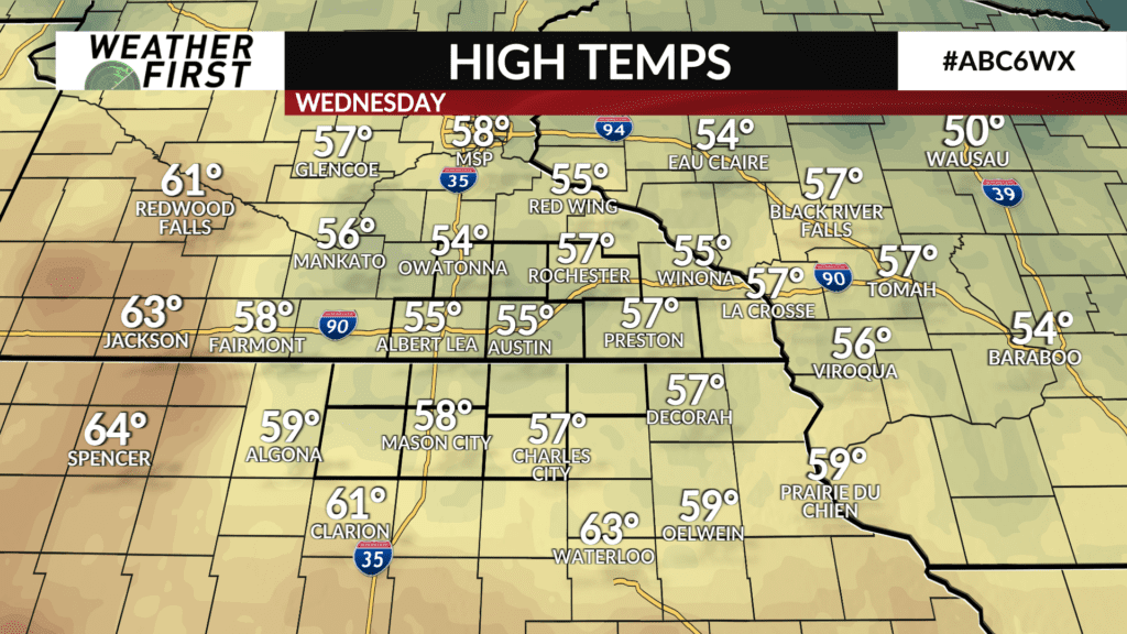
Plenty of sunshine allowed temperatures to quickly warm up through the morning and afternoon, resulting in high temperatures well into the 50F’s. Rochester saw a high of 57F, which falls nearing 20F above the long term average high for March 12th!
Mason City was the warmest location across the area Wednesday, with a high of 58F/59F.
The record high for Rochester on March 12th is 69F, set back in 2024, only 1 year ago! The record low was a bone chilling -10F, set back in 1948.
So far this month, we are above average in terms of monthly rainfall for now, by about half an inch. We are behind, however, in snowfall by just over 1″. Overall, we are well behind average in terms of seasonal snowfall, by over 2′, and an inch behind average in terms of rainfall for 2025.
Hopefully the rain on Friday can give us an added boost to yearly and monthly rain totals so that we have a better chance of seeing rainfall totals closer to average for the month of March, and going through spring!