Who’s ready for a temperature roller coaster?

Temperatures are going to be behaving in true Minnesota fashion over the next week, with a mix of bitterly cold air and well above average temperatures throughout the week!
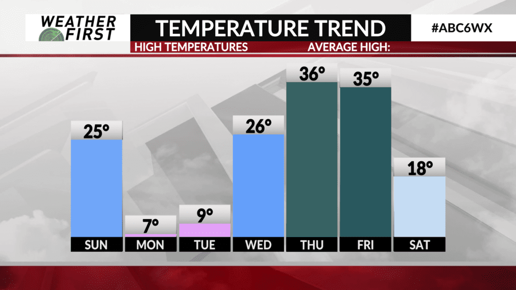
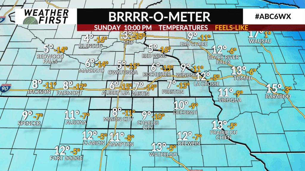
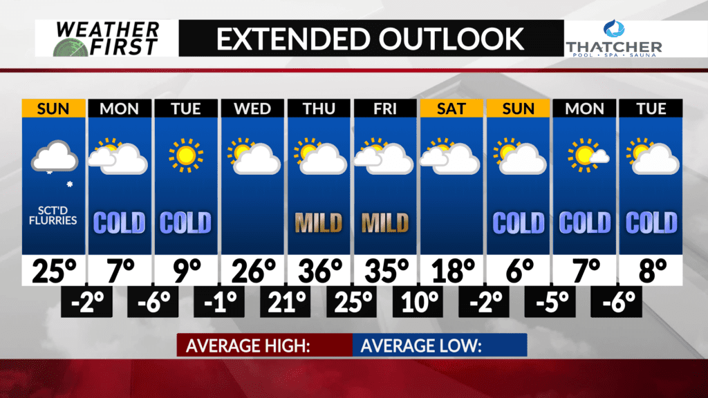
Temperatures plummet throughout the day on Sunday, with highs in the mid 20F’s during the morning hours, dropping into the teens by the afternoon. By Sunday late evening, temperatures will be in the single digits, with wind chills as low as -10F.
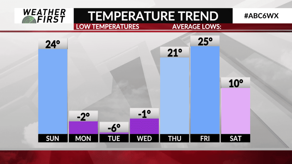
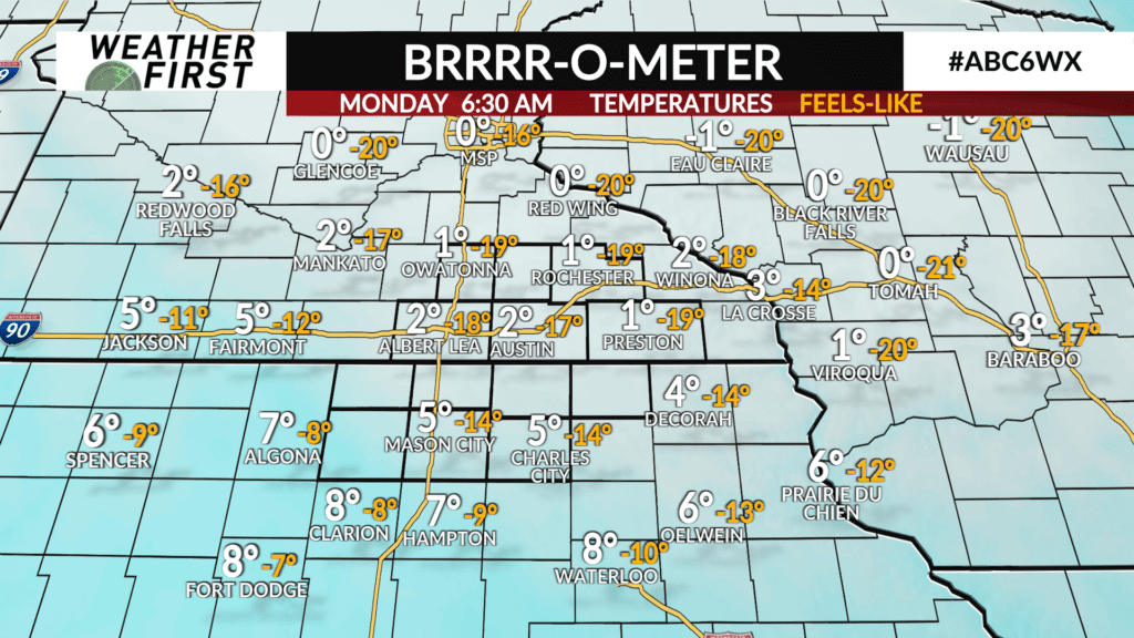
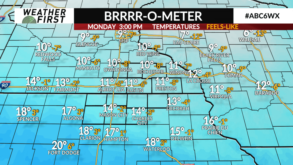
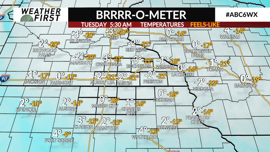
Monday and Tuesday mornings will be RAW thanks to bitterly cold temperatures and brisk northwest winds adding an additional chill to the air. Overnight/morning lows both Monday and Tuesday will be in the negative single digits, with wind chills as low as -20F at times. At least the sun comes out for Tuesday!
These wind chill temperatures fall into the dangerously cold range, and can lead to frostbite if you are exposed to it for longer than 15 minutes. Remember to bundle up when heading to school or work!
Wednesday will start out bitterly cold once again, with morning lows near 0F. Southerly winds develop during Wednesday afternoon, and bring much warmer air northward across the area. As a result, highs will be in the mid to upper 20F’s Wednesday afternoon!
Thursday and Friday will be even warmer, with highs in the mid to upper 30F’s! Nearly 15F above the average high for this time of year for most locations!
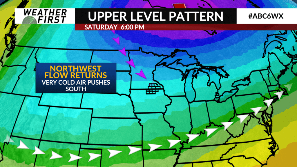
It won’t last, unfortunately. The persistent upper level pattern that has exposed us to multiple shots of bitterly cold arctic air will strike again next weekend, knocking temperatures back down to near 0F by the end of next weekend.
As far as precipitation chances go? Nothing to report…we dry out after Sunday, with no precipitation chances in the extended forecast for next week. Back to quiet!


