Wintry temperatures return next week
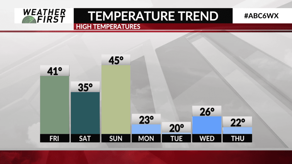
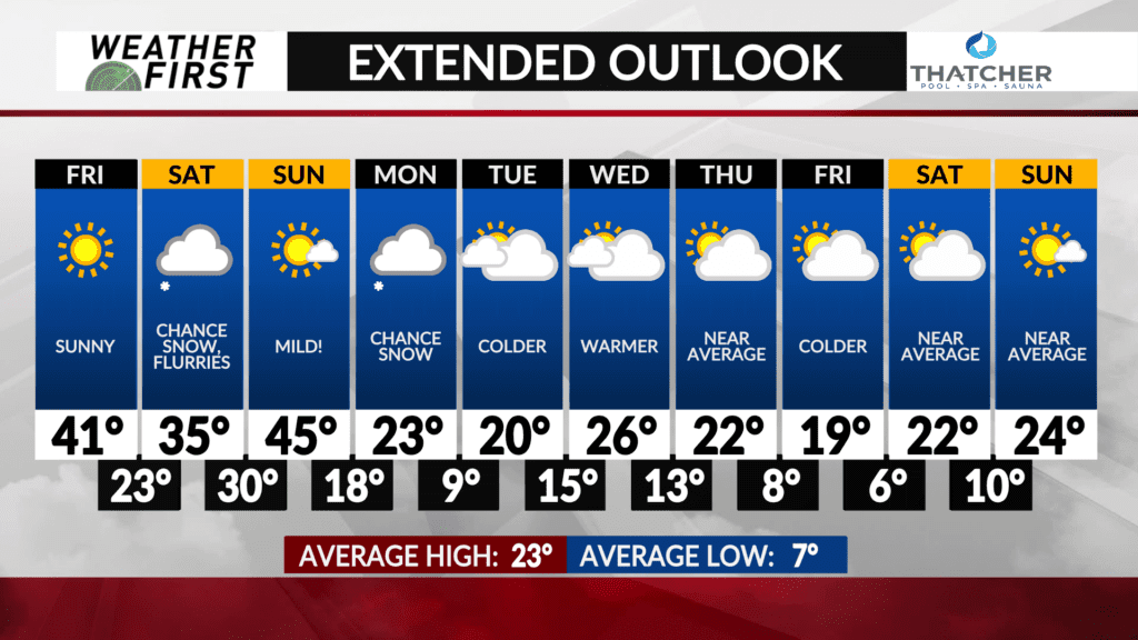
The recent warm spell that has gripped the area over the last few days will soon be replaced with colder and more seasonal temperatures heading into next week.
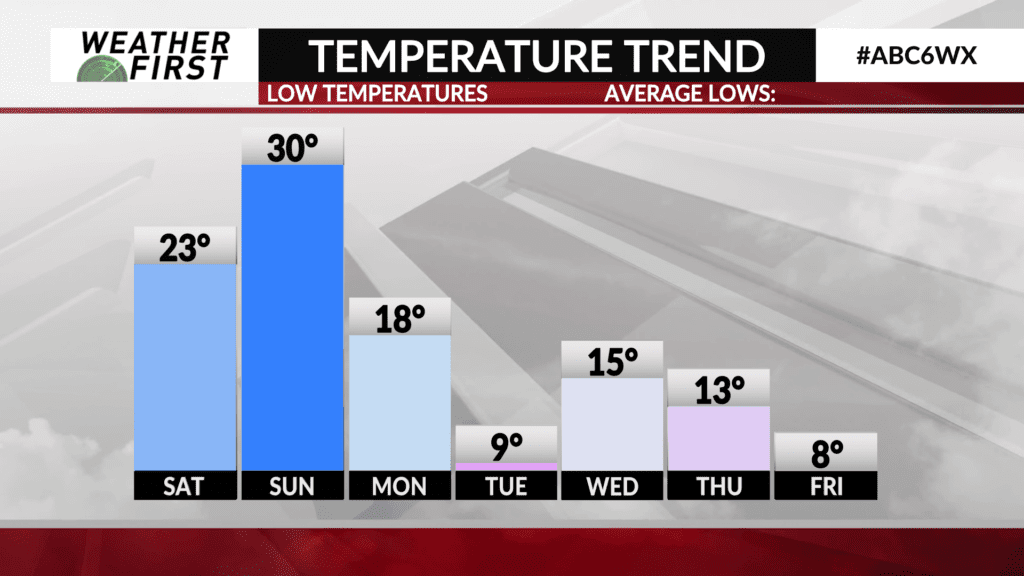
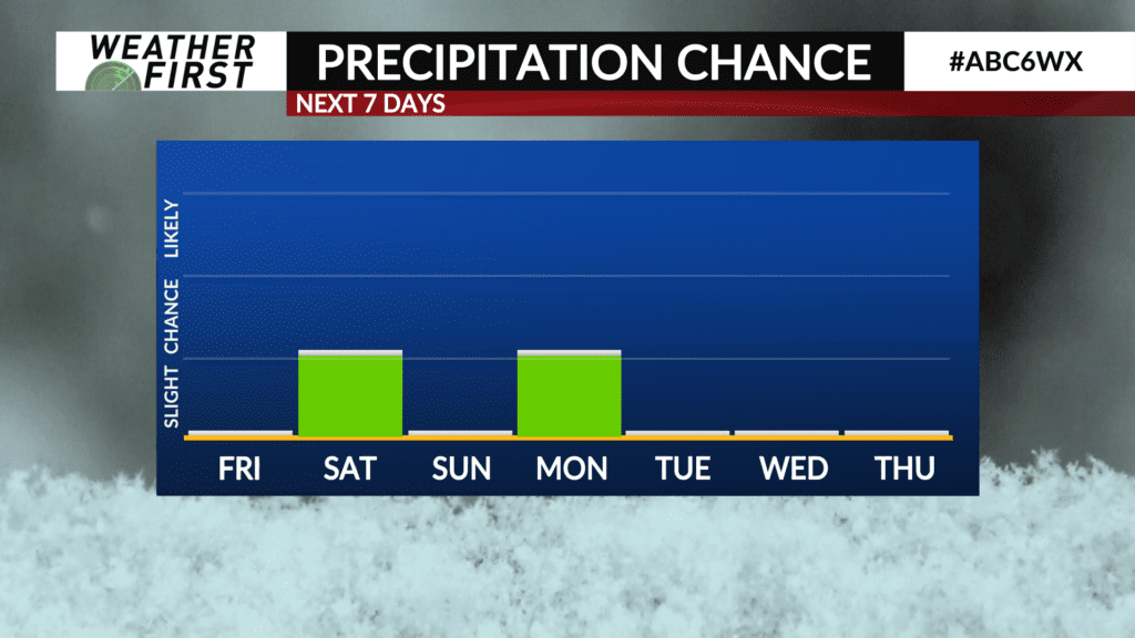
A cold front will pass through Sunday night into Monday. It will also bring the chance of light snow with some minor accumulations looking possible.
Temperatures will fall back to near average for this time of year as colder air funnels in behind the front. Highs on Monday are expected to be around the lower 20s and near 20° on Tuesday before inching upward into the middle 20s on Wednesday.
Another front will come through sometime on Thursday which may bring more wintry precipitation to the area followed by colder temperatures in the teens for highs on Friday.
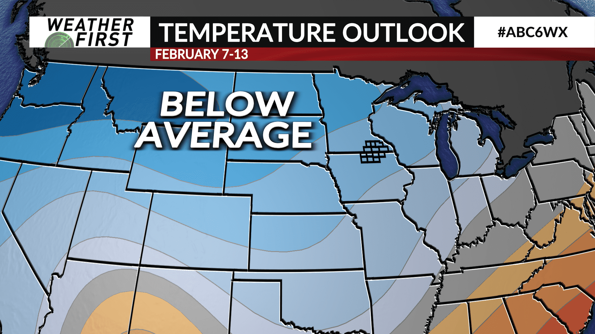
The Climate Prediction Center’s latest 6 to 10 day temperature outlook covering the period of February 3rd through 7th, has a likelihood of below average temperatures locally and across the northern tier of the country.