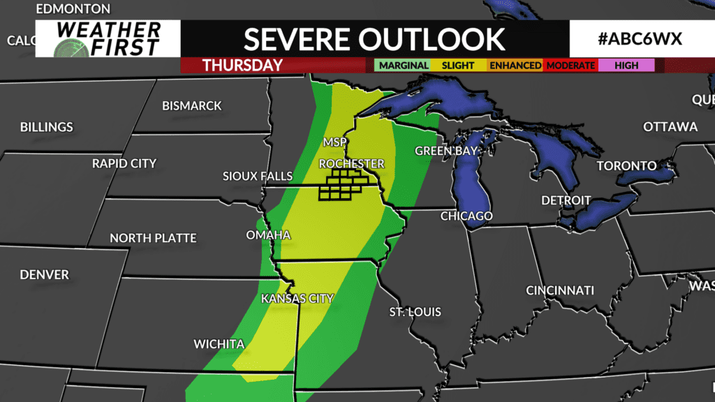
Severe threat is slowly fading going into late evening

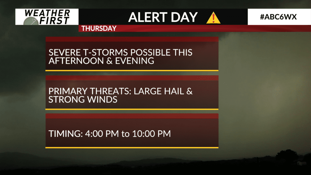
ALERT DAY THURSDAY for the Weather First area!
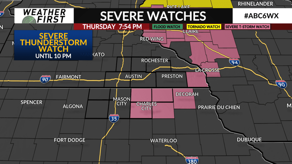
A few counties in northeast Iowa remain in the SEVERE THUNDERSTORM WATCH issued earlier today.
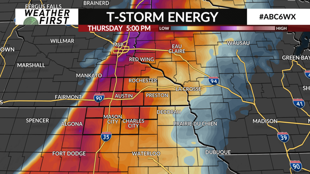
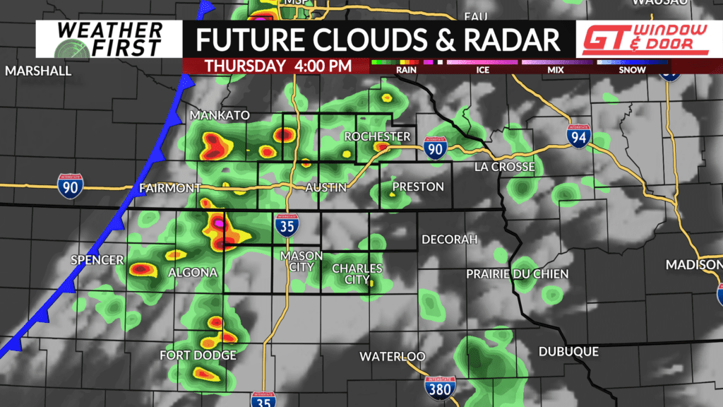
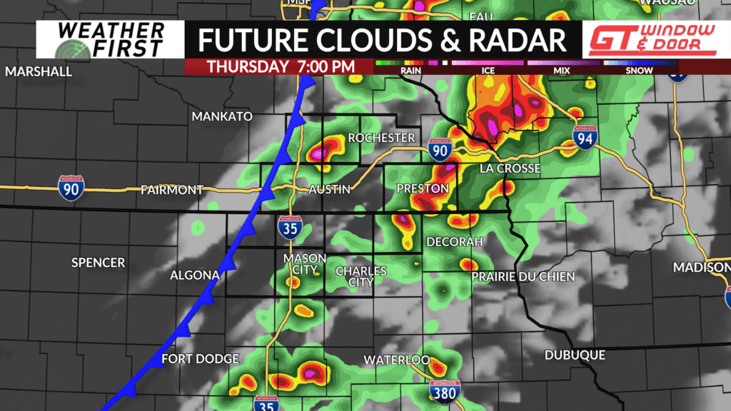
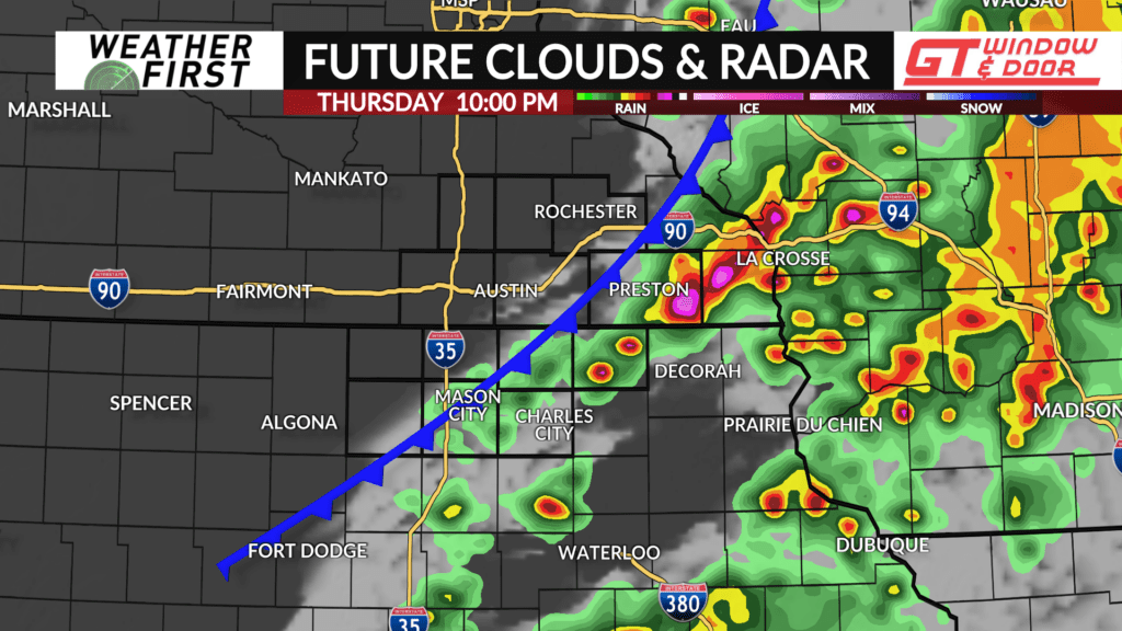
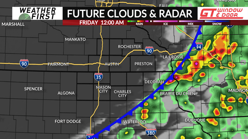
A cold front is expected to track through late Thursday afternoon and/or into the evening hours, bringing the likelihood for t-storms, some of which could be strong-to-severe.
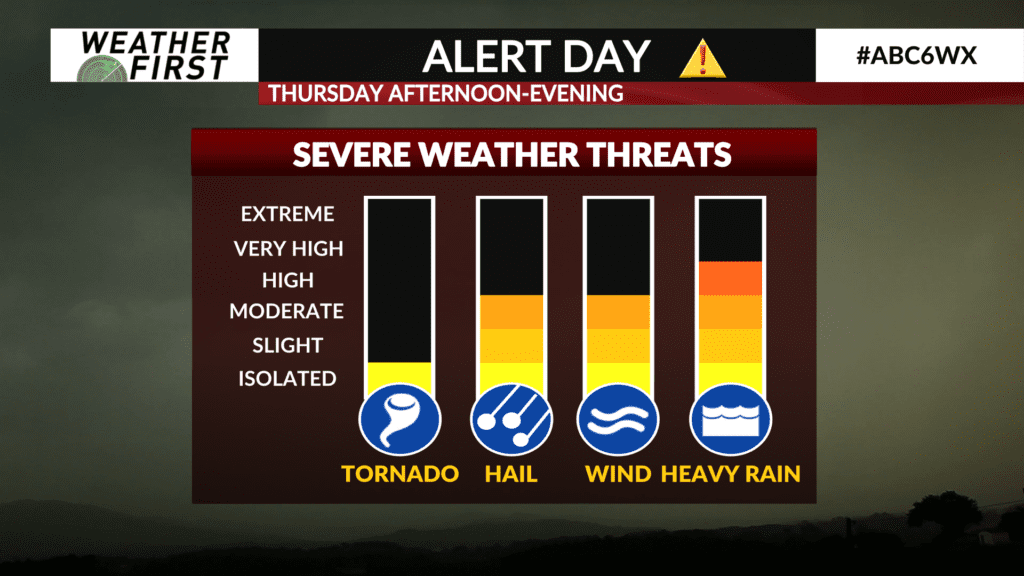
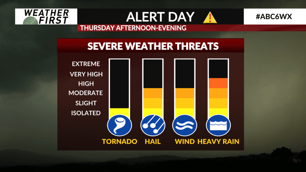
All of the Weather First area is under a Level 2 out of 5 risk for severe t-storms capable of producing large hail, damaging winds, and an isolated tornado or two. Heavy downpours are also likely where any stronger t-storms develop and track although flooding will likely be at a minimum due to how dry it’s been.
Timing for severe t-storms looks to be between 4:00PM to 10:00PM, but some t-storms may take place within an hour or two ahead or past that timeframe depending on location and speed of the cold front.
It’ll be a warm and muggy day with high temperatures in the low-to-mid 80s which will provide plenty of fuel for strong t-storm development. After the cold front passes, drier air will arrive clearing out the clouds leading to sunshine and lower humidity on Friday.
If you have outdoor plans late this afternoon into the evening, be sure to stay tuned to the latest forecast and keep an eye on Interactive Radar. We’ll have any Watches and Warnings right here at kaaltv.com, on-air, and on our ABC 6 News app.