Blustery Wednesday with rain at times, thunderstorm also possible
A storm system will continue to impact the Weather First area on Wednesday with rain, gusty winds and a possible thunderstorm or two.
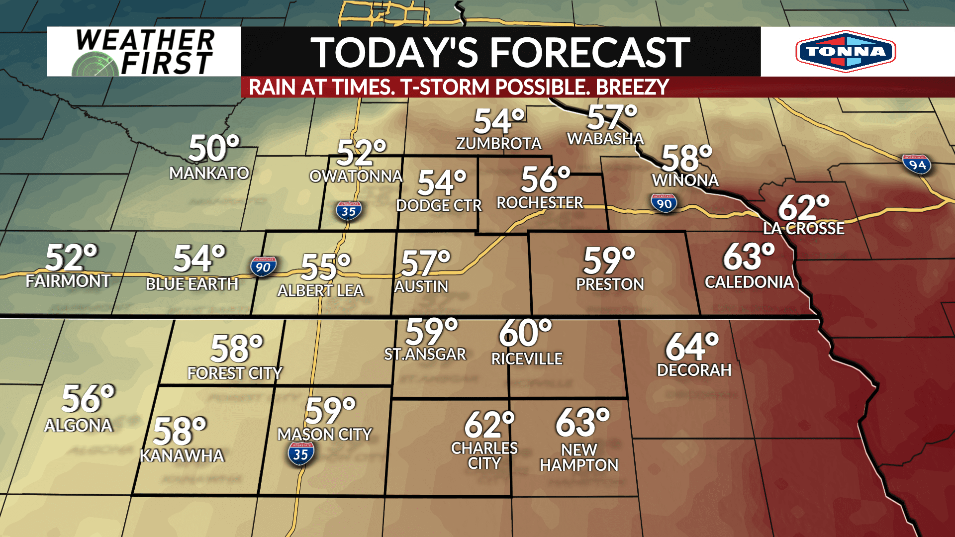
Rain will be likely through much of the early to mid morning hours on Wednesday. A few spotty showers and even a thunderstorm is possible by late morning into the afternoon as the center of the storm system moves overhead and drives a cold front through the area. Any thunderstorms that do develop could produce some small hail. Any showers or thunderstorms will clear the area around or before 3PM. Temperatures will get a boost into the middle-to-upper 50s for highs with portions of Northeast Iowa likely surging into the lower 60s.
The wind will continue to be blustery with gusts up to 35-40 mph at times, however gusts up to 45 mph are possible across North Iowa where a **WIND ADVISORY** is in effect Wednesday afternoon until early evening.
Clouds will remain overhead Wednesday night into Thursday morning. Temperatures will drop back down into the middle 30s. The wind will come down a bit, but still remain gusty around 25-30 mph at times.


